Weekly North America Forecast – Temps Fluctuate as Storms Favour the North
Written Wednesday, 5th March (Pacific Standard Time)
Well, guys and gals, this will be my final forecast for the 2025-2026 North American snow season. It’s been a funny ol’ season that saw some Canadian resorts cranking through December with near-endless snowfall, followed by a long, warm, dry spell, which US resorts in particular suffered from as high-pressure took over the West, while the East went into a storm-laden deep freeze.
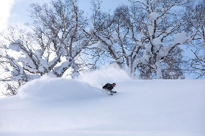
Storms returned to the West mid Feb, and resorts have had a great few weeks as snowpacks have bounced back. At present, snowpacks in the northern half of the Rockies, from Canada and Alberta down to Wyoming and Idaho, are sitting at or above their long-term median, highlighting where conditions have been the best this season.
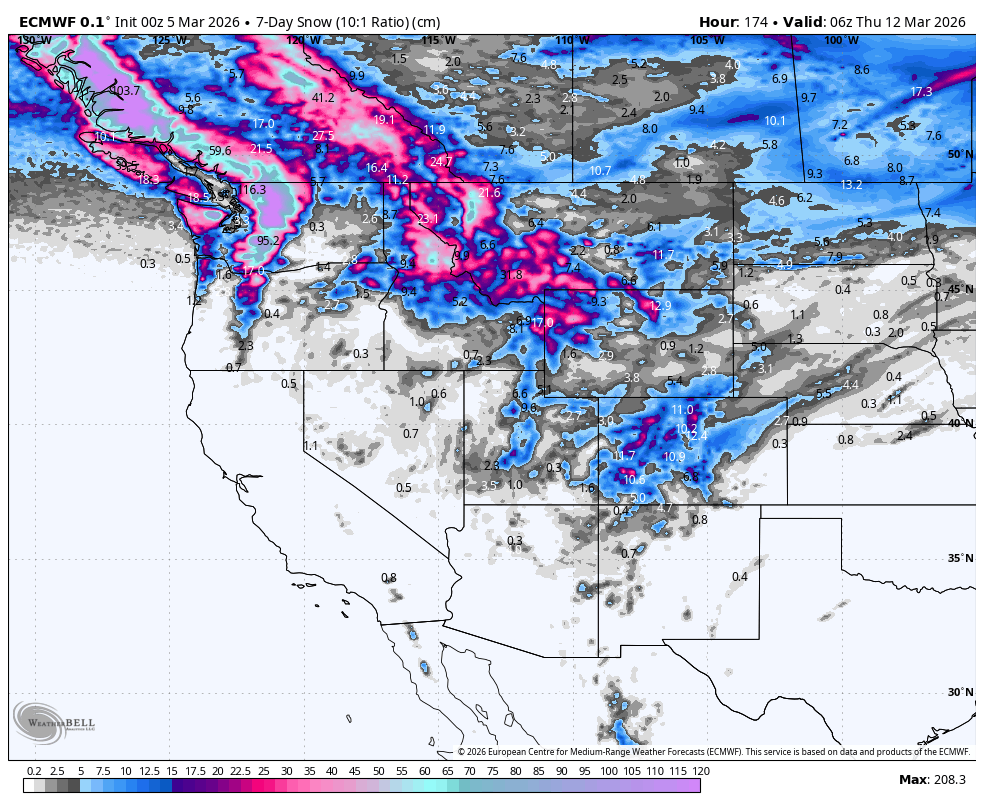
Storms will once again favour the north in the upcoming seven-day period, although snow quality and snow levels will fluctuate as warm and cold airmasses are dragged in with each storm system. The central and northern US Rockies will also receive a nice round of powder at the start of this period (Thursday and Friday), before settled high pressure then takes hold over the central and southern US.
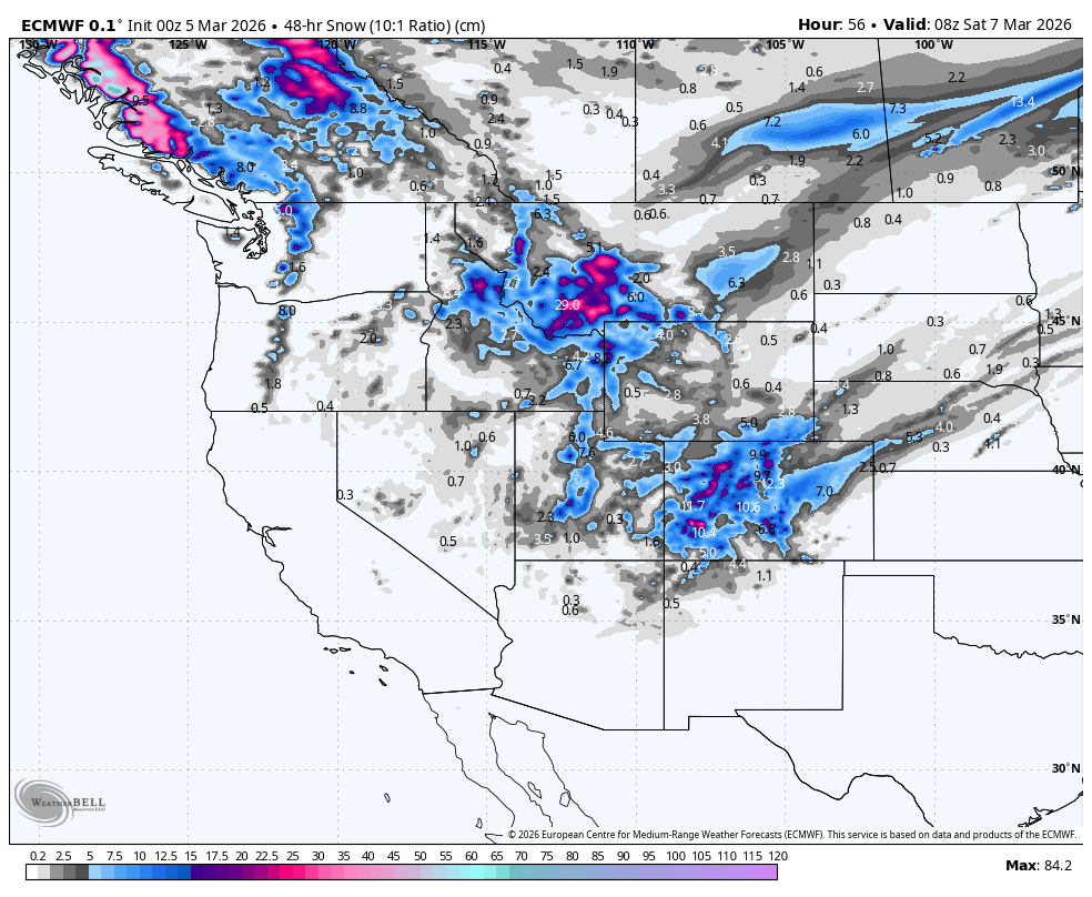
Thursday 5th & Friday 6th March
A storm that arrived in the northwest on Wednesday will continue tracking southeast through the US Rockies on Thursday before exiting late Friday. The storm, which started wet and warm, will see snow levels drop as a cold front now leads the charge. Snowfall will favour northern Idaho, Montana, Wyoming and Utah on Thursday and then Colorado on Friday. Totals will mostly range between 15-40cm in the central and northern US Rockies, with 40-50+cm possible in the most exposed terrain, particularly in Montana.
Leftover snow showers will give BC and the Cascades a further dusting before the storm exits the area on Thursday. But a new storm entering the northwest from late Thursday through Friday will bring a mix of rain and dense snow as a warm, humid air flows in from the Pacific. The bulk of this will fall in northern BC, with only light falls in southern BC, where most resorts are located.
Having received a few showers on Wednesday, Tahoe and the Sierra Nevada will stay dry for Thursday and Friday, while Arizona and New Mexico will only get a light dusting in their northern parts.
Saturday 7th & Sunday 8th March
This weekend, all the action will take place in the north. The warm storm that arrives here on Friday will become colder on Sunday as a cold front pushes down from the north. Once the cold front hits, snow levels will drop, and snow quality will improve.
Interior BC, the northern Cascades, and to a lesser extent, Alberta, will be favoured for the biggest accumulations of this quality powder during the latter half of Sunday, while Idaho, Montana and Wyoming will also see snow developing ahead of the cold front on the warm side of the storm.
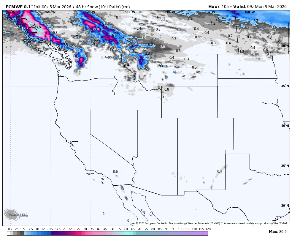
Monday 9th to Wednesday 11th March
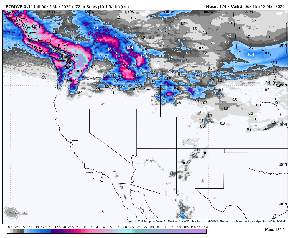
Most of the action continues in the north during this period, with the cold front pushing down into southern Idaho and Wyoming during Monday, where it’ll stall for a while. Areas north of this will be treated to light-to-moderate falls of smoky powder on Monday and Tuesday.
But on Wednesday, temperatures and snow levels will rocket up as a new, warmer storm enters the fray, bringing heavy low-to-mid-level rain and upper-level snow. The northern Cascades, in particular, are expected to get nailed. Thankfully, this injection of warm, humid air will be short-lived, and by the end of the day (Wednesday), temperatures will be hastily making their way down.
In the south, a weaker storm system will track over Arizona and New Mexico on Monday and Tuesday. Temperatures will be warm, so it’ll be a mix of rain and snow for resorts there. If we’re lucky, some resorts could see moderate accumulations on their upper slopes.
That’s all from me today, and for the season. It’s been a blast and a pleasure being a part of it all. See you all in June when the Aussie and Kiwi seasons get underway.
Grasshopper