Storm Watch NZ – The 3-peat
STORM WATCH by The Grasshopper
Brought to you by ESS Boardstores
It’s a 3-peat. Another big south-easterly storm is pounding Canterbury, following on from two very similar systems earlier this month. We’ll take it.
Who would have seen this coming? Around July 20 things the cupboard was looking a little bare for the South Island, but the season has come right in a big way during August, especially for the Canterbury ski fields.
Our saviour has been a series of slow-moving low pressure systems that have sucked, pushed and otherwise encouraged a series of wet south-easterly airstreams onto the South Island.
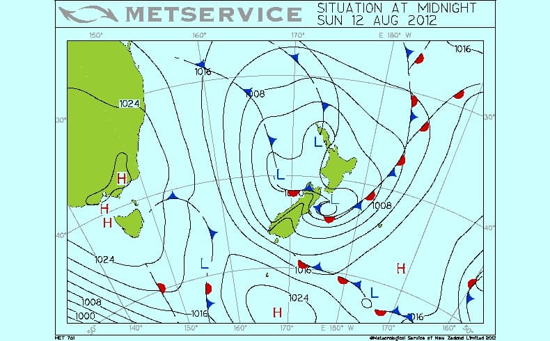
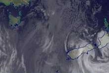
The analysis above shows a complex area of low pressure crossing New Zealand, with an embedded low centre just off Banks Peninsula driving wind and rain into the east coast. The satellite image below gives you a visual on that swirling cloud.
Mt Hutt is reporting 50cm out of this little puppy and there’s more to come over the next three days.
See today’s forecast data update here:

Mount Hutt forecasts,
snow reports and
live snow cams.


