Grasshopper’s 2026 Australian Snow Season Outlook – El Niño on the way
Mountainwatch | The Grasshopper
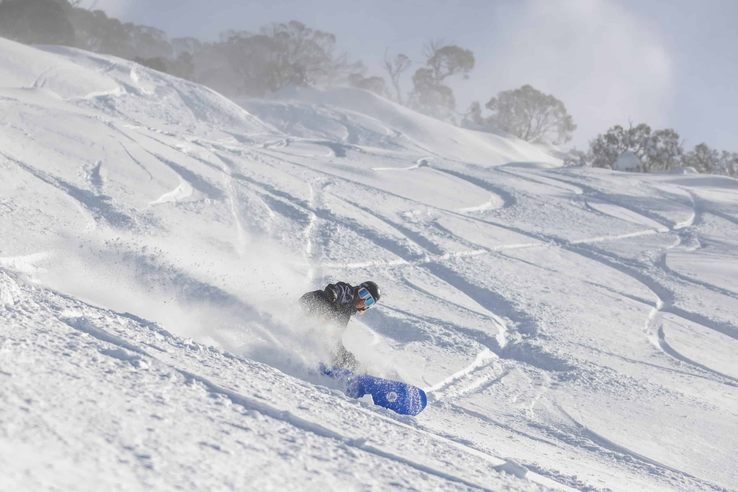
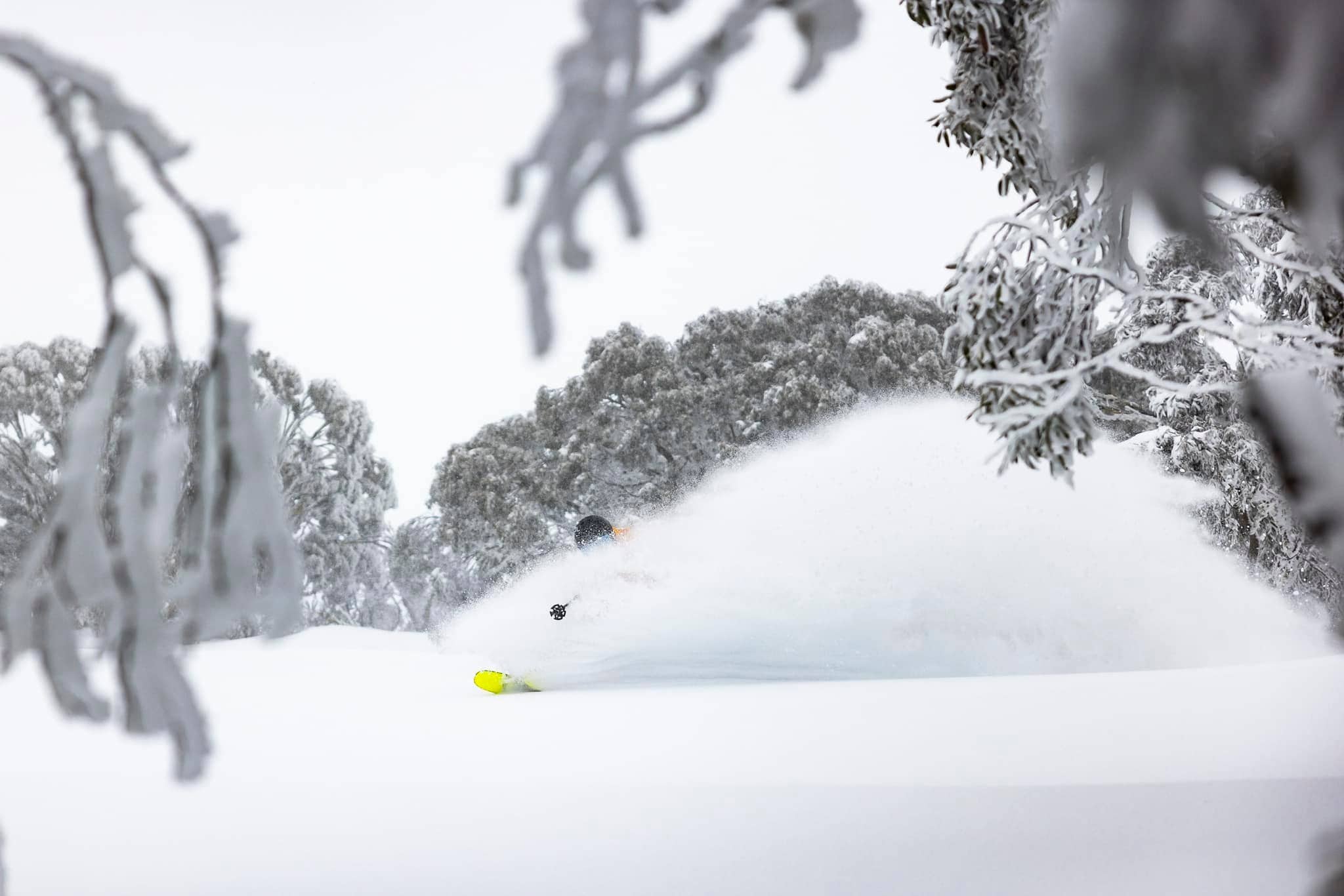
April has arrived, bringing shorter days and cooler temperatures across southern Australia. It’s time to start looking ahead to the 2026 winter season. Some very early snowfalls have already been recorded across the Australian Alps in the past month – but is this a sign of things to come, or just a tease?
Recent Conditions Recap
We’re coming off a weak La Niña and a season that took some time to get going, but ultimately built into a relatively consistent winter. Snow depth peaked at a healthy 220.4 cm at Spencer’s Creek.
If you followed the Northern Hemisphere season, you may have noticed that after La Niña peaked around February, conditions quickly returned to neutral. There is now increasing discussion around a potential shift toward El Niño.
That, combined with a positive IOD, is expected to bring drier, clearer skies and possibly less snow.
Quick Dynamics Recap
Long-range outlooks for the Australian snow season often focus on major climate drivers – most notably ENSO (El Nino- Southern Oscillation and the IOD (Indian Ocean Dipole). While many other factors influence conditions, they are difficult to predict accurately at this lead time.
ENSO is a key player, widely recognised as the most important driver of seasonal precipitation and temperature globally. For Australia, its phases – El Niño and La Niña – typically influence moisture availability to the north of the continent. This, in turn, leads to reduced or increased rainfall across the country, particularly in the east, via changes in trade winds and large-scale atmospheric circulation.
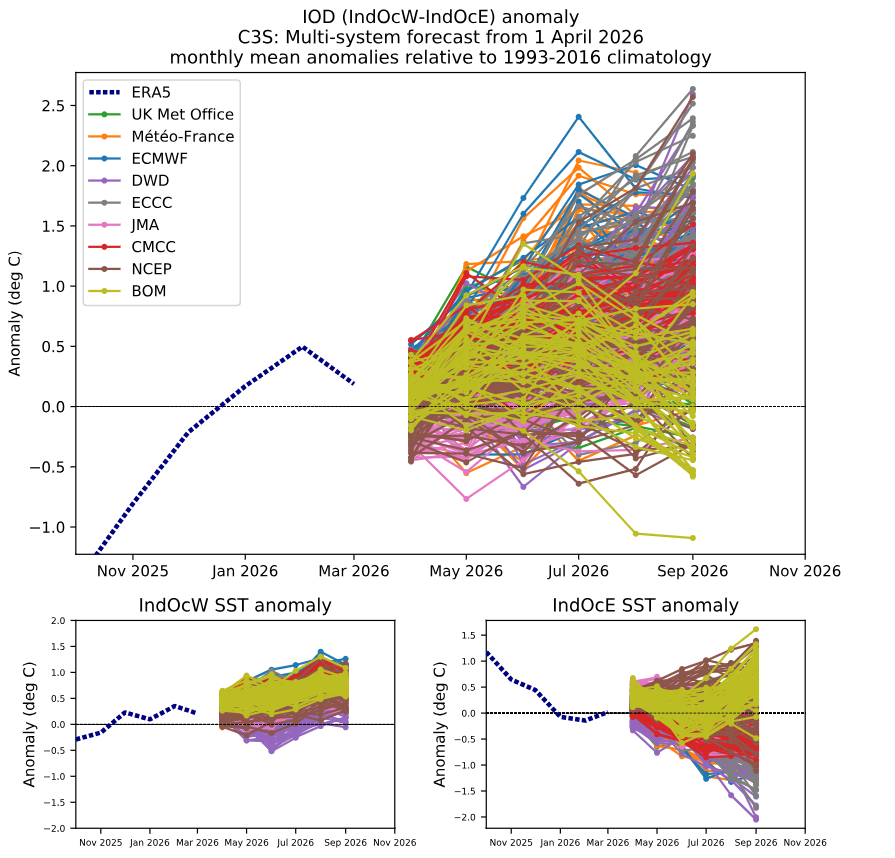
The Indian Ocean Dipole (IOD) is another important climate mode. It describes sea surface temperature patterns in the Indian Ocean northwest of Australia. A positive phase is associated with cooler waters near Australia and reduced moisture availability, while a negative phase brings warmer waters and increased moisture.
With that context in mind, let’s look at what’s expected for the season ahead.
Initial ENSO Thoughts
As mentioned, we are transitioning out of a weaker, third consecutive La Niña event. Conditions are now trending toward neutral, with a probable shift into El Niño territory – typically not ideal for the Australian snow season.
Current forecasts suggest a gradual warming toward El Niño thresholds. NOAA assigns a 61% chance of El Niño developing during May–June and persisting through the end of the year. This is reflected in projections of the Niño 3.4 index, a key indicator of ENSO phase based on sea surface temperatures in the central-eastern equatorial Pacific.
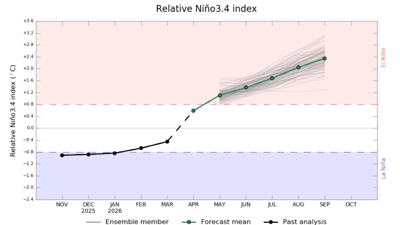
Ensemble forecasts from multiple agencies reinforce this outlook. While a neutral scenario remains possible, the most likely outcome at this stage is the development of a weak to potentially strong El Niño event.
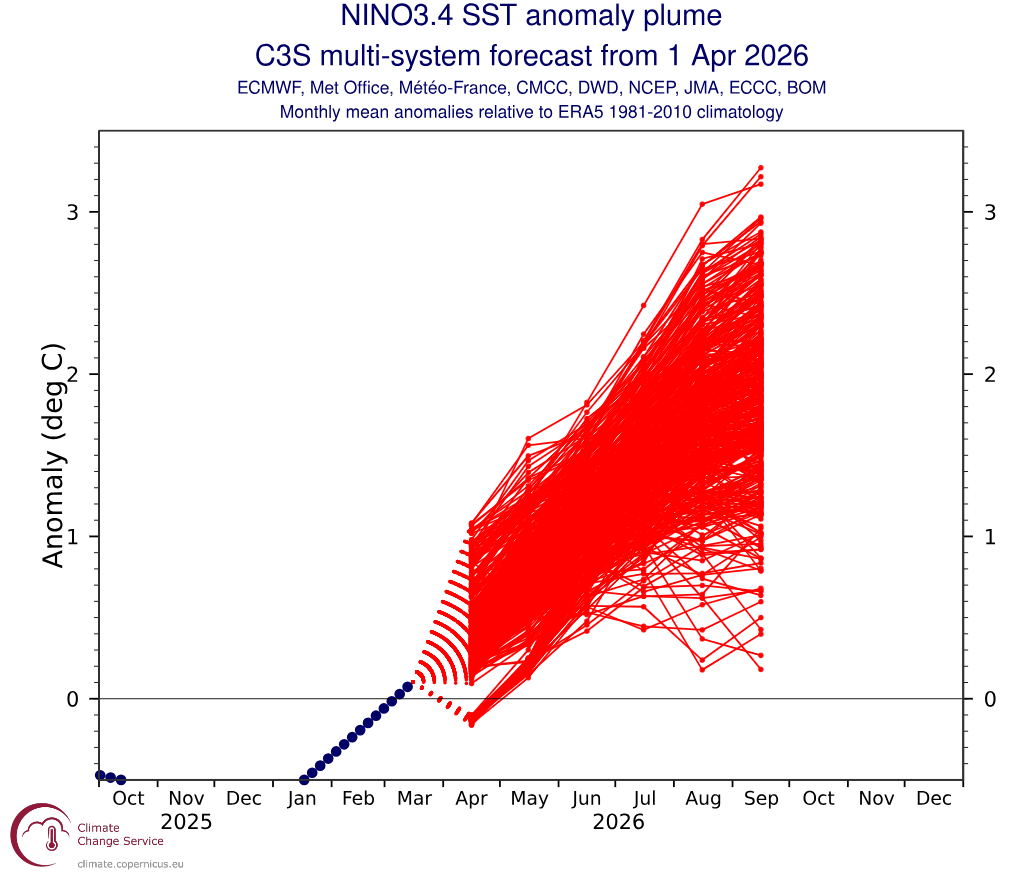
Another Nino3.4 ensemble forecast showing potential evolution of the Nino3.4 SST through to October. We can see a clear shift towards high positive values remembering the Bureau of Meteorology threshold is at 0.8°C. Source: Copernicus Climate Change Service.
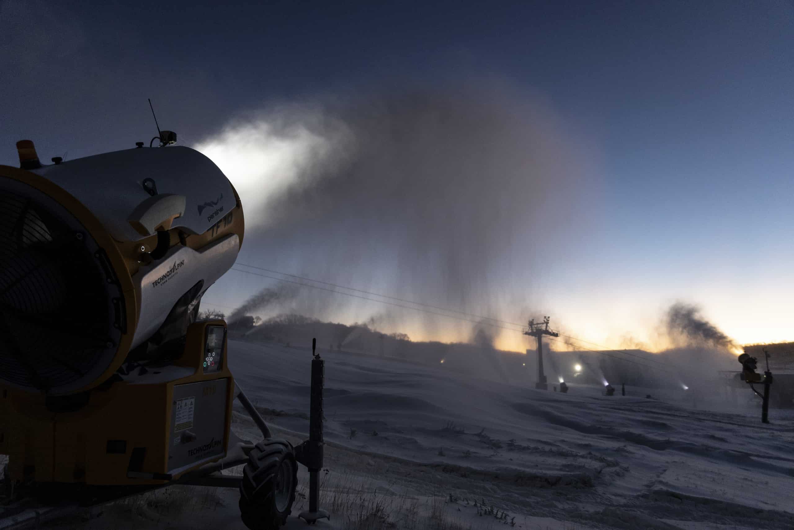
The longer it takes to form and strengthen the less immediate the impact. Although it looks like we’ll reach the El Niño threshold in early winter, clear nights with colder temps may enhance snowmaking. Short term weather patterns may also see bursts of cold air and early season storm activity
IOD Outlook
Turning to the Indian Ocean Dipole, forecast models show greater variability compared to ENSO projections. However, there is a general tendency toward neutral to positive IOD values through the season.
As noted earlier, a positive IOD is typically less favourable for Australian snow seasons. It reduces moisture availability to the northwest of the continent – moisture that would otherwise feed into troughs and cold fronts moving southeast.
Putting the Pieces Together
Taken together, the most likely scenario is a neutral-to-El Niño ENSO phase combined with a neutral-to-positive IOD. This combination generally leads to reduced moisture availability, limiting the potential intensity of systems delivering snowfall across the Alps.
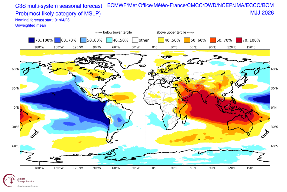
Seasonal mean sea level pressure (MSLP) forecasts for May–June show higher-than-average pressure across the eastern Indian Ocean and western Pacific. This pattern is consistent with reduced convection and aligns with typical El Niño/positive IOD conditions.
Seasonal Products
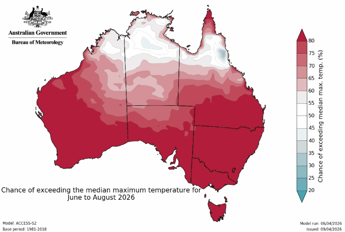
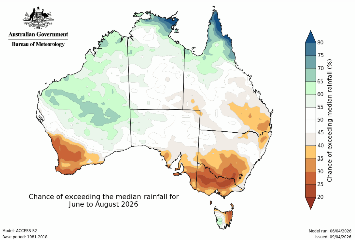
The Bureau of Meteorology’s early outlook for June–August supports this picture. Current projections indicate:
- Below-average rainfall across the Alps
- An increased likelihood of above-median maximum temperatures, particularly in southern Australia
These signals reinforce the broader expectation of a warmer and drier start to winter.
Wrapping It Up
At this stage, the outlook for the Australian snow season is not especially encouraging. A developing El Niño combined with a positive IOD could significantly limit snowfall in a worst-case scenario.
That said, there is still plenty of time for conditions to evolve. Shorter-term drivers such as the Southern Annular Mode (SAM) and the Madden–Julian Oscillation (MJO) will also play important roles during the season.
It is also worth remembering that while climate drivers account for a big percentage of snowfall variation the rest is determined by synoptic weather variability (individual storms, cold fronts, cutoff lows) and random atmospheric variations. And that, as I’ve said before, is in the hands of the snow gods.
In other words, it’s far too early to write the season off.
I’ll continue monitoring developments over the coming months and refine the outlook as we get closer to winter. For now, make the most of the remaining warmer days – snow season will be here before we know it.


