2011 SNOW SEASON OUTLOOK – Australia
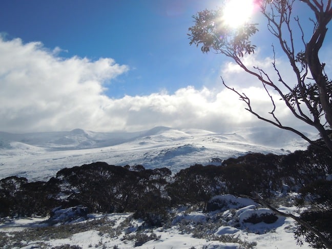
looking towards Carruthers Peak from above Charlotte Pass, 15 May, following a week of wintry cold and consistent snow. Image:: Courtesy Perisher
Snow Season Outlook 2011 | The Grasshopper
Here we go. Mid-May and there’s already a few inches of snow on the ground. Perisher and Falls Creek have fired up the snow-guns to try to maintain the cover and there’s optimism all around for a bumper season.
So what can we expect? If you’ve read any of my mad ramblings before, hopefully you will know that I try not to get carried away in the hype, and I do my very best not to promise anything that can’t be backed up.
Having said that, let’s look at some of the signals, and at the end of this forecast I’ll throw caution to the wind, stick my neck out, and try to predict the next big snowfall and the maximum base we’ll reach this year.
To come up with a long range snow forecast, it makes sense to first look at the conditions that are needed for snow. Obviously we need it to be cold, so that snow doesn’t melt before it can settle on the ground. Next, we need a good source of moist air to supply all the water needed for snow.
It turns out that historically, this is best achieved by weather patterns that lead to persistent westerly winds. Embedded in this westerly flow are cold fronts, and as they rise over the Australian Alps, the copious amount of water vapour within them is squeezed out as snow.
Although big southerly storms are impressive, they’re not essential. We don’t need it snowing in Melbourne for good skiing at Falls Creek. It simply has to be just cold enough, with plenty of rain. The persistent westerlies do a good job of this.
The weather map below from Jun 30 2009 is a decent example of this. Thredbo got about 50cm of snow in this moist westerly flow.

But it’s not at all easy to predict whether we’re going to get enough of these westerly conditions months in advance.
In Australia much of our seasonal variability is driven by whether we have “El Nino”, “La Nina”, or neutral conditions. El Nino leads to higher atmospheric pressures over South-east Australia and generally less rain, whereas El Nino’s opposite “La Nina” leads to lower atmospheric pressures and more rain.
So you would think that El Nino would be bad news and La Nina would be good news for snow. Unfortunately, studies have shown the relationship between wind and El Nino over the Alps in winter is weak, so El Nino isn’t a great tool for forecasting when we’ll get those persistent westerlies. There have been El Nino years with great snow (’91,’92) and La Nina years that were below average (’98).
We’ve just had one of the strongest ever La Nina’s, responsible for massive flooding across VIC, NSW and QLD this summer. It’s now on its deathbed, with atmospheric activity moving back to neutral conditions. There are also subtle hints of a possible El Nino event developing in spring, but this is far from certain.
For what it’s worth, I think this situation looks quite similar to 1976, when a strong La Nina died away and a weak El Nino developed around September. I would also be inclined to look at 1989, which also featured a strong La Nina dying away, but then sat on neutral conditions right through spring.
The graph of snow depth for those years is included below (thanks to Snowy Hydro).
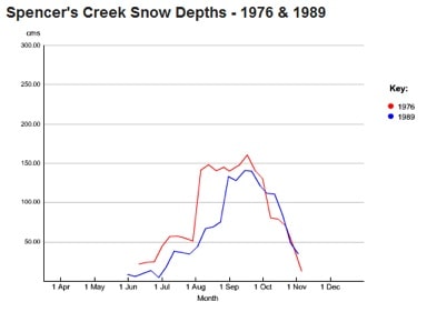
We can see that these two years were average, with the snow base gradually building through June and July. If we get anything like this it should be a solid, but not spectacular, season.
What else is there to look at?
The Bureau of Meteorology is predicting about-average rainfall for the Australian Alps from May to July. That fits with our concept of La Nina dying out and relatively neutral conditions. The problem is that they are also predicting warmer than average daily maximum temperatures. Clearly that’s bad news for the early snowpack, as it will encourage melting before it is fully established.
There were remarks from Thredbo this week that they were confident that the 20cm already on the ground would be enough to get a base going. That would be great news, as it will maximise any further snowfalls. But I am a little skeptical. My instinct is that some of the warmer afternoons expected in the next two weeks could melt away a lot of that thin base. I’m more than happy to be proved wrong on this, but with afternoon temperatures of 9°C forecast at Perisher Valley, I have my worries.
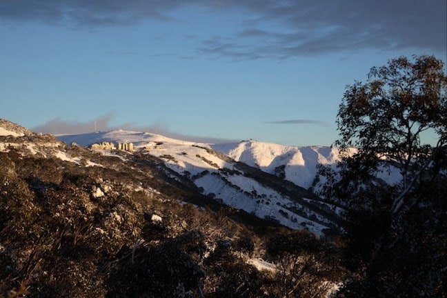
The view from Hotham 12 May 2011, at the beginning of a week of early snowfalls. Image:: Courtesy Hotham
There are a few other theories doing the rounds at the moment that we should cover:
The first one you might hear about is the Antarctic Oscillation (AAO, also known as Southern Annular Mode or SAM). This is a measure of a pressure see-saw between Antarctica and the Southern Ocean. If the index is positive, the strong westerlies in the Southern Ocean move south, away from Australia. When it’s negative, they move north, which as we saw before is good for snow. The problem with talking about the AAO is that we can’t predict this any better than we can the day-to-day weather, so it’s kind of pointless bringing it up when we’re looking months into the future.
Another factor being mentioned on some forums is the Leeuwin current that runs south past WA and round into the Bight. It is particularly warm this year, and there are hopes this could add moisture to any cold outbreaks. This is probably a fair call, but I’m not convinced how much of this extra moisture we can expect to fall as snow, and how much as rain, so I don’t think this is a done deal.
Finally, there are hopes being pinned on just a tiny shred of La Nina flavoured weather conditions remaining, meaning lower pressures and more chance for cold fronts to move up over Australia. This is also fair enough, but I believe La Nina is more likely to decay completely, so I’m counting this factor out.
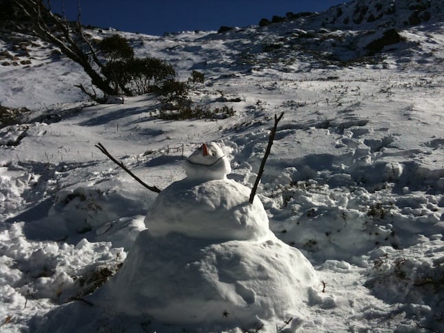
Plenty to smile about with a start to winter like this one. Thredbo 15 May. Image:: Courtesy Thredbo
Now it’s time to stick my neck out. Here’s a situation that I think is as plausible as any other:
• It’s going to be warm and mostly clear for the next 7 to 10 days. This will melt a lot of the existing base, except for the highest elevations and those areas covered by snow making equipment, which should be able to run at full noise given the cold, dry, overnight temperatures we’ll be expecting.
• Then we’ll get a little snow, five to 10 centimetres over a couple of days, before another high takes a week to drift past.
• This pattern will repeat for another week or two.
• A week or so either side of July 1, we’ll get the next big juicy dump of snow, say 30cm plus, and snow bases will build via a couple of big dumps to give us a decent August and September.
• The Spencer’s Creek snow depth will break one metre in late July and peak at 1.9 metres.
You’ve got to take all of this with a grain of salt. In the end seasonal forecasts involve a lot of guesswork and I’m making educated guesses based on historical averages. Do you disagree with the forecast above? tell us what you think in the comments box below…
In the meantime, keep an eye on the forecasts and snow cams!
Perisher forecasts,
snow reports and
live snow cams.
Falls Creek forecasts,
snow reports and
live snow cams.
Mount Buller forecasts,
snow reports and
live snow cams.
Charlotte Pass forecasts,
snow reports and
live snow cams.
Hotham forecasts,
snow reports and
live snow cams.
Thredbo forecasts,
snow reports and
live snow cams.
Mount Baw Baw forecasts,
snow reports and
live snow cams.


