2022 Australian Snow Season Outlook – August Update: Plenty of Precipitation to Come
Mountainwatch | The Grasshopper
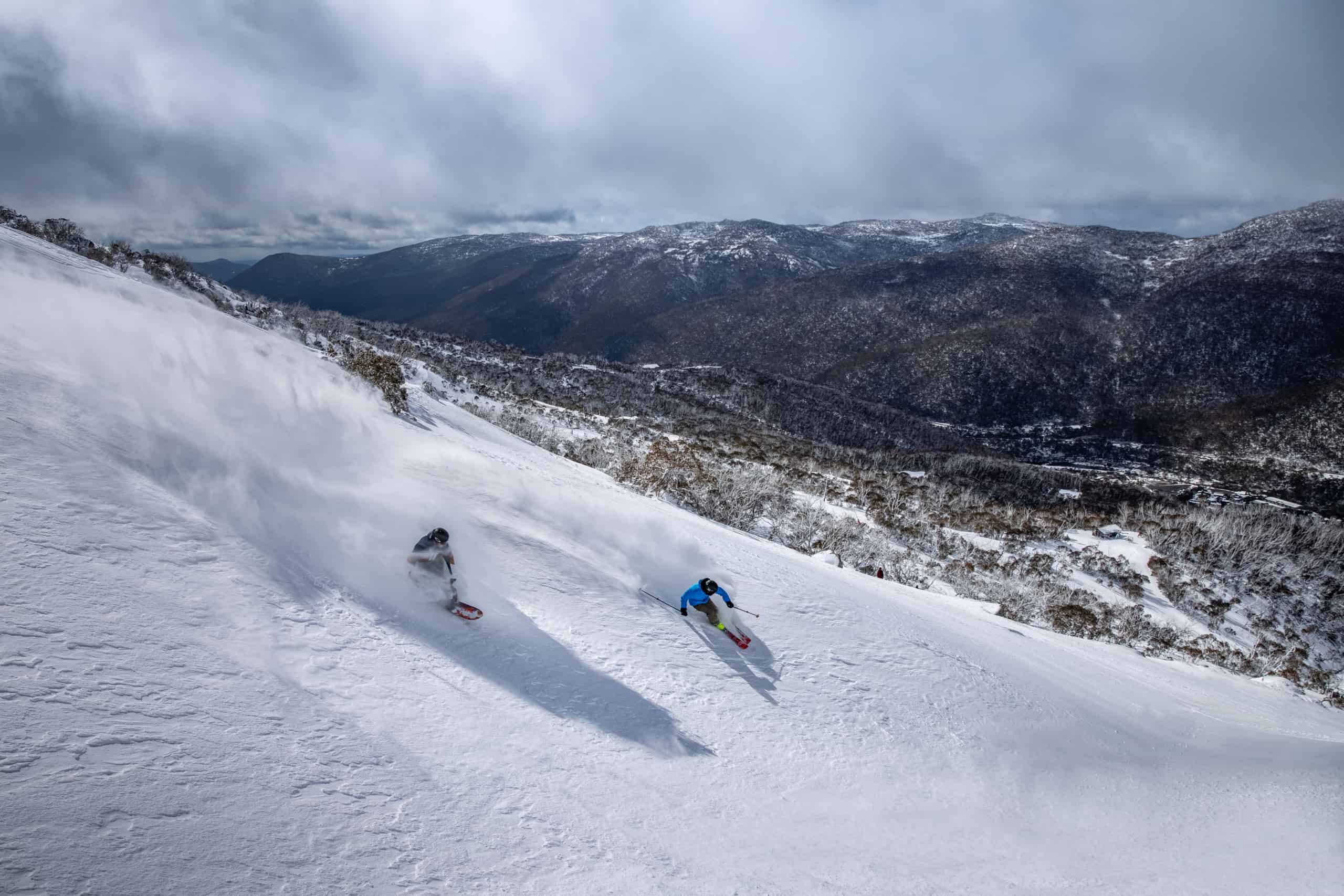
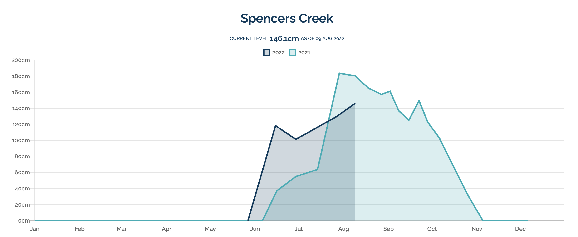
Welcome back folks. Well after the best start to an Australian ski season in more than 30 years, snow depths have only increased incrementally through July and August.
A big rain event in early August did some damage, but the snow base was quickly replenished with healthy follow up falls in the week that followed.
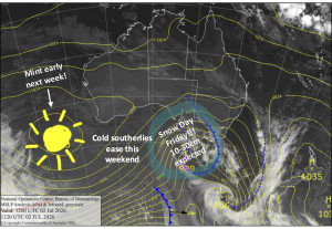
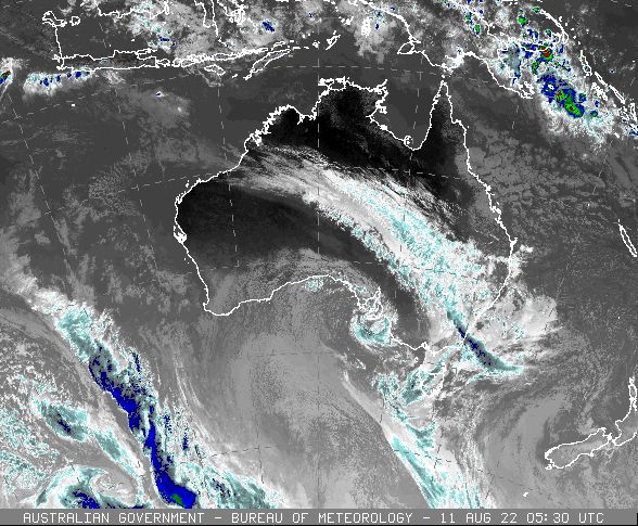
Another big band of precipitation is crossing the Victorian Alps and Snowy Mountains as I type, but with temperatures only borderline for snow instead of rain. This is likely not to be a one-off situation for the rest of the season, due to the development of a significant climate driver between Australia and Africa.
Climate Driver Overview for the Remainder of Winter and Spring
Most readers will be familiar with El Nino and La Nina over the Pacific, which can have impacts on Australia’s weather for many months, driving it towards drier or wetter conditions depending on the phase. A similar climate driver exists to our west, known as the Indian Ocean Dipole.
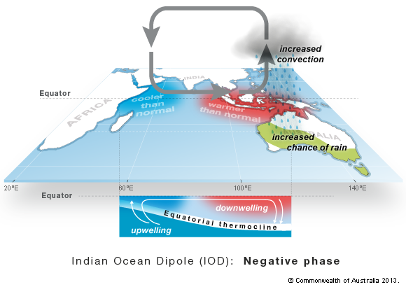
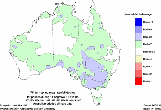
Like its Pacific cousin, the Indian Ocean Dipole has phases that can either enhance or reduce winter and spring rainfall for southeastern Australia, including the ski fields. For the remainder of this winter and spring, we have the wetter negative phase of the IOD in place, which is strongly correlated with higher precipitation for all of Australia’s larger ski fields.
Cold fronts crossing Western Australia tap into a moisture feed from the warmer than usual waters to the north, creating impressive northwest cloud-bands across the nation. When these fronts and associated cloud-bands encounter the Dividing Range, rainfall is further enhanced. It should be noted that Mt Baw Baw on the southern side of the range is not as strongly correlated with above average precipitation (compared with the major Victorian and NSW resorts), nor are the ski fields of Tasmania.
Impacts on Australian Ski Fields for the remainder of Winter and Spring
The negative IOD gives us one important ingredient for the rest of the season, that being above average precipitation. The next critical thing to look at is temperature, so that we end up with more snow than rain. With a negative IOD we tend to see warmer than usual nights and cooler than usual days due to increased cloud cover. This may hinder nighttime snowmaking activities a little for the rest of the season although the resorts usually wind-back snowmaking in early September. However it doesn’t rule out the possibility of good natural snowfalls – although there is an elevated risk of more rain events as well.
In the near term, there are signs that the ski fields will see a good injection of cold air from the Southern Ocean around the 19th and 20th August, which should contribute to some significant snowfalls at this time. There is the risk of milder weather and rain in the week that follows, so try to hit the slopes not long after the snow falls.
For the month of September, there are often powerful cold air outbreaks for Southeastern Australia, emanating from near the Antarctic Ice Shelf, which nears its maximum extent around this time of year. With the negative IOD providing abundant moisture, there should be some healthy dumps of snow for spring skiers and boarders.
There will however be the risk of milder and wet periods in between, so keep your schedule flexible to take advantage of the best days. And of course, keep an eye on my short term forecast updates on Mountainwatch to pick your windows of opportunity.