AUSSIE WEEKLY SNOW JOURNAL – A Perfect Follow Up
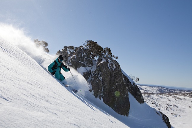
Simon Blondel enjoying Perisher’s brilliant conditions on the weekend. Image:: Dominic Kieler
Aussie Weekly Snow Journal | Alex Horvath
This time last week I was writing this very journal and singing praises for the storm that was hitting the mountains as I typed. Once the clouds had parted and the reports came flooding in I was truly amazed at the stories I was hearing. Rumours were flying that the Aussie hills were bearing a certain resemblance to their overseas alpine counterparts.
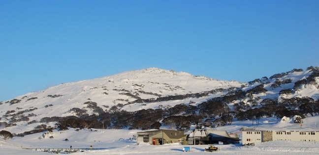
Perisher – bluebird after the storm. Image::Courtesy of Perisher
The series of cold fronts that screamed through the south east of Australia last week set up a true winter pattern of snowfalls leaving us with storm accumulations of over one metre across NSW resorts. The storm was the final key in the lock for season 2011 and resorts are now able to operate at 100% of their capacity. Anyone who was out on Thursday will be sure to remember that day as one of the best in recent memory for shredders in Australia. For an epic account of the day check out Boothy’s Blog .
Snowfalls eased through the rest of the week and unfortunately the wind picked up on the weekend due to the strong pressure gradient and southwesterly flow. Sunday turned out to be particularly wild, severe weather warnings were issued for highland areas across NSW and VIC and unfortunately this meant that the majority of lifts were placed on wind hold.
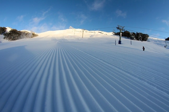
AM corduroy in Falls Creek Image:: courtesy of Falls Creek
Weather for the remainder of the week
A moderate ridge of high pressure is going to dominate this week setting us up with mostly fine conditions, winds will likely remain strong today bringing about a severe wind chill so stay warm! Light and isolated snow showers are expected in NSW although we probably won’t see any significant accumulations. VIC on the other hand should see a few cm more adding to the snow they received last night. By the weekend winds should ease and conditions should be unreal on the weekend.
The models are beginning to show signs of a snow event hitting the mountains late on Sunday and into Monday, we should know more about this when The Grasshopper delivers his next analysis so stay tuned.
Resort breakdown
NSW
Perisher Light snowfalls are continuing at Perisher this morning, winds remain moderate to strong meaning lifts may be on wind hold. The dusting of snow overnight combined with 116 snow guns firing means that the cover will be in great condition. Temperatures will remain cold over the next few days, the trees will be the pick until the next big storm where lots of windblown snow will create some awesome stashes. The entire resort is open helping to spread school holiday crowds, higher traffic areas will be busy so don’t be afraid to hit the more quiet corners of the resort over the next few days.
Thredbo Winds continue to dampen conditions in Thredbo with gusts today reaching 85km/h from the W/NW creating variable conditions. Windblown stashes will be the pick with E/SE aspect slopes providing the best snow quality. The parks are in perfect condition after the recent rebuild with some very fun features to be found on High Noon, the weekend will be amazing once winds ease over the next few days, 100% of the mountain is open.
Selwyn Snowfields All lifts are open at Selwyn and the resort is enjoying a firm 55cm avg. base depth. Snowmaking is helping to keep the cover fresh when conditions allow, consistently low temperatures are expected to continue. Perfect conditions will persist for the remainder of the school holidays keeping family crowds happy.
Charlotte Pass A dusting of snow overnight has freshened up the cover, windblown stashes are deep and all lifts will operate where possible, strong winds currently have some lifts on wind hold. Guthries Poma is operating for the first time this season today. Sunny conditions over the weekend with light winds mean conditions should be spectacular.
VIC
Falls Creek has reported 7cm of new snow over the last 24 hours bringing their average snow depth to 110cm. The new snow has meant that conditions are great this morning, winds are hovering around 28km/h so windblown powder stashes will be found. 100% of the mountain is open.
Hotham. 3cm of new snow fell overnight at Mt Hotham bringing their average natural snow depth to 99cm. Cold temperatures are keeping the snow quality perfect, winds are currently moderate to strong, all lifts will operate although some may go on wind hold throughout the day. Winds will ease and the sun will return later in the week making for an excellent weekend!
Mt Buller should see more light snowfalls throughout the day today. The snowbase has hit 1m in snowmaking areas setting up the resort to open the majority of terrain. Bluebird conditions are expected over the weekend. The Cattlemen’s Rail jam will hit Mt Buller over the weekend so there will be plenty to checkout on Saturday.
Mt Baw Baw Last week’s snowfalls transformed conditions at Mt Baw Baw enabling them to now operate 5/7 lifts. The park crew have been able to install a number of features around the resort making for some super fun conditions. Snow depths in snowmaking areas are around 33cm and sunshine will persist over the weekend before more snow expected early next week.
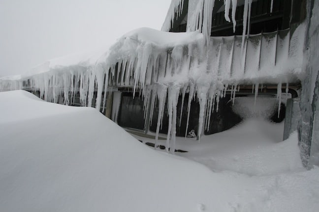
Yep, it’s winter! Image::Courtesy of Perisher
Spencers Ck Snow Depth
The official Spencers Ck depth reading came in at an amazing 158.9 cm, this is officially the highest reading as of July 7 since the 1990 season that many Australian skiiers will remember as being one of the best seasons in recent history. Fingers crossed the next few snowstorms will push us over the 2m mark by the beginning of August.
If you have the opportunity to head to the mountains this week do not hesitate! Conditions really are as good as they get for Aussie riders. Stoked!
Perisher forecasts,
snow reports and
live snow cams.
Falls Creek forecasts,
snow reports and
live snow cams.
Mount Buller forecasts,
snow reports and
live snow cams.
Charlotte Pass forecasts,
snow reports and
live snow cams.
Hotham forecasts,
snow reports and
live snow cams.
Thredbo forecasts,
snow reports and
live snow cams.
Mount Baw Baw forecasts,
snow reports and
live snow cams.


