AUSSIE WEEKLY SNOW JOURNAL – The Storm That Just Keeps Giving
Aussie Weekly Snow Journal | Alex Horvath
We are 48 hours in and this storm has already exceeded my expectations. It is like it doesn’t want to stop! If you take a look at the charts this morning you would be treated to what we in the business term “weather porn”. The setup is almost perfect, cold continental polar air making a bee line direct for south eastern Australia, picking up lots of moist air and dumping it right where we want it in the finest form water can take.
The timing could not be more perfect! Crowds were descending on the mountains for the beginning of the NSW and VIC school holidays and there is no doubt that the snow was needed. All of these school holiday guests could be forgiven for thinking it is August rather then early July.
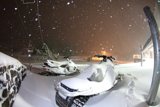
Image::Courtesy of Falls Creek
Today in the mountains will be a wild one. Strong winds are currently blowing from the west causing most resorts to put a number of lifts on wind hold. However this news is not all bad, the dry nature of the snow that has fallen over the last few days means that wind drifts will be accumulating on lee slopes with an eastern aspect and in the trees. Thursday will likely be the day this week, winds are forecast to ease, temperatures will remain below zero and snowfall right through to around midday tomorrow mean that conditions will be prime!
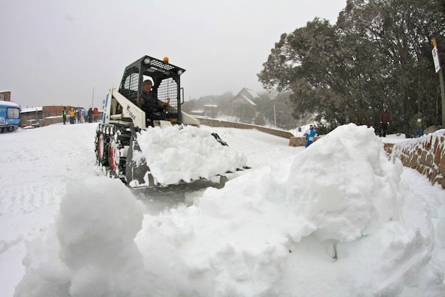
Digging out Image::Courtesy of Falls Creek
The North-South Gradient
If you have been tracking this storm yourself you may have noticed that there is a definite disparity between NSW and VIC in terms of snowfall totals. “The rule of thumb is, NW systems like this one deliver more snow to the northern regions, so you see Thredbo and Perisher leading the way with Falls Creek not far behind.” Said Mountainwatch’s own Steve Lee, “further south to Hotham, which is only 20km south west from Falls, you already see a drop and considerably more to the south for Mt Buller and Mt Baw Baw. Southerly and southwesterly systems are the other way round. We saw that early season storm system drop 50cm on Mt Baw Baw, and not so much in NSW.”
Weather for the remainder of the week
The rest of this week will see even more snowfalls with the majority falling throughout the rest of Wednesday, snowfalls will then begin to ease as the week progresses with steady top ups that will set up conditions beautifully. Temperatures are expected to remain cool, great news for all the resort’s snowmakers!
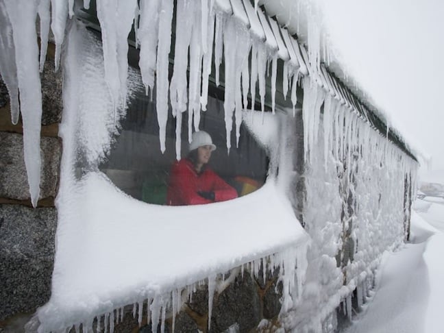
Sheltering from the storm Image::Courtesy of Perisher
Resort breakdown
NSW
Perisher saw another 31cm of new snow fall over the last 24 hours, this brings the total for this storm to 62cms. Temperature is currently -3.6°C at mid mountain. The next few days are forecast to remain cold with minimums around -5°C and max temperatures around -1°C. This will ensure that the new snow remains in great condition across the resort. Winds are currently moderate to strong meaning that some lifts are on wind hold. All this new snow has meant that Perisher has opened lots of new terrain just in time for school holidays. Interceptor quad is tipped to make its season debut later today.
Thredbo was lucky enough to see 15cm of new snow fall overnight, bringing the storm total to 60cm in total. Unfortunately this morning very strong winds and further snowfall is reducing visibility. Thredbo is expecting chilly top temperature of -4°C meaning that there should be lots of powder all day. Very deep wind drifts will be found in the higher alpine although unfortunately strong winds currently have most higher lifts on wind hold. Winds are expected to ease as the day progresses so things could get pretty epic this afternoon. Lots more snow is expected today and right through the week.
Selwyn Snowfields Family holidaymakers heading to Selwyn for the school holidays will be very happy to see the 26cm of fresh dry snow that has fallen over the last 24 hours. Max temperature expected today is -1°C which will keep the cover in great shape. Further snowfalls are forecast for the rest of the day that will improve the conditions even more!
Charlotte Pass received a further 35cm of new snow over the last 24 hours. Their higher elevation has meant that all snowfall from this storm has been super dry creating amazing conditions for those lucky enough to be there. They are expecting a top temperature of -1°C today alongside further snowfalls over the next few days.
VIC
Falls Creek Another 20cm of new snow fell in the last 24 hours at Falls bringing the storm total to 41cms. Temperatures are to remain cold keeping the new snow in great condition. Snowfalls are forecast to continue and Scotts and Sun Valley are expected to operate for the first time this season today.
Hotham A further 18cm of new snow fell last night bringing the storm total to 48cm. As a result of all the new snow Mt Hotham operations plans on opening Heavenly Valley Chair today and has said that they will open further new terrain as the storm progresses. Temperatures are forecast to remain cold through the week with great snowmaking opportunities and further natural snowfall expected.
Mt Buller Snow is still falling at Buller with another 18cms of new snow received overnight. The resort is reporting a natural base of 45cms, with up to 75cms in manmade areas. Forecast maximum temperature is only -2°C, further snowfalls are expected today.
Mt Baw Baw Unfortunately Baw Baw has not been as lucky as more northern resorts over the last few days with only 6cm of new snow over the last 24 hours. Conditions are marginal and all lifts remain on hold pending further snowfalls. The good news is that there is more snow expected over the next few days so fingers crossed the resort will be able to kick things into gear.
Lake Mountain has seen 10cm of new snow fall overnight. Grooming is in progress and XC skiers will be happy to hear that Nordic trails are in great condition and will be open today.
Spencers Ck Snow Depth
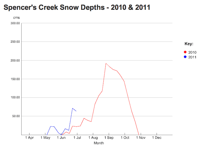
Clearly an improvement on last year already. Next trend will be up. Image:: Snowy Hydro
The latest snow depth reading from Snowy Hydro is due tomorrow morning. The measurement should be interesting as its sure to be a great improvement on the last. As you can see above so far season 2011 is definitely on track to be an improvement on 2010.
The mountains will be a worthy playground this week, when heading down ensure you check road conditions, carry chains and don’t rush!
If you are heading out have fun, it is sure to be a powder day full of smiles, big turns and high fives….
Perisher forecasts,
snow reports and
live snow cams.
Falls Creek forecasts,
snow reports and
live snow cams.
Mount Buller forecasts,
snow reports and
live snow cams.
Charlotte Pass forecasts,
snow reports and
live snow cams.
Hotham forecasts,
snow reports and
live snow cams.
Thredbo forecasts,
snow reports and
live snow cams.
Mount Baw Baw forecasts,
snow reports and
live snow cams.


