AUSTRALIA NEW SNOW – Big Snowfall Set for Tuesday
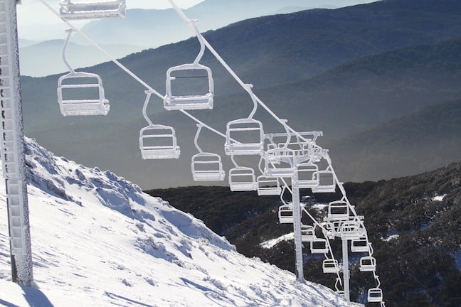
Icy chairlift at Buller in 2010, hopefully the coming storm will deliver some similarly picturesque vistas. Image:: Mt Buller
Snow Journal | Tess Cook
No doubt about it now, a snow storm will hit the Australian Alps some time early Tuesday morning and should leave a healthy serve of up to 60cm of snow on the slopes by mid week.
“Here at Mountainwatch we have been calling it for around a week, and now just a day out this storm looks set to deliver,” wrote Steve Lee in his Monday morning detailed forecast analysis. “Our computer models are showing very large accumulations of snow Monday night through Wednesday, anywhere from 30 to 60cm, the animated forecast and blue Mountainwatch snowline tells the same story, snow, snow and looking like more snow is on the way.”
While Steve tends to get enthusiastic, but our much more cautious meteorologist is similarly positive.
“It’s a laydown misere that this is going to be the heaviest snow of the season so far. No doubt. Parts of the mountains could see 10cm of snow an hour falling at the peak. There’s going to be nothing but smiles once the swarthy mountain folk dig themselves out on Tuesday afternoon/evening to survey the gift from the heavens,” the Grasshopper wrote Monday morning.
“Totals wise, I’m going to hold back for now, and stick to my range of two days ago: At least 30cm and possibly 60cm+, with a period of very heavy falls.
“I’m officially giving Steve Lee permission to get excited.”
With the excellent opening weekend snow thinning due to some rain through the past two weeks, this snowfall is more than welcome and should see the resorts opening up more terrain before the start of the school holidays.
Wind possibility
High winds are also expected with the snow storm, potentially gale force or even cyclonic in strength. Wind is a typical partner to snow storms in the Australian Alps but winds of the magnitude expected Monday night may impact on lift operations. The good news, as always, is when the storm clears the wind-blown stashes will be fantastic.
The ins and outs of forecasting
In typical snow forecasting fashion, this storm kept everyone guessing for several days, with total snowfall amounts, along with freezing levels and other variables jumping about with each update of the forecast model. This variability is constant aspect of any kind of forecasting, trying to pin down weather behaviour in the future, even only six or seven days ahead, is a notoriously inexact science, with accuracy only increasing as the day and time in question moves closer.
For a clear and easy to understand explanation of how forecasting works and how to understand our forecast models, read Alex Horvath’s excellent Forecast Chart Guide
Perisher forecasts,
snow reports and
live snow cams.
Falls Creek forecasts,
snow reports and
live snow cams.
Mount Buller forecasts,
snow reports and
live snow cams.
Charlotte Pass forecasts,
snow reports and
live snow cams.
Hotham forecasts,
snow reports and
live snow cams.
Thredbo forecasts,
snow reports and
live snow cams.
Mount Baw Baw forecasts,
snow reports and
live snow cams.


