Australian 2023 Snow Season Outlook – Mid-August Update
Mountainwatch | The Grasshopper
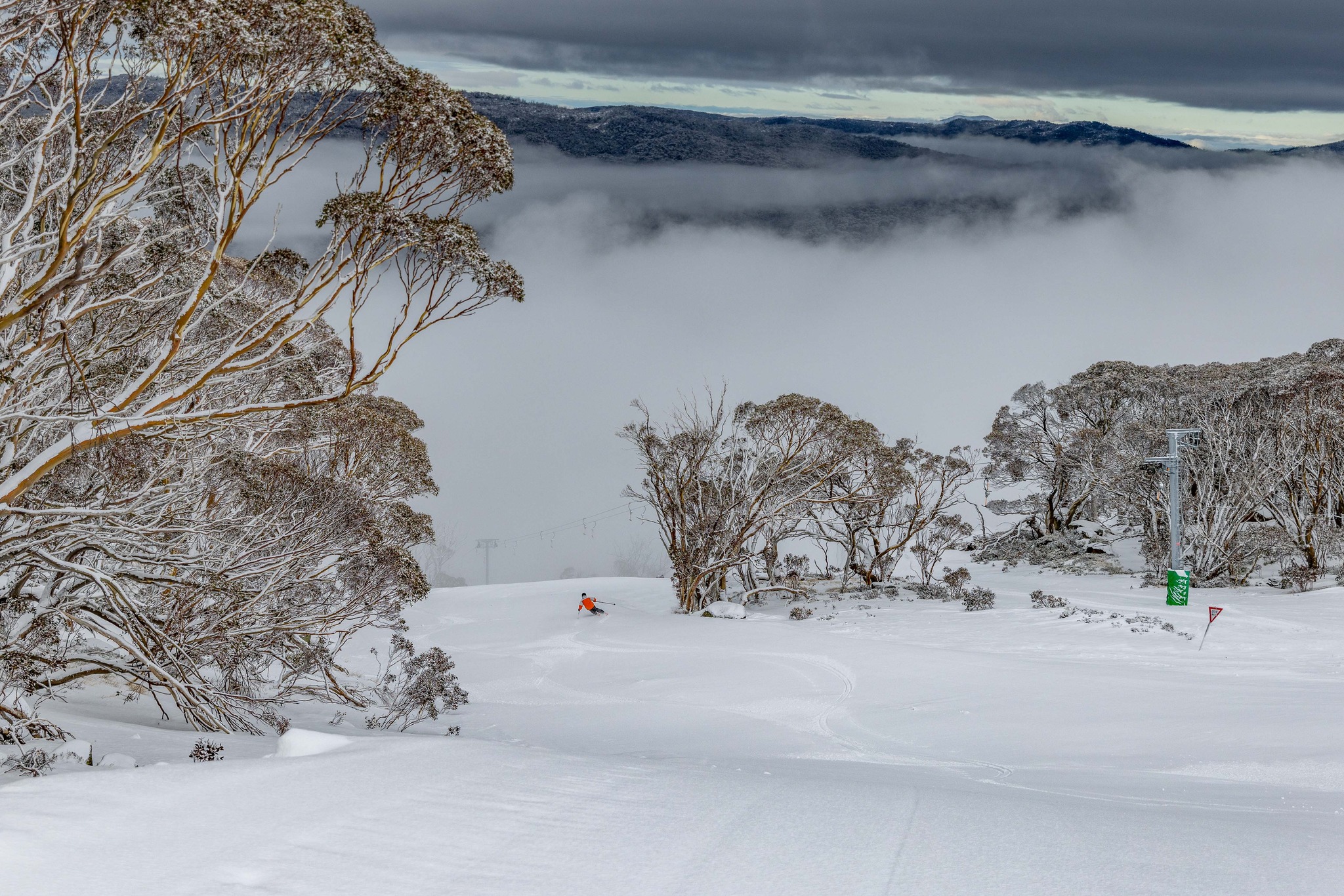
After solid snowfalls across the Victorian and NSW ski resorts in late June and early July, there has been a steady decline in the snowpack due to warmer than average weather and rain. Daytime temperatures were generally 1.5-2℃ above average in the mountains through July and the first two weeks of August. For Perisher Valley, it was the warmest July in terms of both daytime maximums and overnight minimums in at least 13 years. Sydney had its warmest July in 164 years of records.
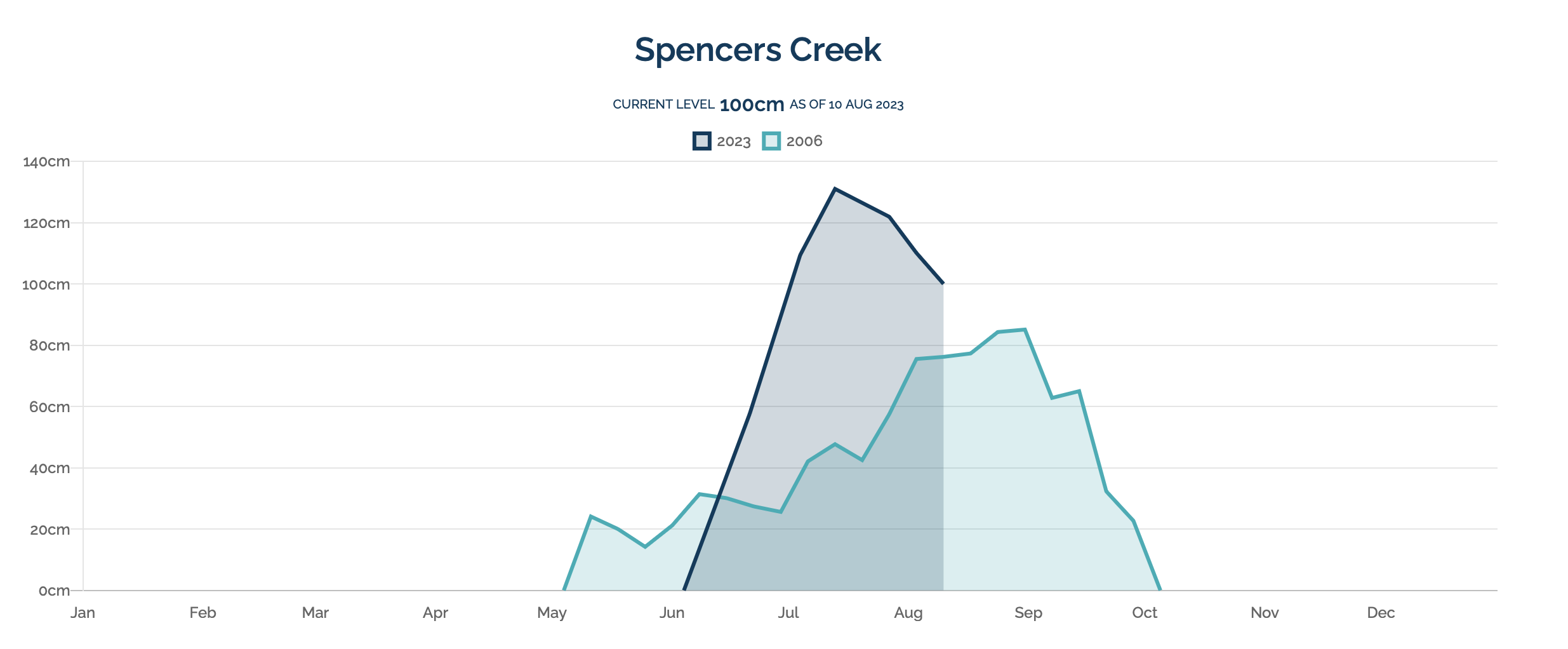
As of 10th August, Spencer Creek snow depths in NSW were edging below the 100cm mark (Figure 1), and below 50cm at Mt Hotham in Victoria. Several small top up events occurred during the second week of August, but no substantial dumps to boost the snow base. Although the season to date has been poor in comparison to the long-term average, it is still ahead of the horror year of 2006, when a blocking high pressure system was in place over southeastern Australia for most of the winter.
The short-range modelling shows some promise for fresh snowfalls in the second half of August to keep the season going at the majority of resorts. A frontal system is due to move across southeastern Australia early on Friday 18th August, with the potential for 5-15 cm of fresh snow across NSW and Victorian resorts. There will be a warming trend over the weekend that follows, with drizzle at times, so don’t expect any fresh, dry powder following this system. There is some prospect of decent follow up snowfalls for Tuesday 22nd August and the weekend of 26-27th August, although with no consensus in the leading numerical weather prediction modelling, this remains speculative.
For September, we start to rely on global scale climate drivers to give us a steer on likely outcomes. And the news isn’t ideal. An El Nino event is expected to become entrenched across the Pacific basin, severely reducing the odds of getting average precipitation and cloud cover across eastern Australia (Figure 2).
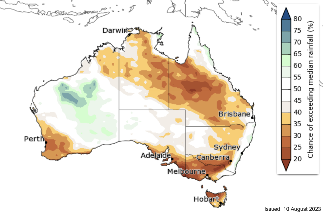
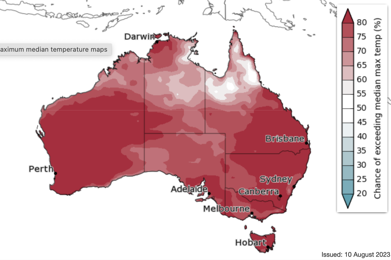
This reduction in moisture and cloud cover (compared with the long-term September average) will allow for intense solar heating of the Australian continent in September, with this warmth being transported to NSW and Victorian ski resorts between frontal systems. There is also a chance that this warm and dry signal will be amplified by a similar pattern on the other side of the continent, known as the Positive Indian Ocean Dipole (IOD). There is less certainty on the Positive IOD eventuating, but El Nino alone still gives a strong dry and warm bias for September (Figure 3).
Many international weather agencies (i.e. NOAA, JMA and the WMO) have already declared that El Nino is underway, based on equatorial sea surface temperature anomalies. And it is likely that the Australian Bureau of Meteorology will follow suit in coming weeks, once atmospheric indicators show a stronger response to the sea surface temperature anomalies across the equatorial Pacific.
It is not all bad news though, as climatologically speaking, we typically see at least one very strong cold air outbreak for southeastern Australia during September. And we are more likely to see more frequent negative phases of the Southern Annular Mode (SAM) than in the previous three La Nina years (as La Nina is correlated with positive phases of SAM), which usually translates into periods of westerly winds (and the chance of cooler weather with snow) sitting further north over southeastern Australia.
The best advice is to take advantage of any one-off snow falls as they occur, and hope that fronts in late August and September keep the snow base intact until at least the end of school holidays. And pack some shorts and t-shirts for the warm bursts of spring weather in-between.
That’s it from me folks. If you’ve got a different theory on what’s going to happen this winter, or just want to provide feedback, then please hit me up on Facebook and hit the follow button while you’re at it. Remember, the key to scoring in the Aussie Alps is often about timing, and the best way to time it right is to keep a handle on weather forecasts, which you can do right here on Mountainwatch with top-of-the-line model data and my very own super-duper forecasts.


