New Zealand Forecast – Ski Fields Hopeful to Open with Snow & Cold Temps Next Few Days
Published early Wednesday, 24th June 2026
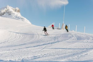
Conditions are set to improve significantly over the next few days as a cold airmass sneaks up from the south today to meet with a storm from the Tasman Sea. By the time the storm departs the country this weekend, Kiwi ski fields will have picked up a fresh coat of snow to low levels and had a good run of snowmaking. Hopefully, this should be enough to get a few more ski fields up and running.
The Southern Lakes is expected to pick up between 2-8cm from a couple of brief dustings. Canterbury will see more substantial and prolonged snowfall with totals of 15-35cm likely for Mt Hutt and nearby ski fields, and 40-60+ cm possible in northern Canterbury. Forecast models have aligned nicely, so we can have more confidence in these numbers.
Whakapapa and Turoa on the North Island’s Mt Ruapehu are scheduled to open on the 4th of July, and are chomping at the bit for any natural snow. Fortunately, the storm will also turn cold there on Thursday, and ski fields are expected to receive 5-15+ cm before temps get too warm on Friday.
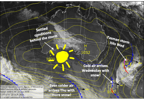
Wednesday 24th June
A storm in the Tasman Sea spreads rain over the country from the North Island down through Canterbury early morning.
At the same time, a cold airmass will sneak up from the south, crossing the Southern Lakes during the afternoon and giving ski fields there a dusting of snow and getting the snow guns started on what will be a prolonged run of great snowmaking conditions.
The cold southerlies reach Canterbury at night, turning rain to snow.
Thursday 25th June
An extra surge of strong, cold southerly winds blasts up the South Island during the morning, bringing snow all the way down to 500-600m altitudes, affecting some roads and towns.
The Southern Lakes will receive a small shot of 1-5cm of snow during the morning, then will be left with partly sunny, partly cloudy skies for the afternoon as winds start to back off. Canterbury will get a more substantial dump, with decent snowfall throughout the day.
Snow will also start falling on Mt Ruapehu from late afternoon as the strong, cold southerlies arrive.
Friday 26th June
It’ll be a nice, fine day for the Southern Lakes as cold southeast winds ease. The snow guns will continue to pump all day and night.
In Canterbury, light snow showers and flurries will continue into the afternoon for Mt Hutt and nearby ski fields, but they’ll keep going strong in the north through the day, benefiting the My Lyford and Hanmer Springs ski fields. Strong, cold southerlies abate.
On Mt Ruapehu, snow will eventually turn to rain as temps warm a little before easing at night. Strong southerlies also abate.
Saturday 27th June
Another nice, sunny day for the Southern Lakes with a light southeast breeze. Great snow-making conditions continue morning and night.
Chilly southeast winds continue to ease in Canterbury. Mt Hutt and nearby ski fields will be cloudy and may see a few more snow flurries during the morning. Light snowfall in northern Canterbury won’t clear until late in the day.
Strong southeasterlies on Mt Ruapehu will be too mild for snow or snowmaking, so there’ll just be a few rain showers.
Sunday 28th June
A mostly fine day for South Island ski fields, with light southerly breezes.
Mt Ruapehu will see a few more light rain showers as southeast winds persist.
Extended Forecast
A high-pressure system drifting over the country early next week will bring dry, settled weather Monday the 29th June, through Wednesday and possibly Thursday, the 1st and 2nd July.
From about Friday the 3rd, the weather is expected to become unsettled again. Things are likely to start warm and wet before a possible cold change around Sunday the 5th July brings another round of snow.
That’s all from me today, folks. I’m sending out NZ forecasts every Monday, Wednesday and Friday throughout the season. Have a great couple of days, and I’ll see you back here on Friday.
Grasshopper