Australian Forecast Friday 25 June – Colder Weekend Temperatures on the Way
Mountainwatch | The Grasshopper
It has been a very average last few days in the mountains this week. Warm temperatures have resulted in significant rainfall across all resorts, but the silver lining is some snow today and a little bit more over the weekend. This rainfall has been caused by a cut off low making its way across the country and rhese systems can bring warm conditions due to being in the mid-latitudes for too long. This particular system was especially wet thanks to tropical moisture just north of Australia giving large rainfall totals all over the country. In the future we can look forward to a colder weekend with snowfall predicted the next three days. Today should offer the largest totals around 5-20cm in some parts. The fluctuating freezing levels still make it hard to predict and so snow will favour higher elevations.
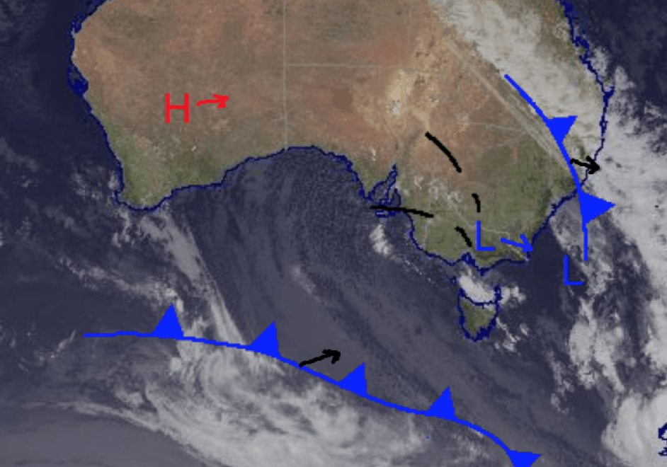
The two low centres in the south east will become one tomorrow in the Tasman as it clears Australia. The front visible in the Southern Ocean is moving east and may bring small amount of snow over the weekend as the top of it passes over Tasmania. (Source: Bureau of Meteorology (vandalised by the Grasshopper)
Friday June 25
High chance of snow above 1500m in Victoria dropping later in the day and a similar story in NSW with the freezing level around 1300m. Totals most likely in the vicinity of 5-20cm, could possibly be more in places.
Saturday June 26
Very high chance of snow above 1200m for both Victoria and NSW. Modest totals of 2-6cm expected.
Sunday June 27
Medium chance of snow above 1100m for Victoria and slight chance in NSW above 1100m around the peaks. Mostly flurries totals around a centimetre or two.
Extended Outlook
Looking forward to next week, fingers crossed we get all the snow we can out of this week’s weather before it’s done. The beginning of next week is dominated by high-pressure bringing nice weather and cold nights which will be useful for some much-needed snowmaking. There may be some more snow on the way end of next week and I’ll keep you updated on that as it develops in my forecast on Monday.


