Australian Forecast, June 10th – Cold Front to Bring Snow & Several Days of Snow Making
Mountainwatch | The Grasshopper
Published early Monday 10th June 2024
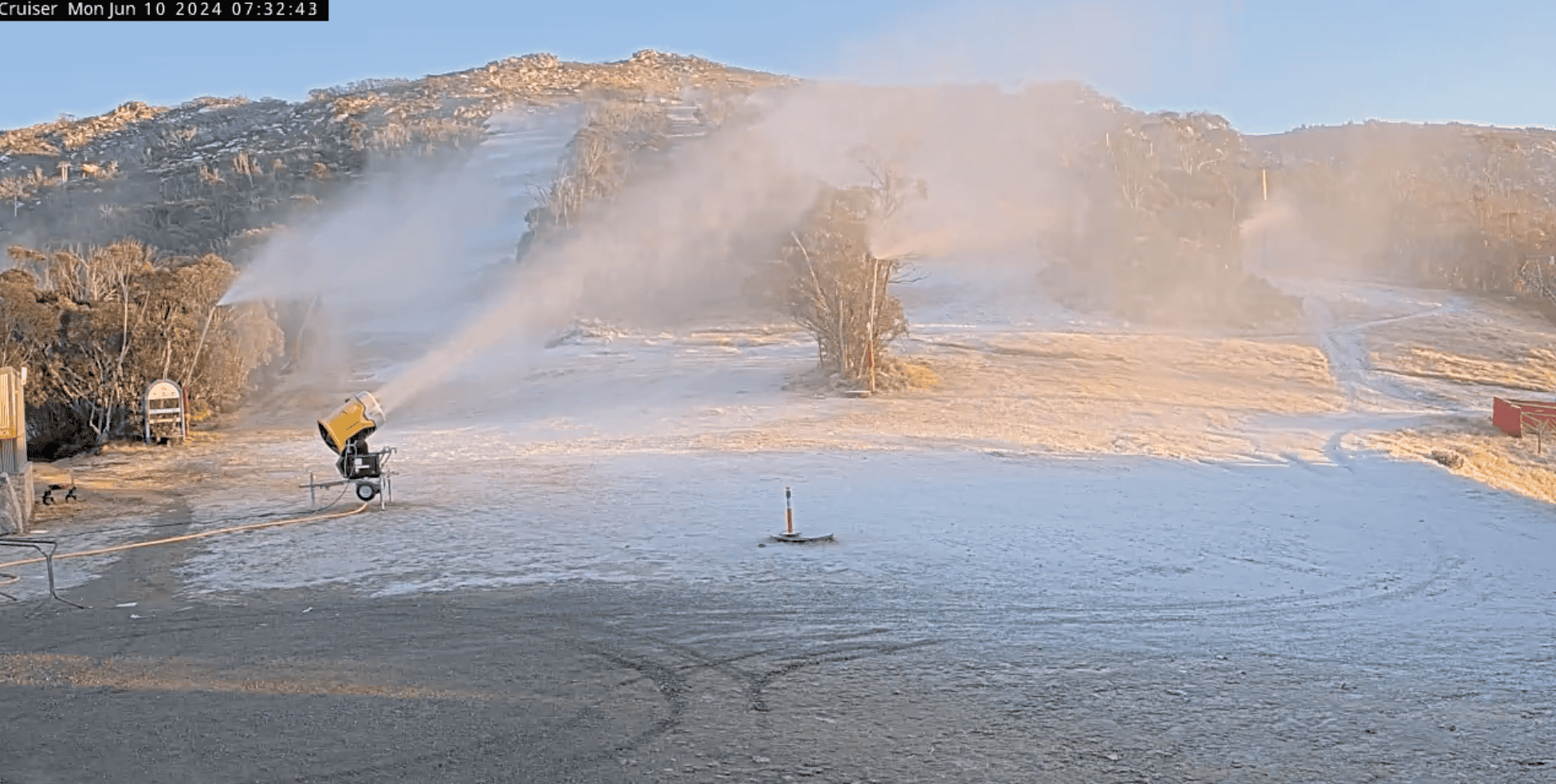
After a little snowfall about the upper slopes last night, the snow guns are blazing this morning with the first cold temps we’ve had in a while. Skies will clear up today for the King’s Birthday, with limited terrain open at Baw Baw, Buller, Thredbo and Perisher.
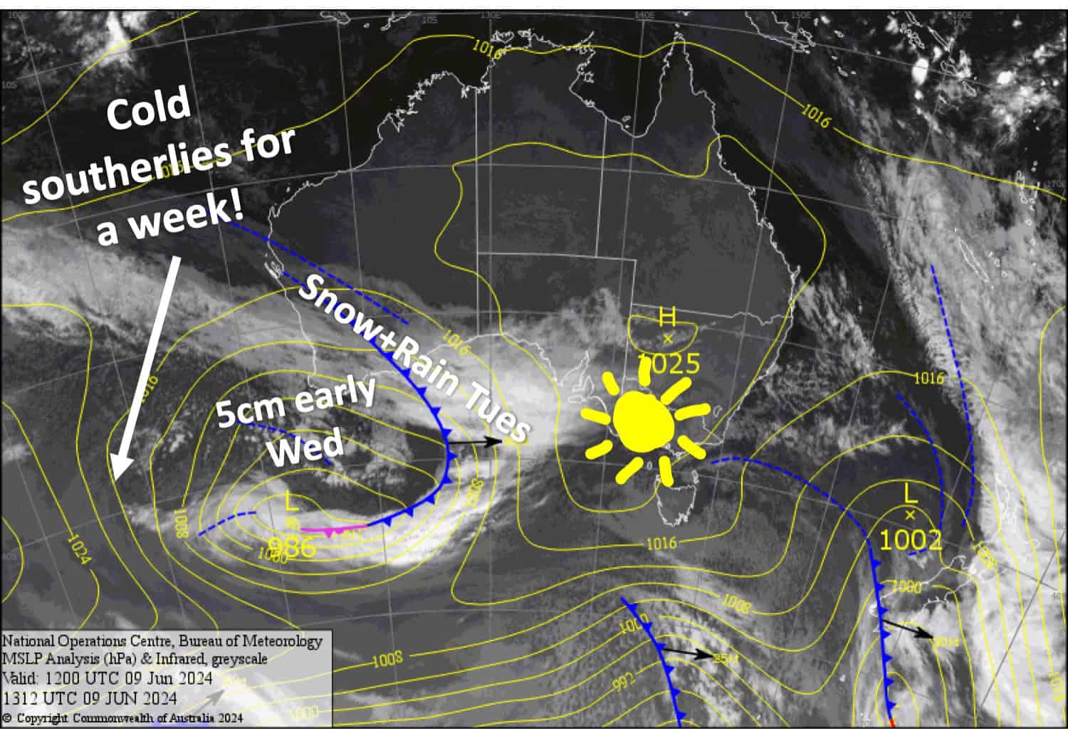
A front passes over us on Tuesday, dropping snow up high before the cold air hits that night bringing snow to low levels early Wednesday. Snowfall totals could be quite substantial up top where 20-30+cm is possible, while around 5cm is expected about the lower slopes.
Temperatures will remain nice and cold for several more days, allowing resorts to pump out the mad-made stuff and open up some more terrain.
Monday June 10th
Any morning cloud will clear to a fine day, although a little high cloud will sneak in overhead this afternoon. SW breeze eases before a NW breeze develops over Victoria.
Tuesday June 11th
Rain spreads eastwards during the morning, with snow mostly falling above about 1800m (possibly to 1700m) while NW winds blow a gale. There’ll be quite heavy falls before snow levels start to drop at night as cooler westerlies start to arrive.
Wednesday June 12th
Snow showers lower to around 1200-1400m early morning (lowest in Victoria), then gradually petering out and becoming fine by the end of the day, although cloud will linger about Buller and Baw Baw. Strong, cold SW winds gradually abate.
Thursday June 13th
Mostly fine, but cloud will linger about Buller and Baw Baw again with light snow flurries possible. A cold SW breeze turns southerly with good snow-making potential.
Extended Forecast
Cold southerlies are expected to continue to blow over the Aussie Alps for several more days as a slow-moving low-pressure system in the Tasman Sea nails New Zealand. This will give resorts a good chance to make a tonne of snow and get some more terrain up and running. These winds will likely die out sometime from Wednesday June 19th . It’s unlikely we’ll receive much in the way of natural snow although some light snow showers are possible.
That’s all from me today folks. The next forecast will be out on Wednesday, see you then.
Grasshopper


