Australian Weekend Forecast, August 25th – Blue Skies Today, Damp This Weekend
Mountainwatch | The Grasshopper
Written early Friday 25th August, valid to Sunday 27th August
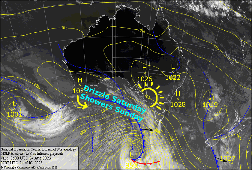
Skies will stay mostly blue today as high pressure dominates over southeast Australia. The tip of a cold-ish front struggles to make any headway as it pushes up against the high pressure during Saturday, bringing some cloud and drizzle to the Aussie Alps.
The front tip gets cut off from the main frontal band during Sunday where it develops into a mini low-pressure system. This destabilises the air over the Aussie Alps, bringing rain showers which may build into thunderstorms during the afternoon.
It’s not exactly the forecast we’re after, and unfortunately there’s no season-maker storm on the horizon, but there’s still plenty of snow about the mid and upper slopes which will tie us over for a while yet. We just hope like heck for something decent to come through during September before it completely disappears.
Friday 25th
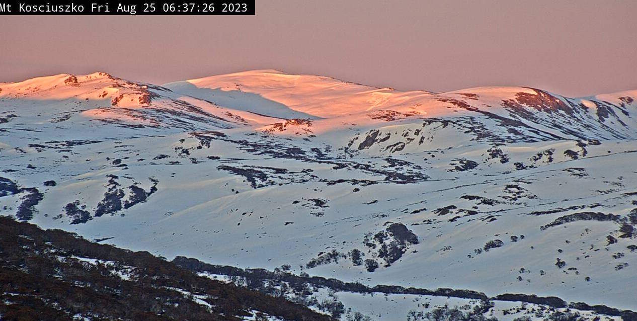
A mostly fine day with just scraps of mid-high cloud about, although Baw Baw and Buller may see a little lower level cloud at the start and end of the day. Winds from the west may be quite strong in exposed areas, especially over Victoria.
Saturday 26th
A bank of cloud and patchy drizzle will push northwards over Victoria during the morning. The cloud bank reaches NSW around midday/afternoon, but the drizzle is unlikely to reach that far, and it’ll be fairly broken with plenty of fine spells coming through. Westerly winds will be fairly brisk up top, especially over Victoria again.
Sunday 27th
Mostly fine to start, then rain showers will develop during the morning (first Victoria, then NSW) with thunderstorms possible during the afternoon. Showers clear during the evening. W-NW winds gradually tending N-NW.
Extended Forecast
There’ll be a few more rain showers during Monday before the mini low-pressure system dissipates, leaving mostly clear skies for Tuesday.
Hair dryer NW winds will blow a gale during Wednesday as a front approaches from the west. As we all too often see, most of the precipitation will fall before the cold airmass arrives late in the day. Fortunately, it’ll just be a light smattering of rain. Colder temps during Thursday should have the snow guns firing at least on mid-upper slopes, and hopefully the lower ones too, along with a natural snow flurry or two.
High pressure will spring-clean out the skies next Friday before NW winds potentially pick up again next weekend. Keep an eye on the following few days, maybe the 4th to the 5th of September for the next possible snowfall.
That’s all from me today, folks. See you again Monday.
Grasshopper


