FORECAST World Heli Challenge – Clear Weather Tuesday

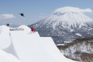
The Extreme Day 2009. Image:: Harro
World Heli Challenge Forecast | Aaron Cook – Mountainwatch.com Alpine Meteorologist
Summary:
When the weather clears Monday we will find out exactly what effect Sunday’s storm has had on the terrain. The terrain will be assessed for avalanche danger and hopefully things will be looking OK for the first day of competition to be held as soon as weather permits.
It still looks like the weather will play its part to allow the freestyle day to be held on Tuesday, but then we’re staring at three straight days with some sort of precipitation and cloud in the forecast. Wednesday will see some light rain with not much wind, while Thursday and Friday afternoons will be affected by separate cold fronts.
The good news is the weekend is looking fine at this stage.
Synoptic Outlook:
A large area of low pressure dominates the Tasman Sea on Tuesday, but is too far away to
deliver any weather to the South Island. However, it takes a south-easterly track to break across the mainland Wednesday morning before moving away to the south-east.
Thursday will see a weak cold front from the south-west cross the region during the afternoon and this will be followed by a stronger cold front Friday afternoon.
Tuesday 3 August:
The low pressure in the Tasman heads towards the South Island. This could cause some
cloud and a few showers along the coast but should leave eastern parts of Mt Aspiring
National Park unscathed and experiencing mainly fine weather in easterly winds. Tuesday is still my pick for the first day of competition.
Wednesday 4 August:
Light rain should develop early and come and go through most of the daylight hours. This
may be out of high cloud at first, but I’d expect some lower cloud to develop as the rain raises the humidity near the surface. The winds won’t be anything to speak of, so it’s hard to say whether this weather will be enough to stop play.
Thursday 5 August:
The forecast is for a cold front from the south-west to pass over about lunchtime Thursday. The front doesn’t look particularly intense, but there will be increasing cloud and northwesterly winds ahead the front that I would expect to cause problems.
Friday 6 August:
A similar day to Thursday, except with more rain and stronger winds.
Extended Synoptic Outlook:
A ridge of high pressure is forecast to extend over the South Island on Saturday and Sunday. The winds will die out and the weather and cloud will clear, allowing the completion of any remaining competition. Hopefully the forecast stays this way.


