Grasshopper’s New Zealand 2024 Snow Season Outlook, June Update – Stubborn Tasman Low Pressure Curbs Autumn Promise
Mountainwatch |The Grasshopper
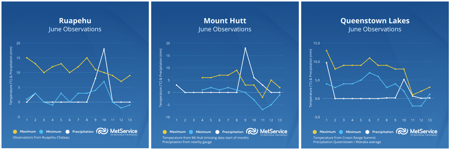
What a tease May was…the coldest May in New Zealand in 15 years with plenty of early snowfall across the ski fields, including 50cm at Turoa, Mt Ruapehu and cracking conditions for snow-making too. It’s fair to say as we headed into the start of winter, expectations were high for a fantastic snow season.
The start of June has seen us temper short term expectations though, with persistent and slow-moving low pressure in the Tasman Sea a constant presence since the start of the month. This has meant an abundance of mild northerly airmasses have affected the country over the first few weeks of winter and taken the shine of some of those early bases. Warm rain continues to affect northern ski-fields at times, whilst southern fields have struggled to see much in the way of precipitation at all.
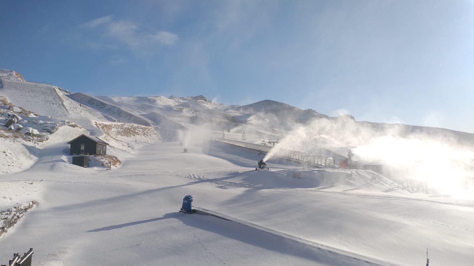
Over the past few days though, conditions have at least cooled off a touch further south and this has allowed for some snow-making, with most resorts on track to open their learner areas on schedule. We may have to wait a few more weeks yet before more terrain becomes accessible on the hills.
Cold snaps returning Late June?
The persistent Tasman Sea Low will unfortunately not be going anywhere too quickly, likely hanging around into the end of next week. This isn’t great news for the North Island, where we remain on the milder side of what is normal for the time of year, especially by night, with rain more likely than snow on the lower slopes of Ruapehu at this stage.
In more promising news for the South Island though, some colder air may begin to sneak in across the island over the weekend and early next week. So, when precipitation does eventuate, it could lead to some useful snowfalls, perhaps most promisingly for the Canterbury fields early next week. Check today’s forecast for the details
Once the low does finally roll away to the east during the final week of June, expect a colder and more unsettled SW regime to finally reappear, which may offer better opportunities for snowfall right across the country’s resorts.
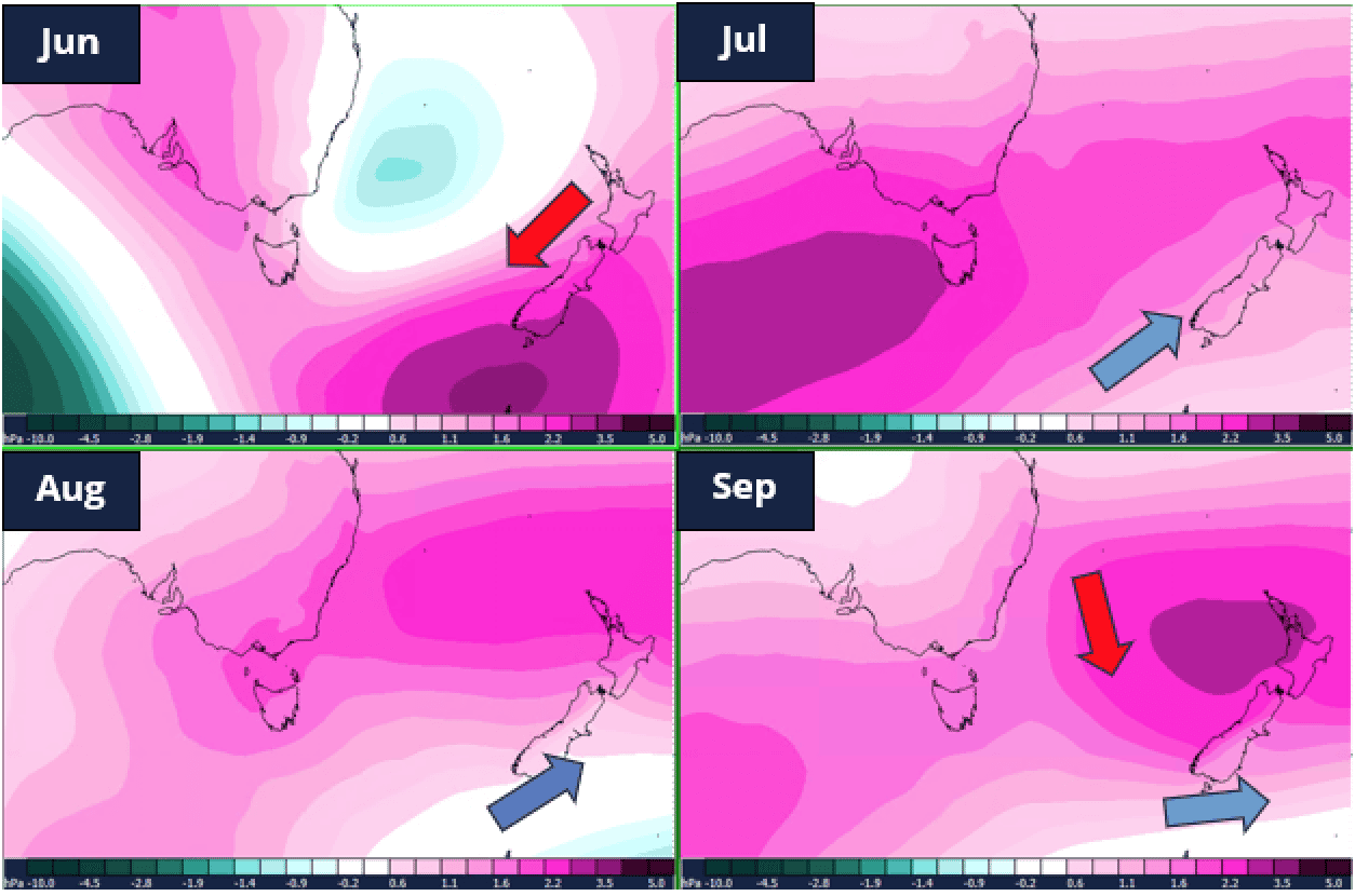
Seasonal outlook remains similar, with SW snow events offering frequent freshies
Whilst June hasn’t gone 100% to plan, seasonal forecasts remain fairly similar this month to my initial outlook last month. There are no major changes to the big climate drivers, with El Nino Southern Oscillation neutral and the Indian Ocean Dipole continuing to flirt with positive thresholds. Shorter term variability is likely to rule the roost this winter with significant month-to-month variation.
July, August and September continue to offer good promise of cold SW flows being the dominant weather regime. With sea surface temperatures around NZ continuing to be cooler than normal (and much cooler than they have been over recent winters) when cold snaps come through, they offer great potential windows for both natural and man-made snow. Recall, when we see SW snow events, they tend to be patchy and short-lived with big variations over quite small distances! To keep up with which hills may be in the firing line during these storms, check my detailed NZ forecasts every Monday, Wednesday and Fridays through the season at Mountainwatch.com.


