Grasshopper’s Weekly Japan Forecast, Jan 24 – Honshu Going Through The Roof
Mountainwatch | The Grasshopper
Thursday 24th January (Japan time)
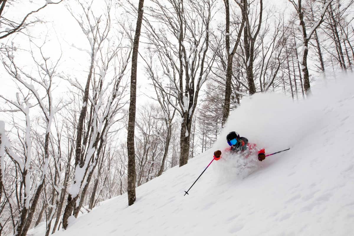
Japanuary will go out with a bang with snowfalls going through the roof on Honshu. Yet again, snowfall accumulations will be getting up near the 1.5m mark for the next ten days on the Hida and Echigo mountain ranges, with our high-resolution model spitting out 65cm+ for Hakuba for the next 7 days. I can also find values over two metres near the Coast! Things will be a bit quieter on Hokkaido with some sunshine even getting mentioned, but we’ll still have good falls today and late Monday/early Tuesday.
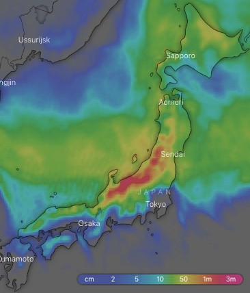
Ten-day snow accumulations. Big snowfalls expected on Honshu this week, while Hokkaido will be quieter and should even see the sun. Source: windy.com
Thursday 24 Jan:
A low sitting over Hokkaido has the Japow Machine cranking at the mo, with blower pow falling from the sky in droves along with freezing, strong-gale force NW winds. It’s a blizzard out there, but it’ll start buttoning off later today as the winds start to ease and the low rambles out to the east.
Friday 25 Jan:
Snow showers/flurries continue, but it’ll be a bit more persistent on Hokkaido. Winds will also continue to button off, becoming fairly calm over central Honshu as a low approaches from the west.
Saturday 26 Jan:
The low deepens as it crosses over Honshu in the hours before dawn with moderate-heavy falls getting going there along with strong N-NW winds. Hokkaido will just see the odd flurry and perhaps a few sunrays too, as well as a northerly breeze.
Sunday 27 Jan:
Good snowfalls on Honshu before dawn, then it’ll back off to flurries/showers as the low tracks away to the northeast while northerly winds gradually ease and swing to the west later on. Hokkaido should see more sunrays than snowflakes.
Monday 28 Jan:
A low coming straight off Siberia is picked to cross over Hokkaido in the evening/night. Before then, there will be little-to-no snow falling first thing, but then snowfalls should ramp up from afternoon, as do W-SW winds. There’ll be heavy falls later as freezing NW winds hit.
Tuesday 29 Jan:
Moderate to heavy snowfalls before dawn, then it’ll gradually peter out by the end of the day as the low sails away and a ridge builds.
Wednesday 30 Jan:
A relatively calm powder day as the ridge passes over. However, a trough passes over northern Honshu and Hokkaido with snow showers and freezing NW winds picking up.
Extended Outlook:
A low is picked to move out of the Yellow or Ease China Sea and then cross Japan next Thursday or Friday. We’re likely to see a warm airmass with rain to higher elevations on Honshu for a time, before cold air hits from the northwest as the low tracks to the east-northeast. Snowfalls may then go through the roof with some models getting carried away. However, we’ll have to wait till closer to the time before we get too excited because there’s a lot of uncertainty at this stage.


