Grasshopper’s Weekly North America Forecast, Feb 22nd – A Much-Needed Deep Week Ahead for the North, the Central & Southern Rockies Cop it from Monday
Mountainwatch | The Grasshopper
Written Thursday morning 22nd February (Pacific Time)
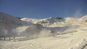
The last several days have been massive across the middle tier of North America, where up to 100cm+ have been recorded in the Sierras and Wasatch Range and up to 50cm in the Southern Cascades, Tetons and in Colorado.
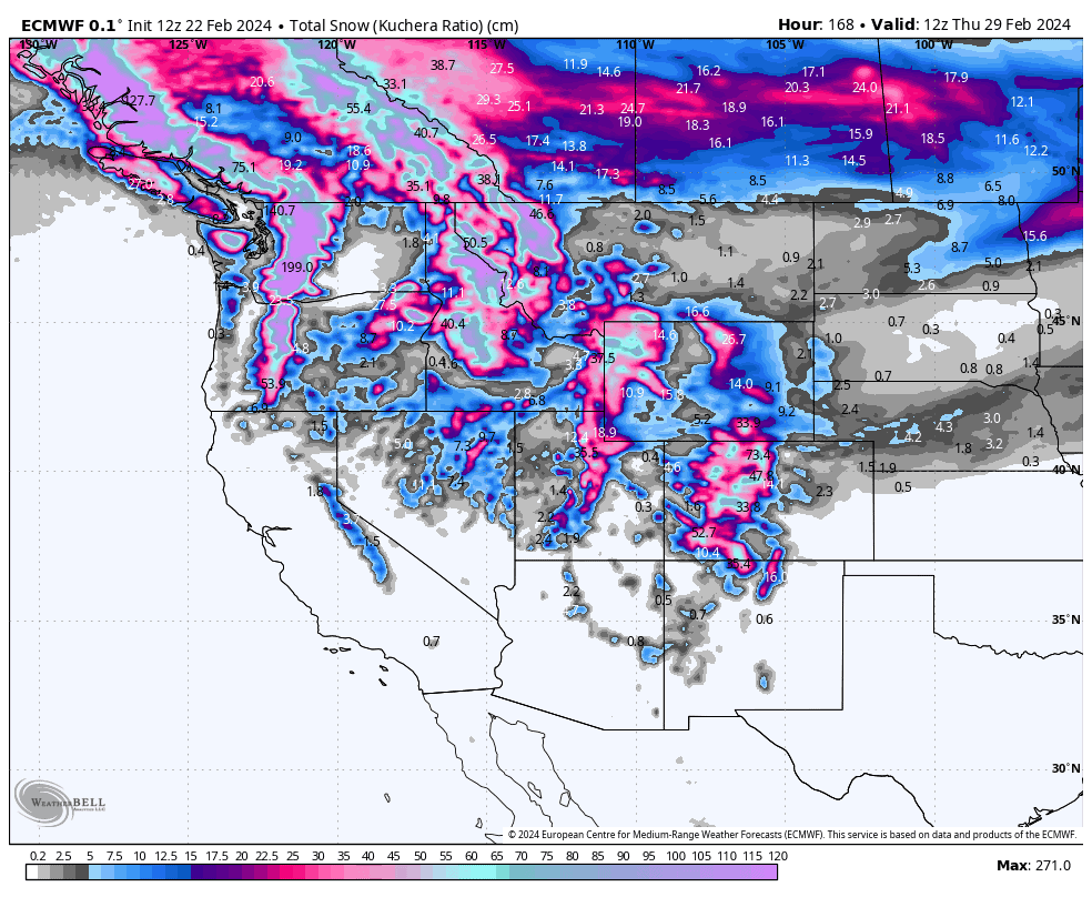
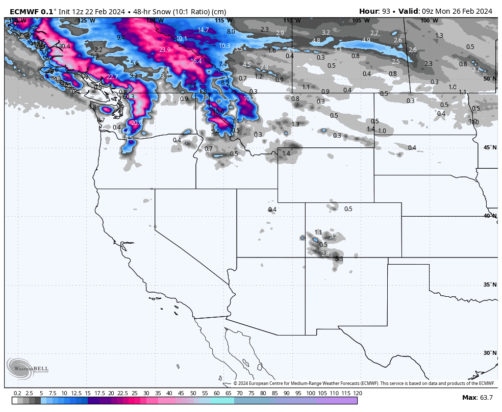
For the next seven-day period, the main action switches to the North where moist Pacific airstreams will bring massive totals. The seven-day accumulations chart should be a sight for sore northern eyes and will provide a long overdue perk-up in conditions there.
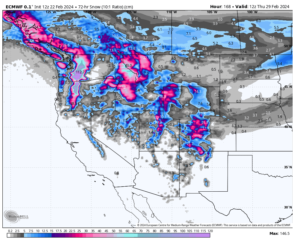
From Monday onwards, the action also spills into the South, where deep totals are also expected in the central and southern Rockies, while the Sierras will pick up just a light top-up.
Thursday Feb 22nd & Friday Feb 23rd
The tail end of the storm that brought massive totals to the Sierras, then the central Rockies the last couple of days, will exit the West today. A few extra centimetres or less of snow will fall throughout the Rockies as remaining light, scattered falls clear up, although they may linger into early Friday in the Tetons.
Saturday, the next storm system rolls down from the north, reaching northern Canadian resorts, such as Shames and Powder King, Saturday morning before reaching the U.S. boarder by the end of the day. The storm will lose a bit of juice on its way southwards, with moderate snowfall for those northern resorts, tapering off to light falls in the south of B.C. and Alberta where the majority of ski resorts are. Temps aren’t super-cold, so wet/dense snow should fall on any terrain below about 900m.
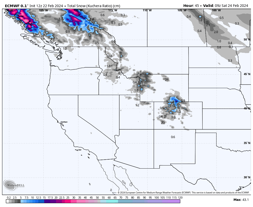
Saturday 24th & Sunday 25th Feb
Mostly light snowfall will continue over Canada during Saturday, while spreading southwards into the Cascades, Montana and northern Idaho.
Snowfall over these areas will build during Sunday as a new low-pressure system enters the scene, becoming heavy at most resorts. From later on Sunday, snowfall will start on an easing trend over Canada as the low passes east of the Rockies, where it will drag in a much colder and drier airmass from the north to replace the mild, moist SW flow.
Monday Feb 26th to Wednesday Feb 28th Feb
Monday, the storm continues to roll southwards, with moderate-heavy falls spreading into the central and southern Rockies, and lighter snowfall spreading through the Sierras. Again, temps will be mild so it’ll be wet and dense for terrain below about 2,500m. Meanwhile, snowfall in the North will become light and scattered as the cold, and drier airmass also continues to spread southwards over the northern tier of the U.S.
Tuesday, snowfall gradually clears the South as the storm heads off out east. Light scattered snowfall over the North build to moderate-heavy intensities a yet another low-pressure system pushes into the Canadian coastline. Temps will trend upwards as this new systems ushers in a milder, more humid SW flow, although snow levels should only lift significantly over the Cascades.
Wednesday, the action still continues over the North with snowfalls still reaching up into the moderate-heavy intensities. Temperatures will continue to trend warmer, especially in the Rockies, but colder air will be entering the from Pacific before the day is done. A few light snowfalls should also show up in the central and southern Rockies.
Extended Outlook
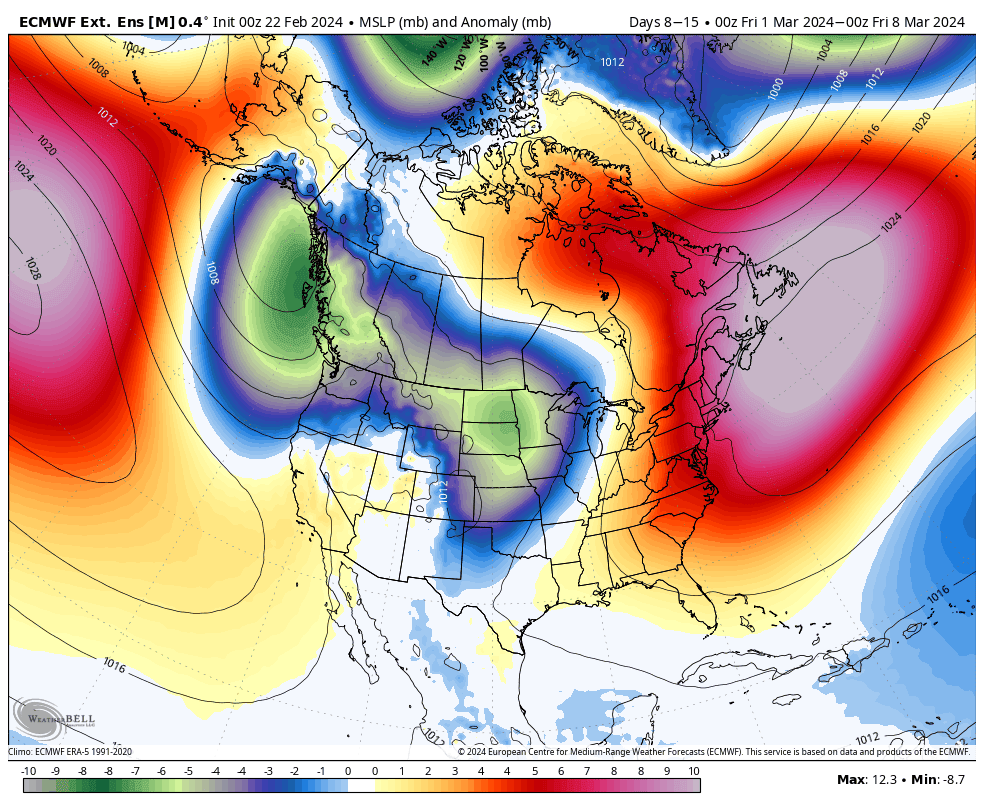
An active pattern is likely to persist over the West from next Thursday through the following weekend, the 2nd & 3rd of March, with a heap more snow likely.
A quiet spell is then expected at least through the first half of the following week, with most of the storm action restricted to the North.
That’s all from me today. Have a great week, see you next Thursday.
Grasshopper