Mountain Safety Collective Backcountry Conditions Report – Friday August 19
Mountainwatch |Mountain Collective
It’s been wild and windy in the mountains over the past couple of days, with mild temperatures meaning the freezing level has been consistently above 1700m and heavier snow into the alpine. The weekend is forecast to see another front come through Saturday with a brief respite on Sunday before yet another front arrives on Monday. Pay close attention to the weather and backcountry forecasts before making any touring or snow camping plans. Cornices and wind slabs on easterly slopes will be loaded while the wind is forecast to remain strong through the next few days.
NSW Main Range (Thredbo, Perisher, Guthega, Charlottes Pass, Ramshead Range, Western Faces) – Friday Report
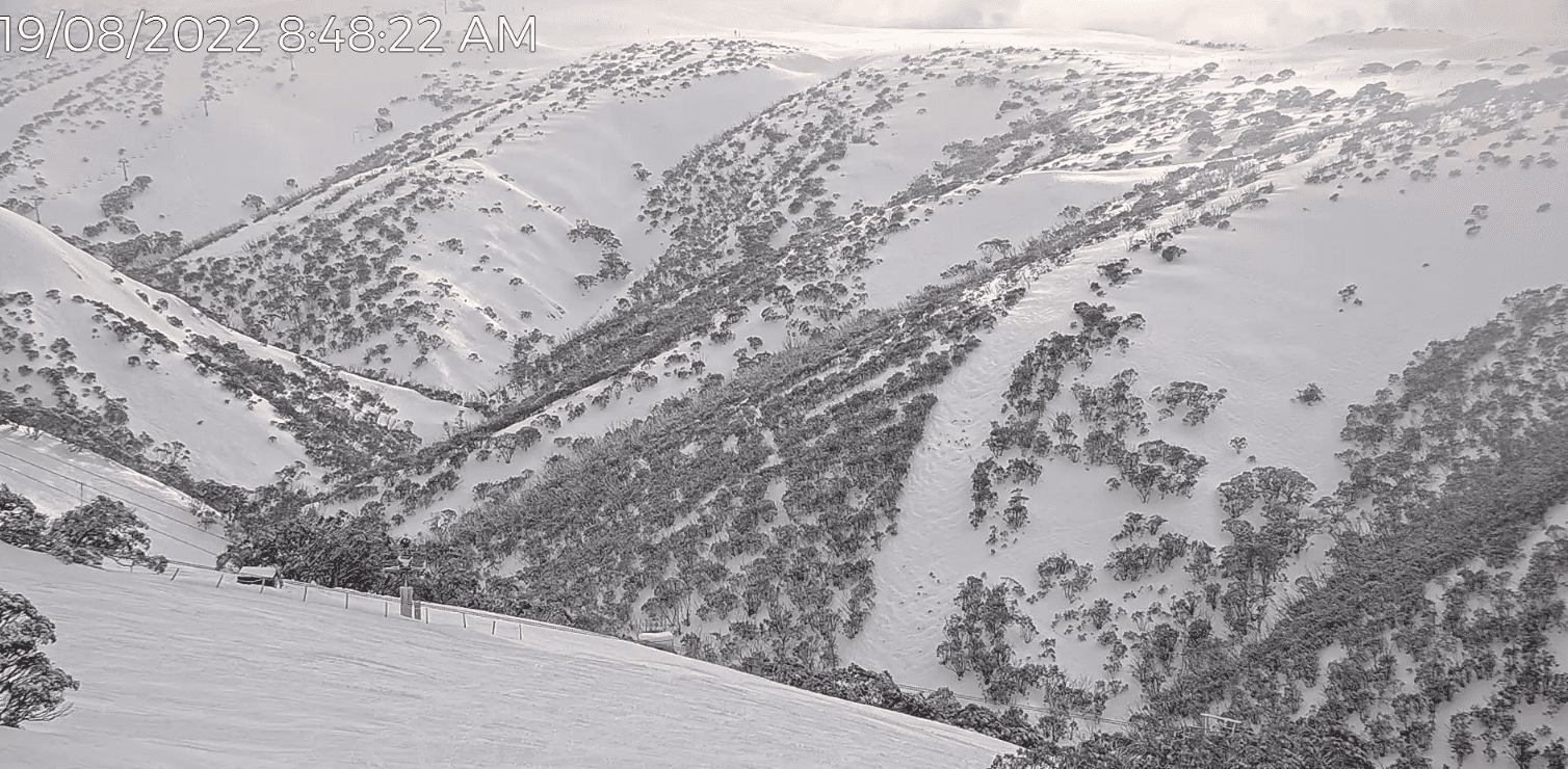
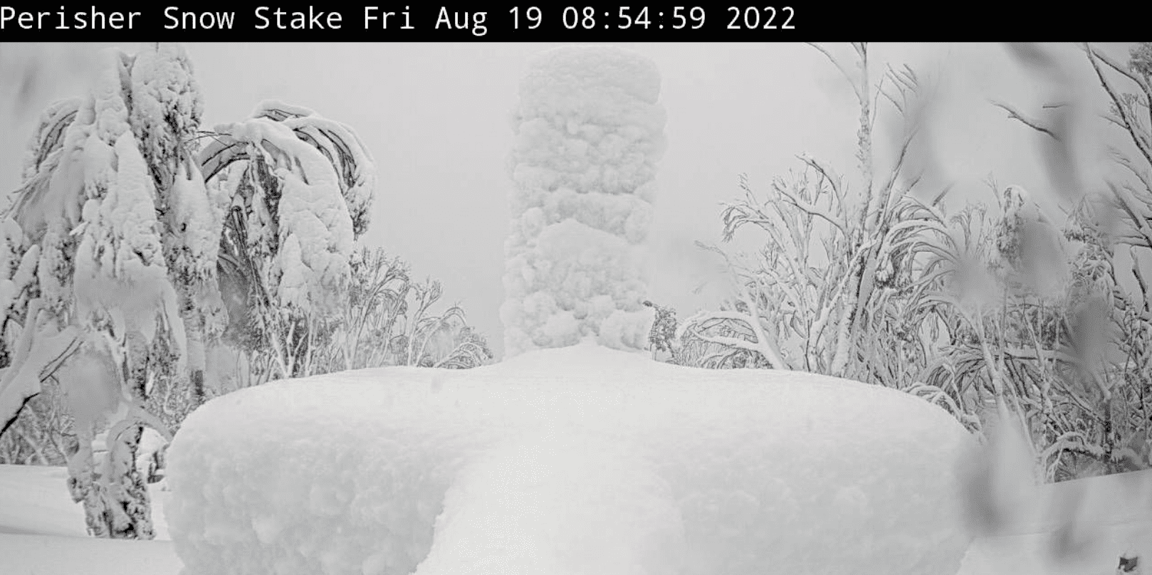
The Main Range received a heavy snowfall overnight (23cm as of 5am) and this will continue this morning and taper off as the day progresses. A cold front associated with a low pressure south of Tasmania is travelling east from Victoria heading towards the region. Snow showers are expected today and Saturday. Sunday will be a break from the storm before starting next week again with more snow.
Significant snow and wind overnight will have created a new wind slab problem in the alpine and in open features in the subalpine. Cautious route finding and conservative decision making is essential. Adopt a mindset of ‘stepping back’ while the storm continues. Visibility will be limited in the alpine and subalpine with whiteout conditions likely in the alpine, particularly first thing. Be prepared for whiteout navigation.
Furthermore, in the alpine, there are many cornices currently that are large and overhanging and it is likely that there have been natural failures with this new load. Give cornices a wide berth from both above and below. Lastly, there is an exposure risk given the continued precipitation, cold temperatures and wind speeds. Don’t forget your extra layers! Read the full report »

VIC Dividing Range (Hotham, Falls Creek, Bogong, Fainters, Feathertop) – Friday Report
Cold air Is crossing through the Dividing Range as a front moves across the Tasman Sea today. Another cold front follows close behind on Saturday morning with a ridge of a high over South Australia moving in on Saturday afternoon
Moderate avalanche danger in the alpine and subalpine as human-triggered avalanches are possible. Size 1-2 wind slab avalanches are possible in isolated areas with an average of 7cm of new snow last night. Size 1 loose wet avalanches are possible in the subalpine due to 11m of rain overnight. Heavy snow in lower elevations as Temperature only just dropped below freezing. With new loading from rain and snow caution on big terrain today, look for instabilities and not stabilities. Poor visibility this morning with a chance of good visibility after lunch, always be prepared for a whiteout.Read the full report »

VIC Front Range (Buller, Buffalo, Stirling, Baw Baw) – Friday Report
Moderate avalanche danger in the alpine and low in the subalpine with the possibility of Size 1 loose wet avalanches are in the subalpine due to 27m of rain overnight. Heavy snow as temperature only just dropped below freezing. With new loading from rain and possible snow caution on big terrain today, look for instabilities and not stabilities. Poor visibility this morning with a chance of good visibility after lunch, always be prepared for a whiteout. Read the full report »

For more information on staying safe in the backcountry, visit Mountain Safety Collective.


