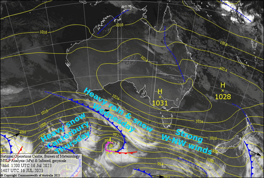
New Zealand Forecast, July 17th – Canterbury To Cop 25-50cm Thursday After Strong W-NW Wind Days
Mountainwatch | The Grasshopper
Written early Monday 17thJuly, valid to Thursday 20thJuly
It was a great, if not breezy, day down in the Southern Lakes yesterday after 4-10cm fell in the early hours, providing excellent surface conditions, and making for “hero turns at every bend” according to one report.
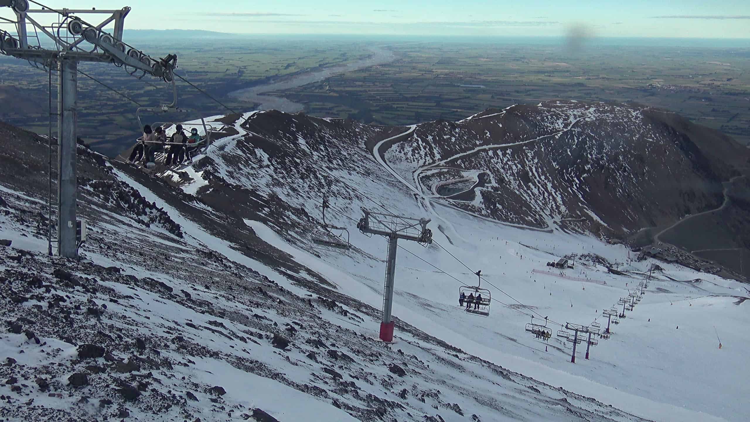
Strong westerlies will continue to blow over the South Island today and Tuesday, with just a few light showers spilling over the Main Divide, while southwesterlies on Ruapehu provide grey, but not-too-mucky conditions.
It gets much more interesting Wednesday and Thursday as a cold front moves up the country. Severe gale NW winds and heavy snowfall will precede the front, although snow levels may be an issue for the lower slopes before freezing southerlies hit. The Southern Lakes will dry out quickly once they do hit, with a mostly fine day lined up for Thursday and approximately 10-30cm of fresh snow.
Canterbury, on the other hand, will cop the mother lode as the cold southerlies undercut warmer, moist air aloft, and is squeezed like a sponge against the Southern Alps. All up we’re looking at accumulations in the 25-50cm+ range to low levels on resorts there.
Monday 17th
Gale westerlies over the South Island will have some cloud blowing over the Southern Lakes, and a few light showers of rain/snow spilling over the Main Divide will most likely reach the resorts during the evening. Canterbury will be mostly fine, with just a little cloud reaching the club fields.
Strong SW winds on Ruapehu will have plenty of cloud clagging up the slopes along with light snowfalls, which will turn to drizzle about the lower slopes during the morning as temps warm.
Tuesday 18th
Strong-gale W-NW winds continue to blow over the South Island, with a bit of cloud cover over the Southern Lakes and a few early snow showers possible. Canterbury will remain mostly clear and sunny.
Mostly cloudy again on Ruapehu, with light showers of snow/rain late morning and afternoon. However, the upper mountain may be clear. Brisk SW winds, tending to the west.
Wednesday 19th
The Southern Lakes will cop heavy snowfalls from late morning through the afternoon, along with severe gale NW winds. However, it may be wet and slushy on the lower slopes before cold air arrives evening, lowering snow levels while snowfall and winds ease.
Severe gale NW winds for Canterbury too, with light showers of snow/rain spilling onto the club fields, but just some mid-high cloud over Mt Hutt. Widespread heavy snowfall developing at night, which may initially be wet on lower slopes before cold southerlies arrive.
Mostly cloudy on Ruapehu, with light snowfall from midday, falling as drizzle about lower slopes. Westerly winds turning NW and picking up.
Thursday 20th
Lingering light snow flurries over the Southern Lakes clear during the morning and becoming fine, while freezing southerlies ease and turn to the east.
It’ll be one for the books in Canterbury: Heavy snowfall to low levels and strong, cold southerlies will gradually ease throughout the day. Remaining snowfall will finally clear during the evening, while winds turn a light easterly.
A few light showers of snow/rain on Ruapehu as strong NW winds ease a little and turn NE. We could see a period of more decent snowfall to lower levels during the evening as colder SE winds arrive.
Extended Forecast
Apart from a weak front dropping a few light snow showers over the Southern Lakes during Saturday, high-pressure and settled weather will dominate the South Island over the next several days, while a series of low pressure-systems hang about the top of the country. Ruapehu won’t be too bad either with just a few minor rain showers as easterlies blow over the North Island. Westerlies and transient fronts may return early-mid next week.
That’s all from me today, folks. See you again Friday.


