New Zealand Forecast, June 12th – Rain & Snow Thursday into Saturday as Low Parks Up in the Tasman
Mountainwatch / The Grasshopper
Published early Wednesday 12th June 2024
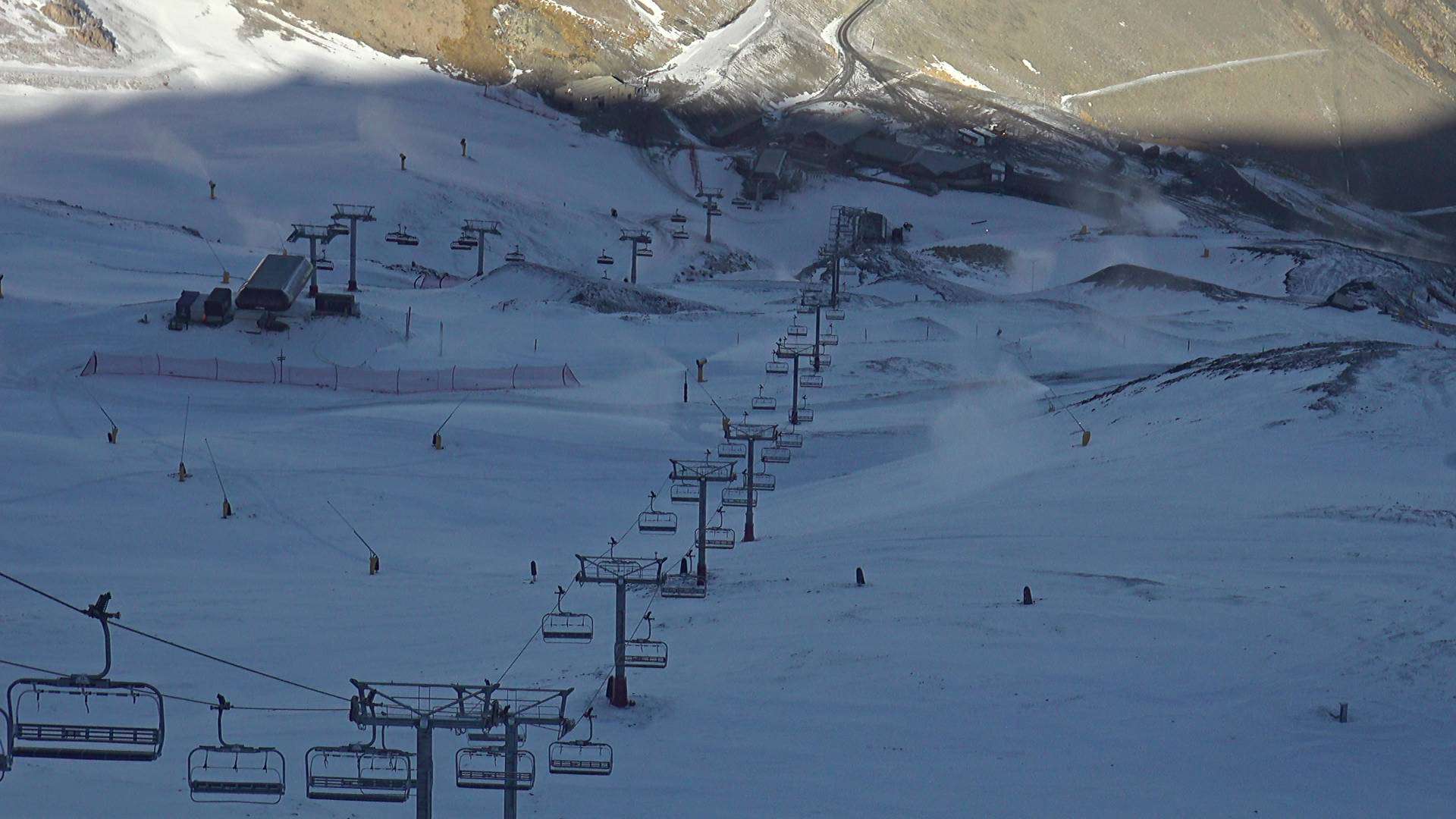
The South Island resorts are looking much whiter after a couple of quick cold fronts came through on Monday and Tuesday, bringing a dusting of snow and colder temperatures for the snow guns to work their magic. And not a moment too soon either, because this coming weekend is Opening Weekend for many Kiwi resorts. Mt Hutt is scheduled to open this Friday, while Coronet Peak, The Remarkables and Cardrona are scheduled for Saturday. Treble Cone and all other resorts are planning to open from late June.
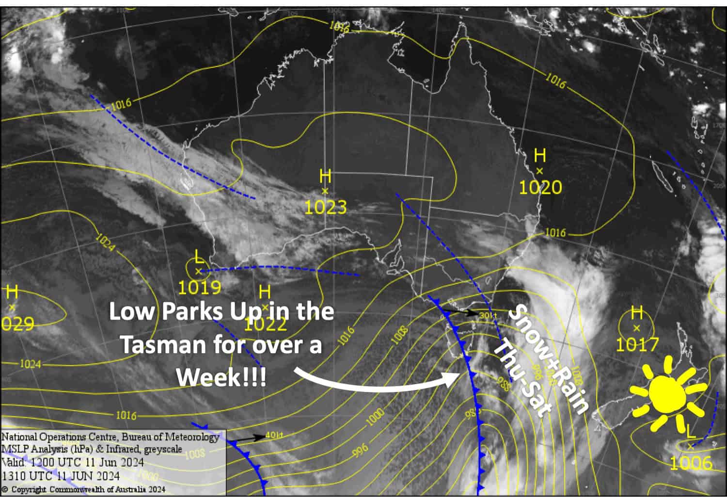
Clouds will start to gather today, Wednesday, as a low-pressure system enters the Tasman Sea. Here, the low is expected to park up and drive New Zealand’s weather for over a week. Last week it was high pressure, this week it’s the opposite. These slow-moving features are a change from the fast-moving ones we had under El Nino’s influence the previous couple of months.
The low is expected to bring winds from the north and east to the country, with periods of rain and/or snow, which may be heavy at times. There is a lot of uncertainty in the forecast, especially regarding snow levels and the timing and amount of precipitation. So it’s worth keeping an eye on conditions before venturing up the hill as it may be better or worse than we expect.
Wednesday June 12th
A chilly start to the day will have the snow guns firing on South Island resorts before northerly breezes kick in. High cloud will thicken over the Southern Lakes from afternoon and a few light showers are possible there at night, most likely at Treble Cone, falling as snow on mid-upper slopes.
Thursday June 13th
For the Southern Lakes, the odd light shower will become more frequent from afternoon while snow levels start to drop, turning to a period of more persistent snowfall down to at least base levels at night/overnight.
A fine day for Canterbury, but cloud will build from afternoon and rain develops at night. N-NW winds picking up.
Friday June 14th
Rain over the South Island will be more persistent over Canterbury where it’ll be heavy late in the day with snow possible about the tops. N-NE winds there.
The rain will be lighter and more intermittent over the Southern Lakes and fall as snow about the upper slopes, but more persistent snowfall to base levels likely at night. Light E-SE breezes.
Saturday June 15th
Rain is likely over the South Island, with heavy falls possible, especially in Canterbury where it may fall as snow up top. Snow levels in the Southern Lakes will fluctuate between the bottom and top of resorts. E-NE winds could be strong.
Extended Forecast
The low in the Tasman will continue to affect the country through to around Thursday June 20th, directing N-E winds over the country the whole time. As I mentioned earlier, there is a lot of uncertainty in the forecast and models are jumping around something mad. So at this stage it’s too early to say if and when and where it’ll snow. However, at some point after Thursday June 20th, the low should move east of the country, which will likely lead to colder southerlies and snowfall.
That’s all from me today folks. The next forecast is Friday, see you then.
Grasshopper


