New Zealand Forecast – Massive Storm Totals In Canterbury And There’s More To Come!
Mountainwatch | The Grasshopper
Written early Monday 24thJuly, valid to Thursday 27thJuly
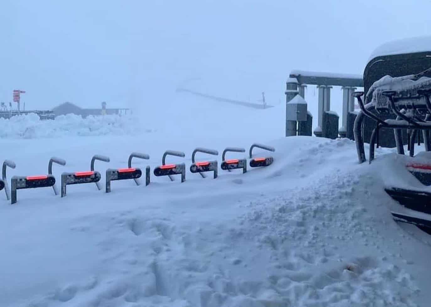
Light snowfall in Canterbury turned heavy Saturday night, and by time the team there turned in for the night late Sunday, 70cm had accumulated at the base and about 1m above 1700m.
Heavy snowfall has continue into these wee hours of Monday morning, and will eventually clear later this afternoon, by which time we could see another 25-50cm+ added to the storm total. It’s a season maker for sure.
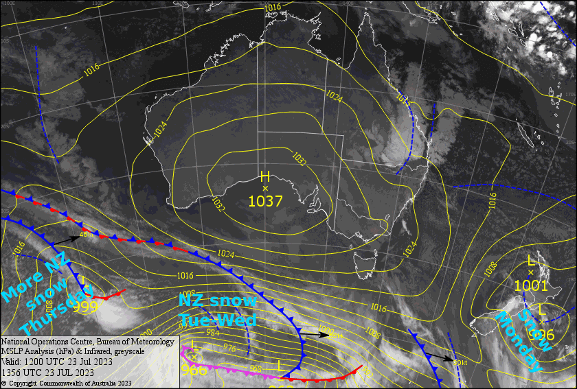
Canterbury usually cops at least one of these big dumps every season when a low sits off the east coast, as there is right now. This low will eventually pull away to the east, allowing a strong, cold and SW flow to develop over the country during Tuesday. Rapid fire fronts embedded in the flow will spread snowfall up the country during Tuesday into Wednesday, and again on Thursday. The South Island will receive a dusting then a top-up, while Ruapehu will cop a couple of decent dumps which will be more than welcome there.
Monday 24th
A cloudy morning for the Southern Lakes with a possible snowflake or two falling. The cloud will start to break up this afternoon with some sunshine blazing through. SE winds gradually turning east while dying away.
The snow in Canterbury will continue to bucket down this morning, then it’ll peter out this afternoon while strong southerlies abate. The snow may be a little slushy at base levels, however.
Light snowfall on Ruapehu will gradually build through the day as southerlies strengthen, but then it’ll clear this evening. The snow will also be wet and slushy at base levels here too.
Tuesday 25th
The Southern Lakes may start off pretty clear, but it’ll quickly cloud up before snow showers start late morning. Just 1-4cm is expected and skies should clear up late afternoon or evening. Westerlies, strong up high, gradually turning SW.
It’ll be a most fine, deep powder day in Canterbury, but westerlies will get quite strong. A strong, chilly southerly change late afternoon will bring snowfall and possible thunderstorms, which will clear at night. Between 2-10cm is expected, but possibly more.
Strong W-SW winds on Ruapehu will have slopes there pretty clagged up with cloud and drizzle, which will fall as snow on mid-upper slopes. Temps will drop at night with heavier snowfall!
Wednesday 26th
Down in the Southern Lakes, there could be a few early flurries over Queenstown resorts, then it’ll be mostly fine, as strong, cold SW winds turn to the west. However, cloud will build later in the afternoon before it starts snowing at night.
Canterbury will be clear and sunny, while strong southerlies ease and turn W-SW during the afternoon. A little snow may spill over the Main Divide onto the club fields overnight.
Ruapehu will cop decent snowfall during the wee hours before dawn. Snow showers will continue through the day, eventually petering out in the evening. However, it’ll be rough as guts with a cold, gale southerly blowing.
Thursday 27th
Snow showers over the Southern Lakes will continue throughout the day, eventually clearing at night, while freezing, strong-gale westerly winds turn to the south. The Remarkables are best placed, and may pick up around 15cm, while Treble Cone will likely receive just a few centimetres due to sheltering.
For Canterbury, there’ll just be some mid-high level cloud while strong SW winds develop. There’ll be about 5cm of snow during the evening-night as a strong, chilly southerly goes through.
Snow will start up again over Ruapehu during the morning, with decent falls on the cards before eventually clearing at night/overnight. Gale W-SW winds will make it hard going again.
Extended Forecast
It’ll be a mostly fine weekend for Kiwi ski resorts, apart from a little bit of cloud here and there, as a low is passes up west of the country, taking all the weather with it. It’ll remain that way during next Monday – although Ruapehu may see a light dusting – as the low shoots out east. The next snow-bearing front looks to arrive next Tuesday or Wednesday.
That’s all from me today, folks. See you again Friday.
Grasshopper


