New Zealand Forecast, Monday September 9th – More Snow + Rain Monday & Tuesday Amidst Strong Northwesterlies
Mountainwatch | The Grasshopper
Recent strong northwesterly winds, rain and even sunshine have nailed New Zealand’s snowpack, especially in Canterbury, where Porter’s Pass has had to close for the season while other resorts are on life support, waiting for more snow to get up and running again. A dusting of snow did fall over the weekend, but it mainly benefited the Southern Lakes who are looking nice and refreshed this Monday morning.
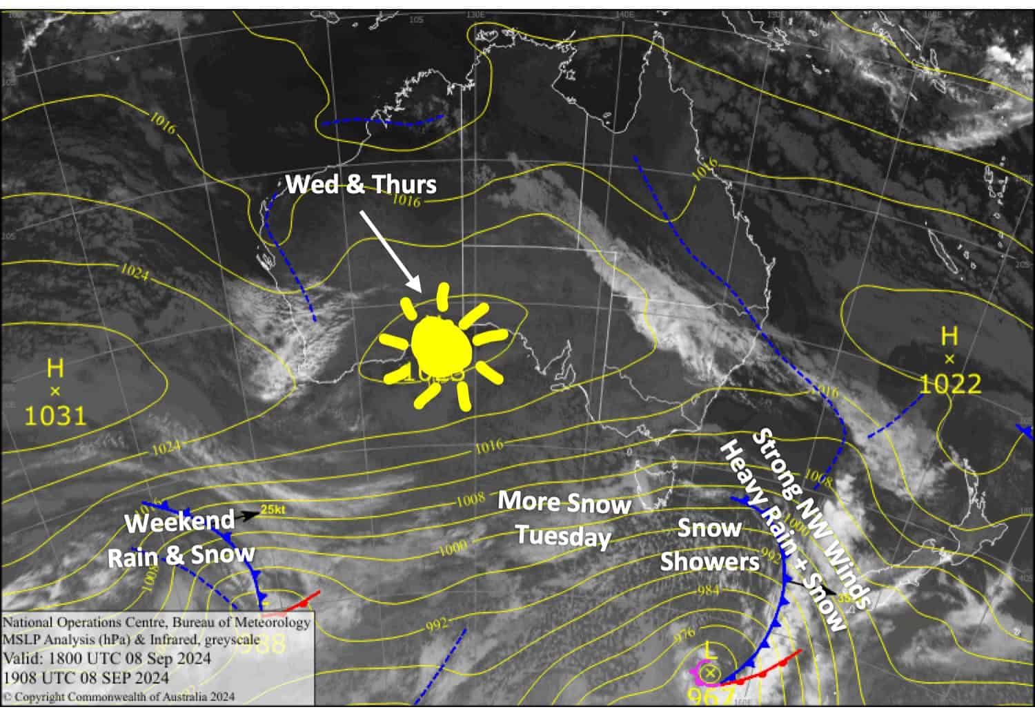
Monday and Tuesday will bring more strong northwesterlies and a mix of rain and snow to the South Island as a pair of fronts cross the country. Lift operations will be affected, especially in Canterbury, where some resorts won’t be able to open.
However, the Southern Lakes will do well again, with 10-30cm on mid-upper slopes today and 10-20cm below base levels on Tuesday. The MacKenzie Basin will also receive a similar amount, while the Craigieburn resorts could pick up around 5-15cm. On Mt Hutt, precipitation will mostly be wet, with only a skiff of snow possible about the top. The weather will be nicer for South Island resorts on Wednesday, but northwest winds will pick up again on Thursday.
Mt Ruapehu, meanwhile, is still running at low tide, a lack of snow allowing only very limited terrain to be open. While that won’t change within the next several days, at least the weather will be mainly fine, with Tuesday being the worst of the bunch.
Monday September 9th
A front moving onto the South Island in the morning will force rain and mid- to high-level snow over the Main Divide as strong northwesterlies rise to severe gale in exposed areas. Heavy snow falls over the Southern Lakes will pin back to snow showers around evening behind the front. There’ll also be heavy falls in Canterbury through the afternoon, although less so for Mt Hutt and Porters, and it’ll clear in the evening.
Mt Ruapehu resorts should remain above the clouds as southwest winds turn northwest and strengthen this afternoon.
Tuesday September 10th
Another front moving up the South Island will bring heavy snowfall to low levels over the Southern Lakes in the morning, easing to snow showers around midday as strong northwesterlies turn westerly, then clearing evening.
In Canterbury, northwest winds will rise to severe gale ahead of the front, which spreads heavy snowfall over the Mackenzie Basin in the morning. A mix of rain and snow starts falling over Mt Hutt and nearby resorts from around midday, although here, it’ll be a bit lighter. Skies clear evening.
It’ll be mostly clear about the upper slopes of Mt Ruapehu, but cloudy and drizzly lower down. Westerly winds will be strong in exposed parts.
Wednesday September 11th
A fairly cloudy day for the Southern Lakes as westerly winds gradually turn northwest and strengthen.
Canterbury will be mostly sunny as west-southwest breezes gradually turn northwest.
Any morning cloud affecting Mt Ruapehu resorts will clear for a fine day while brisk southerly winds gradually ease.
Thursday September 12th
Strong northwesterlies over the Southern Lakes and the Mackenzie Basin will blow a gale in exposed areas. Treble Cone and Ohau will likely see showers of rain and high-level snow. The other resorts may see one or two showers on an otherwise cloudy day.
Elsewhere in Canterbury, northwest winds will be strong in exposed areas with high cloud overhead.
Mt Ruapehu will be nice and sunny as westerly breezes turn northwest.
Extended Forecast
The weekend may see a low-pressure system cross the country from the west. This will likely bring rain and northerly winds initially, followed by cold southerlies and snow once the low moves east of the country. The cold southerlies and snow may persist through Monday and Tuesday next week, leaving behind a decent top-up of powder and much-revitalised conditions for Kiwi resorts.
That’s all from me today, folks. The next forecast is Wednesday. See you then, and have a great couple of days.
Grasshopper
