New Zealand Weekly Forecast, August 29 – Unsettled Mid-week, Chance of Snow for the South on the Weekend
Mountainwatch | The Grasshopper
Last week brought a more subdued weather pattern across the ski fields, and while a couple of weak systems brought minor snow accumulations from Mount Hutt southwards, these were interspersed with bluebird days.
This week sees a continuation of favourable skiing conditions for South Island fields on Tuesday. On Wednesday, a front brings increasingly gusty northwest winds and precipitation to the Remarkables, with spill over possible further north across Mount Hutt on Thursday. Most of this will fall as rain with freezing levels only dipping to around 1800 metres, though higher levels of Mount Hutt could see modest snow falls. Hanmer and Ruapehu are unlikely to see anything in the way of wintery weather conditions with this system, though gusty winds and periods of rain are expected.
Friday sees a brief interlude between weather systems across southern South Island, with the potential for lighter winds and clearing skies for the southern fields, while ski fields from Mount Hutt northwards may see a continuation of the unsettled weather.
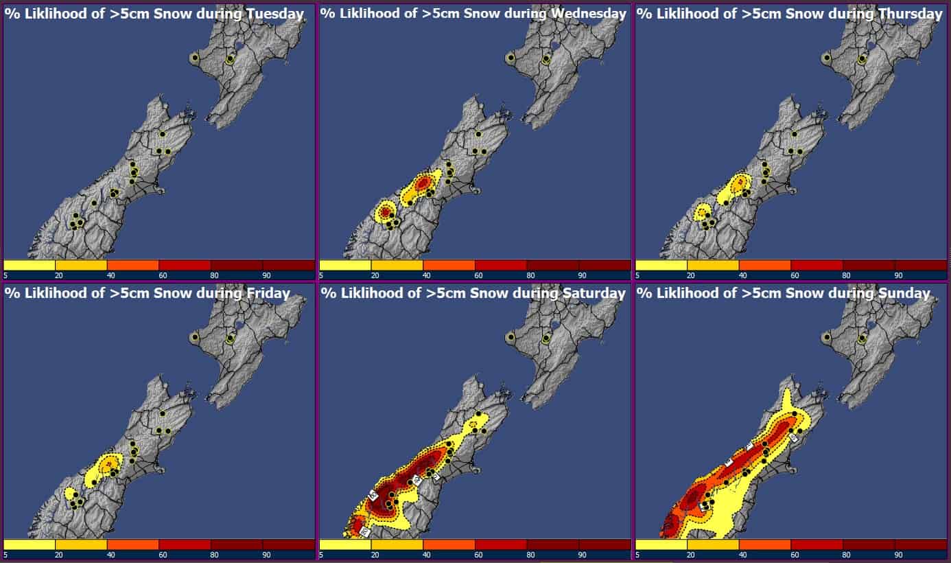
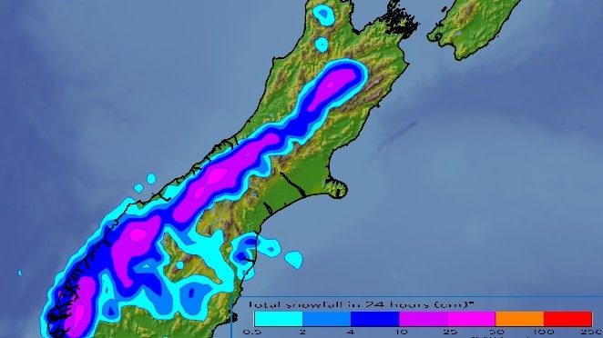
This weekend brings the best chance for spring-time snow to South Island fields as a cold front moves up the South Island during Saturday and drags in cooler southwesterlies over the day, then progresses further north over the last half of the weekend. Snowfall is likely from Mount Hutt southwards during Saturday with lowering freezing levels, though the Remarkable fields have the best shot of seeing measurable accumulations exceeding 5cm in more frequent snowy showers. Hanmer and Ruapehu could also see brief snow showers on Sunday, though these are unlikely to produce enough accumulations to rebuild the base and reopen the fields.
Tuesday 30thAugust
A bluebird day for South Island fields. Mainly light winds to start, but northwesterlies becoming blustery as the day progresses, with cloud increasing later in the day.
Wednesday 31stAugust – Thursday 1stSeptember
A northwesterly front brings periods of rain to the Remarkables on Wednesday, then spreads northwards to central South island fields the following day. Smaller amounts could fall as snow about the slopes of Mount Hutt on Thursday. Strong and gusty northwest winds are likely to inhibit skiers from enjoying any new snowfall.
Friday 2ndSeptember
Friday sees a calm in between weather systems across southern South Island, with lighter winds and reduced cloud cover bringing more favourable skiing conditions near the Remarkables. Periods of rain and northwest winds from central South Island to Ruapehu.
Saturday 3rd– Sunday 4thSeptember
Southwesterlies bring cooler weather and wintery showers across South Island on Saturday, with the potential of picking up in excess of 5cm for ski fields near the Remarkables in the hit-to-miss style showers. Mount Hutt may also see accumulations, but more likely to a lower extent. The colder air then spreads over Hanmer and Ruapehu during Sunday, and while the odd snow shower is possible, a dump is very unlikely.
Extended Outlook
Southerlies easing early next week as high pressure moves in from the Tasman Sea, with increasing chances for bluebird days to start the first full week of Spring.


