New Zealand Weekly Snow Forecast, Monday August 15 – A Wet and Windy Week Ahead
Mountainwatch | The Grasshopper
Valid Monday August 15th – Sunday, August 21st
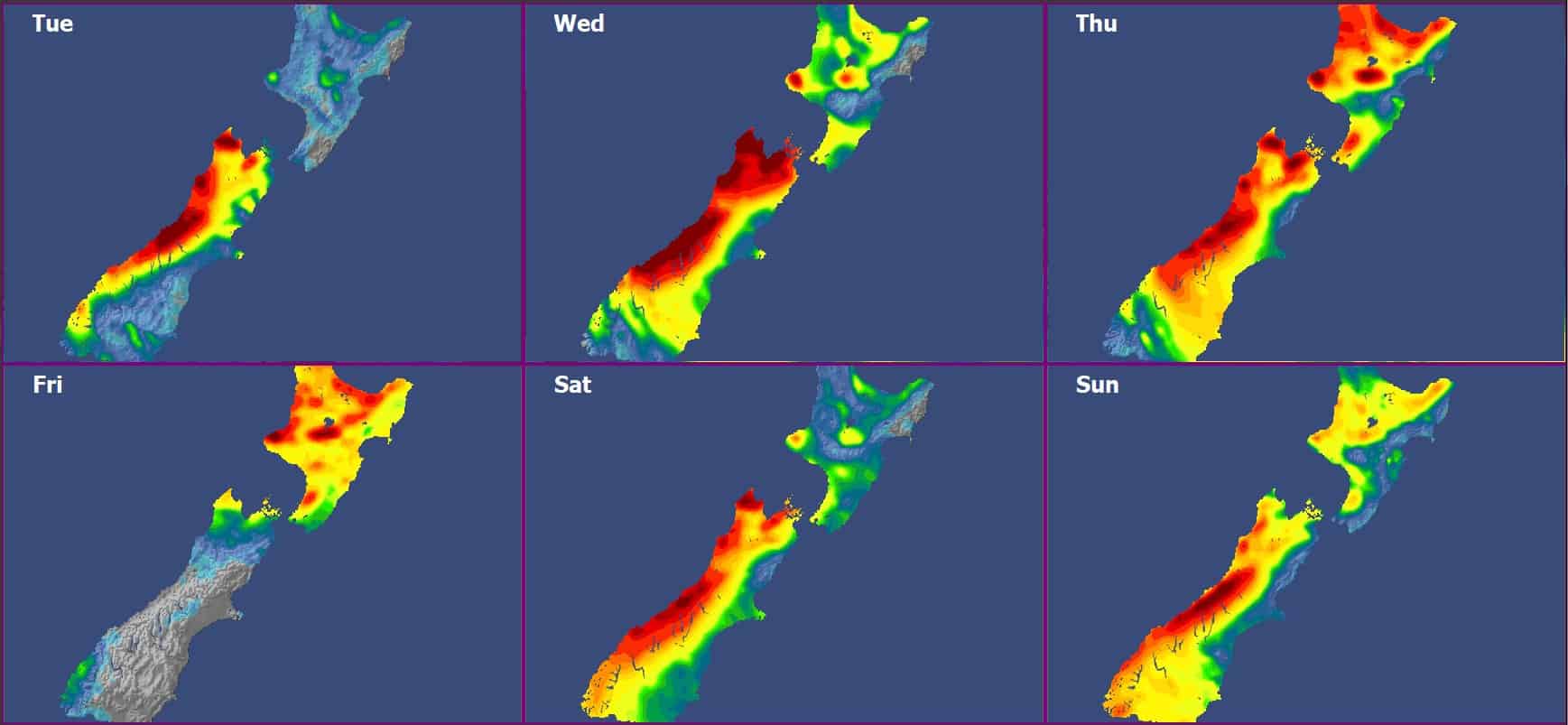
This week sees a major shift in the weather regime across Aotearoa New Zealand. While the past fortnight brought some mint bluebird days and added to a healthy snow pack across South Island fields, New Zealand ski fields are likely to see a warm and moist air mass bring deteriorating weather conditions as the week progresses. There is a significant risk that heavy rain reduces existing snow packs.
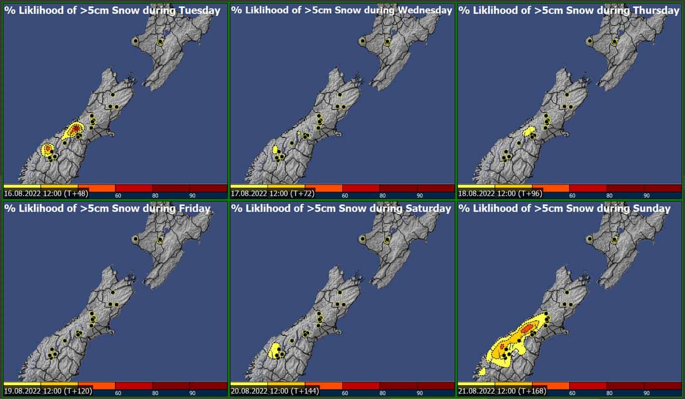
A weak cold front spreads up the South Island during Thursday, with rain turning to snow from Mount Hutt southwards at higher levels, though snowfall accumulations look marginal. A brief ridge on Friday brings the best chance of favourable weather for South Island, while North Island is unlikely to have a rain- or wind-free day apart from Tuesday.
Inclement weather could persist through the weekend, with rain and gusty northerlies for all fields bringing less-than-desirable conditions, though it could turn to snow for southern fields Sunday. Looking into early next week, a ridge brings clearing skies and easing rain for the first couple of days before a cold snap (and accompanying wintery showers) spreads up the country from mid-week.
Tuesday 16thAugust
Rain and strong northerlies are picked for South Island ski fields, while North Island sees a few showers in the northerly flow. This is particularly true for Whakapapa, while Turoa is the place to be as it’s somewhat sheltered.
Wednesday 17th– Thursday 18thAugust
Weather conditions becoming inclement throughout, with gusty N’lies and rain (sometimes heavy) spoiling any chance for winter-time activities across both Islands. Hanmer may see some sheltering to some extent, though some rain is still likely.
A weak cold front spreads across central South Island during Thursday, with rain potentially turning to snow about high-levels from Mount Hutt southwards, though a heavy dump is unlikely at this stage.
Friday 19thAugust
Rain persists across the North Island, while a ridge provides more suitable conditions over South Island. While both wind and rain ease in the south, a bluebird day may be hard pressed as some cloud cover is still expected.
Saturday 20th– Sunday 21stAugust
Unfavourable weather conditions are likely, with another round of strong northwesterly wind and rain on Saturday.
Winds tending SE during Sunday as a low crosses the South Island, which brings a risk of snowfall in the tail-end of the system. Similar to Thursday, this is likely to occur from Mount Hutt southwards.
Extended Outlook
There is potential for skiable days early in next week, then a change to cooler southwesterlies around mid-week brings the next decent shot at measurable snow accumulation.


