Snow on the Way!
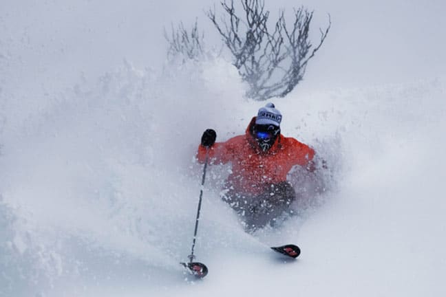
Andreas Gloor enjoying Thredbo at its snowy best in 2009 – could tomorrow bring on these conditions? Image:: Ben Hansen
Mountainwatch.com
A healthy dose of new snow should arrive in the Australian snow resorts early on Wednesday morning.
As of Tuesday afternoon at 4pm 35cm of snow is forecast for Thredbo, 30cm for Charlotte Pass, 26cm for Perisher and 25cm for Selwyn Snowfields – those measurements have been steadily rising since Sunday, when the prediction was for around 20cm, as the cold front establishes itself as a serious snow-bringer.
In Victoria between 10cm and 26cm is forecast across all the resorts.
It’s not a moment too soon for the resorts, which have been surviving on the product of their extensive snowmaking systems through the busy school holiday period. While dramatically cold temperatures have allowed for record snowmaking efforts the areas of the resorts beyond snowmaking coverage have been out of action.
This snow storm could be just what’s needed to get the resorts’ advanced terrain and off piste areas going.
Read all about the record snowmaking week here
Keep track of the snowstorms:
snow cams, forecasts and snow reports
Always be in the snow-know with the SNOW iPhone app & mobi site and SNOW widget for desktops and websites
Perisher forecasts,
snow reports and
live snow cams.
Charlotte Pass forecasts,
snow reports and
live snow cams.
Thredbo forecasts,
snow reports and
live snow cams.


