SNOW SEASON OUTLOOK 2013 – Australia
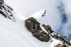
 In a good snow year skiing back home is like nowhere else, can we expect bluebird pow days this year? Read on to see what our resident Guru thinks is in store… Image:: Perisher/Andy Lloyd
Australian Seasonal Snow Outlook | The Grasshopper
Brought to you by ESS Boardstores
And it came to pass that Easter arrived, and the people did gorge on chocolate and notice that the sun was sitting lower in the sky and that their bank accounts were heavy after several months of no skiing. And the resorts did say to the people: “why don’t you give us some of that money and we’ll give you a season pass for this winter?” And the people thought: “that might be a bloody good idea, but what if the season is rubbish?” And so the people said to the Grasshopper: “any chance of a long range forecast for Down Under buddy?” And the Grasshopper did say “no worries mate, I’ll see what I can do”.
Here we are, anticipating another Australian ski season that is sure to have as many twists and turns as the Gossip Girl finale. The first thing you need to know is your climate catchphrase for 2013, and that is “Neutral”. The global climate is staring at us blankly right now, with most key indicators sitting on the fence.
The El Nino Southern Oscillation (ENSO) is in a neutral phase and the odds are that it will stay there through winter. The Indian Ocean Dipole is showing few signs of life. Both of these expectations could well change come May when I update this outlook, but for now there’s enough consensus among the models that I’m ready to back the idea that a truly neutral climate season is ahead of us. If there’s anything different from normal it’s the warmer sea surface temperatures around Australia. Sometimes this can add a bit more juice to weather systems, meaning slightly enhanced rain, but it also means warmer temperatures, so it’s hard to confidently link the sea surface temperature effect to any effect on snowfall.
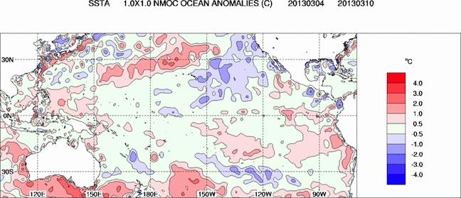
Temperatures across large parts of the Pacific are within 0.5 degrees of normal, but there’s a nice warm patch around Australia Image:: Bureau of Meteorology
Vodka might not have a flavour, but neutral does
On the surface, a neutral year isn’t bad news. Over the last 43 years, neutral ENSO winters have averaged about 20 centimetres more snow than La Nina or El Nino winters. The median snow depth at Spencers Creek in the Snowy Mountains during neutral years is 192cm, against a median for all years (1971 to 2012) of 178cm. The graph below shows the entire distribution over that period. (For my Victorian friends, I would love to also analyse snow depths from Falls or Hotham if someone can dig out a historical sequence).
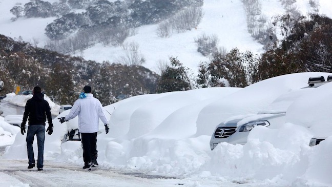
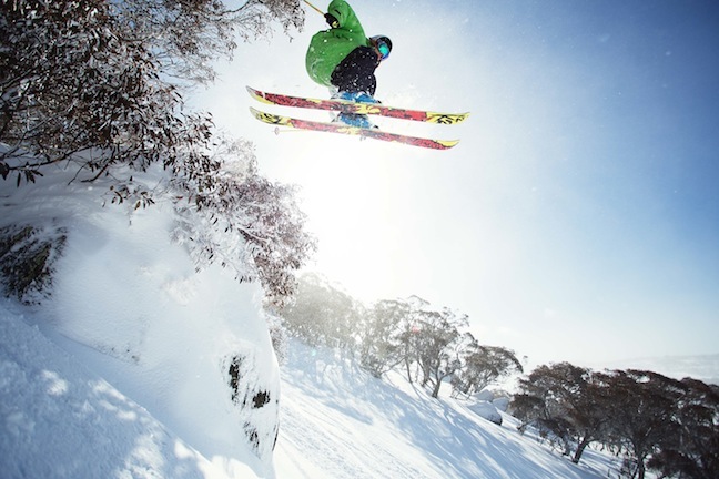
Mid August 2012, some lucky punters search for their car after a solid snowfall Image:: Falls Creek/Hocking
When we delve a little deeper into long range climate models however, we see that in addition to neutral ENSO we are also expecting a fairly average run of weather patterns. If anything, pressures might tend to be a little higher south of Australia and New Zealand during winter, and a little lower in the central Tasman. This would suggest we’re a little less likely to get big strong cold fronts moving through, and a little more likely to have low pressure systems skating eastwards through the Bight, creating a chaotic mix of warm moist air from the north and cold dry air in the south. We could spend even more time than normal worrying whether we’ll get rain or snow.
Because we’re not expecting the average pressure pattern over the winter to diverge wildly from normal, we can rule out some of the crazier neutral years on record. Out go 1983 and 1993, which both had a huge high pressure anomaly in the Tasman that kept out snow and resulted in two of the worst seasons ever (142cm and 112cm).
And say goodbye to 1981, 1990, 1992, and 1996, which were all pummelled by an unusual number of cold fronts to record 361cm, 293cm, 316cm and 262cm respectively.
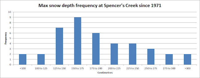
Not normal: 150 to 175cm might be the most common outcome, but there’s a long tail out to the right.
By the numbers
Toss out another few misfits that don’t match and in my mind we’re left with 1979, 1985, 1989, and 2001 as reasonable examples of what might be possible this year. The worst of these years, 1989, saw only 141cm accumulate at Spencers Creek. The best of them, 2001, managed 196cm. Meanwhile 1979 managed 171cm and 1985 managed 174cm.
So Lay it on the line for us!
Bringing all this together it’s time for some predictions:
- Spencer’s Creek to break one metre snow depth in the first week of August and to top out at 171cm in late-August.
- June to see a slow start, with the first big snow storm (40cm+) in early July.
That will do for now. We’ll update this outlook in late-May as the excitement starts to build before opening weekend. Last year it was our May update when we correctly predicted that 2012 would be the first year since 2004 to bust the 200cm mark. If you’ve got a different theory on what’s going to happen this winter then please hit me up at grasshoppermw@gmail.com or join the discussion via Facebook by leaving a comment below.

Perisher forecasts,
snow reports and
live snow cams.
Falls Creek forecasts,
snow reports and
live snow cams.
Mount Buller forecasts,
snow reports and
live snow cams.
Charlotte Pass forecasts,
snow reports and
live snow cams.
Hotham forecasts,
snow reports and
live snow cams.
Thredbo forecasts,
snow reports and
live snow cams.
Mount Baw Baw forecasts,
snow reports and
live snow cams.