Storm Journal August 27th-30th – Storm of the Season Drops 60-80cms

Mountainwatch | Reggae Elliss
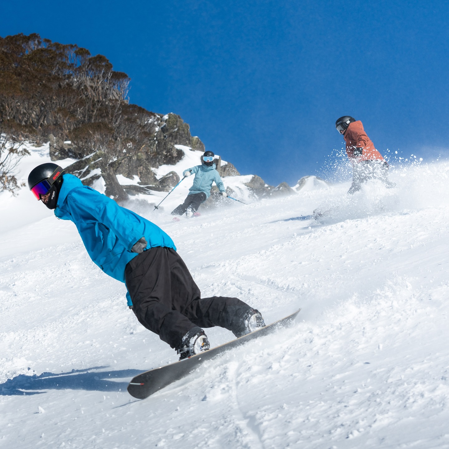
It was a bright sunny morning here in Thredbo, light winds, all lifts open, a great cover of dry snow and a lot of people enjoying some of the best conditions of the season after 70cms of snow since Wednesday morning.
But what a wild week it has been, warm spring weather at the start of the week, heavy rain on Tuesday night, followed by a heap of snow, blizzard conditions and howling northwest winds and which impacted chairlift operations for three days in most resorts.
The “storm of the season” certainly lived up to expectations and has set up a deep base in the major resorts as we head into spring while resurrecting the cover on Selwyn and Baw Baw.
The Grasshopper called the storm in his extended forecast on Monday August 19, writing that on August 26th “we’ll see heightened storm activity, with two or three systems passing over before the end of the week. Models are still all over the shop, but there’s a good chance we’ll cop rain, high-level snow, and strong northwesterlies initially, followed by cooler winds and snowfall to lower levels through the back half of the week.”
By the following week, the storm had firmed up and we had three system heading our way, although the first one was going to be warm and wet, with heavy rain expected. However, the back half for the week was looking good, our forecast models calling big totals which were verified by the Grasshopper: “40-60cm, but a lot more is possible about the upper slopes where some early rain will fall as snow and extras will blow in from the windward slopes. If you like storm riding, you’re in for a treat.”
The rain overnight Tuesday/Wednesday was heavy, the weather station at Perisher recording 79mm between 9pm Tuesday and 6am Wednesday. The rain did some damage to the snowpack at lower elevations, but a natural repair job was on the way.


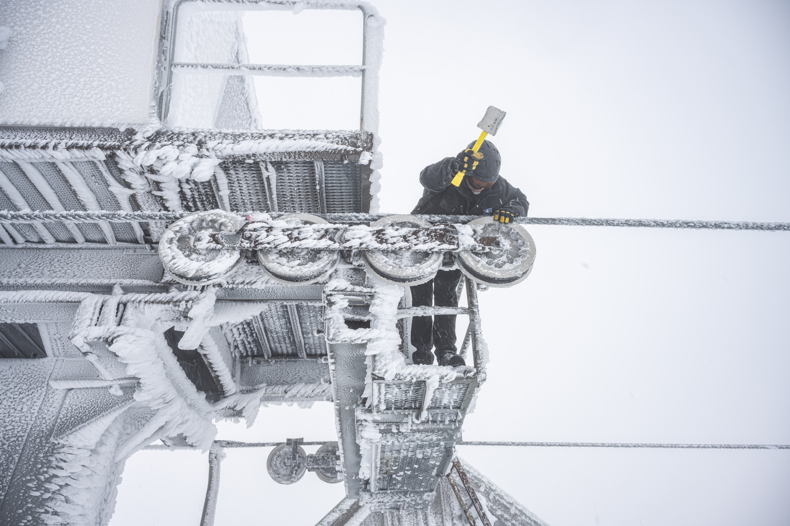
The rain turned to snow above 1700 metres just before dawn on Wednesday morning, and snow showers continued throughout the day with a mix of rain/sleet/snow at lower elevations. It was day for the very keen and plenty of chairlifts were on wind-hold, the northwest wind hitting 90-100ks at Hotham and the top of Thredbo.
The next front crossed late Wednesday and on Thursday morning our snow reporters were reporting 24-hour totals of 20-27cms. The winds were again very strong and impacted lift operations but with the temp at minus three it was quality fresh snow. I headed over to Perisher to film the snow report where the T-bars were open accessing plenty of terrain had some fun powder turns around Perisher’s Centre valley.
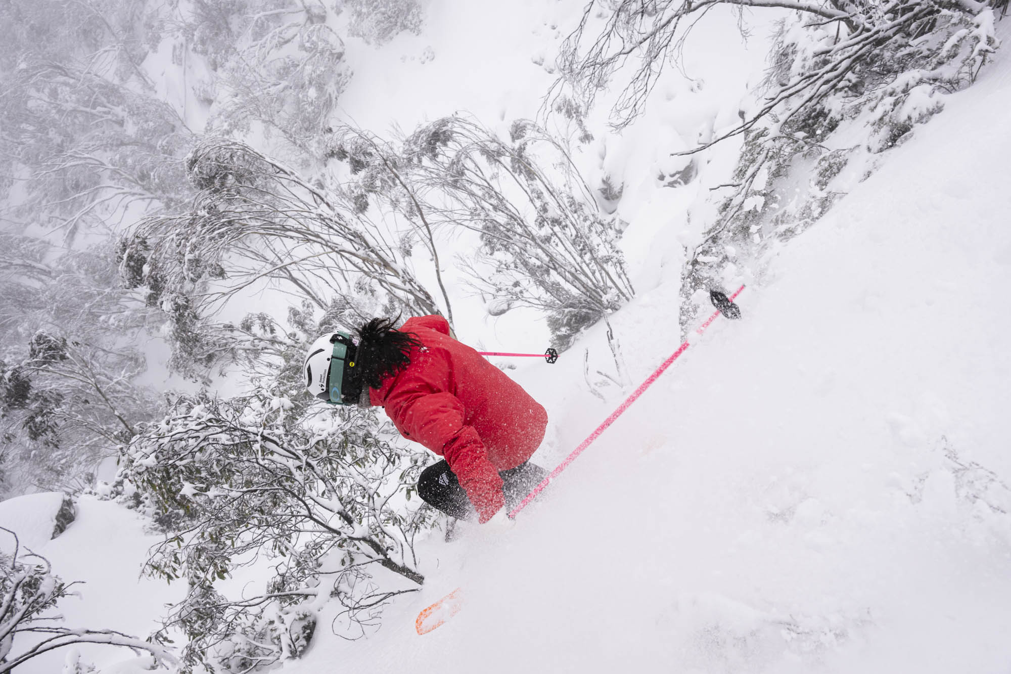
Snow falls continued during the day, ramping up overnight and there was another 20-25cms by Friday morning. There was a break in the snowfalls during the day but strong the northwest winds again saw some chairlifts on hold but those who braved the elements found some fun fresh turns in good powder.
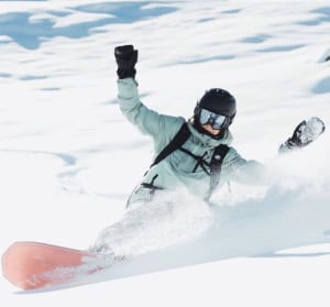
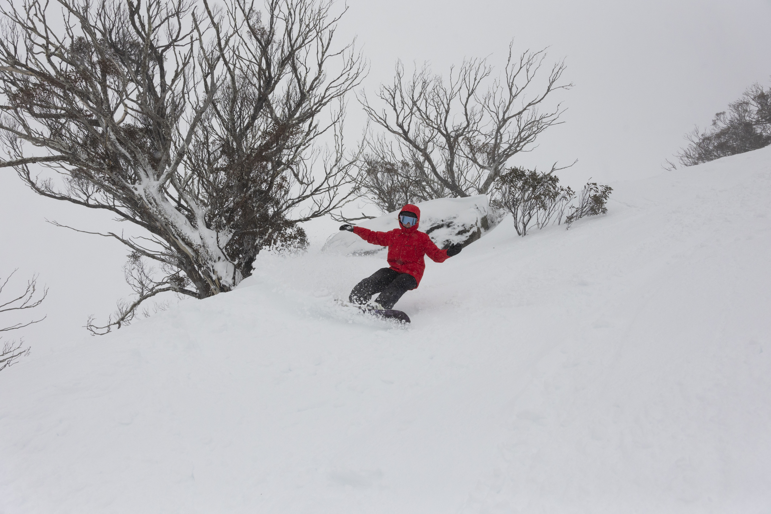
The final front from the system was colder and stronger and crossed the mountains on Friday night, leaving another 25-30cms in its wake with snow settling down to 1200 metres with 10+cms outside our place in Thredbo. It was the lightest snow of the storm and after a few lift delays in the morning, Saturday was one of the best days of the season – light powder, wind-blown drifts and it was good all day.
The snow showers cleared by mid-morning and it was the first time since Wednesday that the upper mountain was visible. The cat drivers had told me they were dealing with massive wind-drifts but the amount of snow on the upper mountain is the most in years. If the storm dropped 70cms the wind blew in just as much, transforming the terrain above 1700 metres.
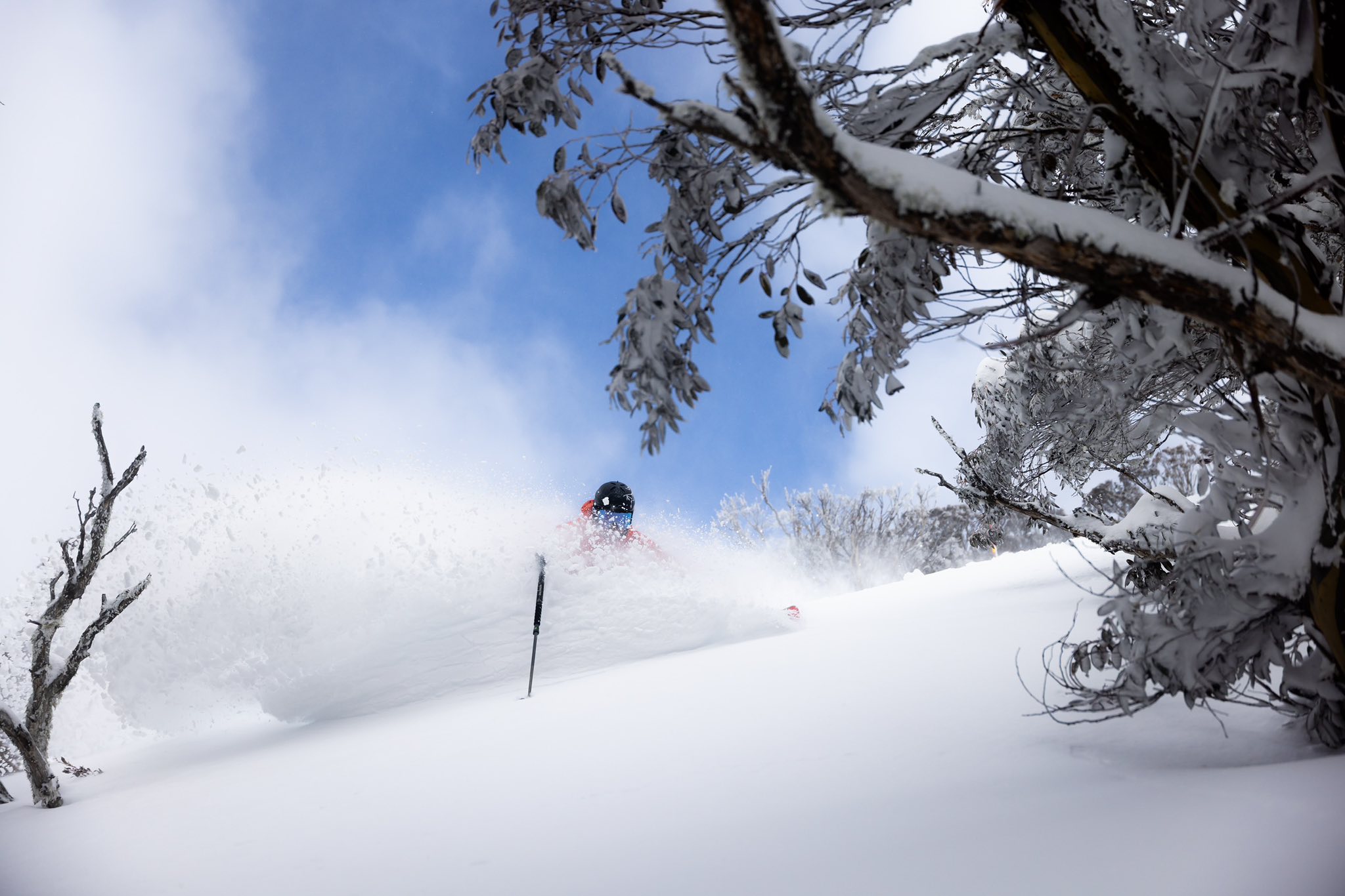
Yesterday was sunny with light winds and the busiest weekend in over a month, the road to Perisher closed at 8.30am and the carparks in most resorts were full by 10am. As they say, “if it snows, they will come”.

Snowy Hydro also released its latest snow depth reading at Spencers Creek (altitude 1830m,) today and it is an impressive 220.4cm up from 158.2cms on August 21st. Last year it was 75.3cms on September 4th and in 2023 it was 110.5cms on September 6.
That is a very healthy base as we head into the final five weeks of the season and it looks like higher elevations will get another top-up this week. It is going to be a good spring – don’t put away your skis or boards just yet.
Stay across conditions for the rest of the season with our daily snow reports , snow cams and the Grasshopper’s forecasts.