Weekly Japan Forecast, Feb 29th – Late Season Perk-Up with a Deep Week Ahead
Mountainwatch | The Grasshopper
Written Thursday morning 29th February (Japan Standard Time)
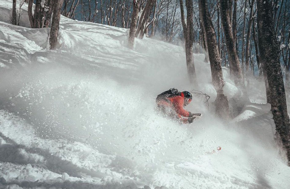
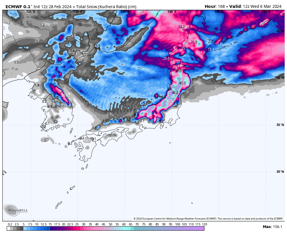
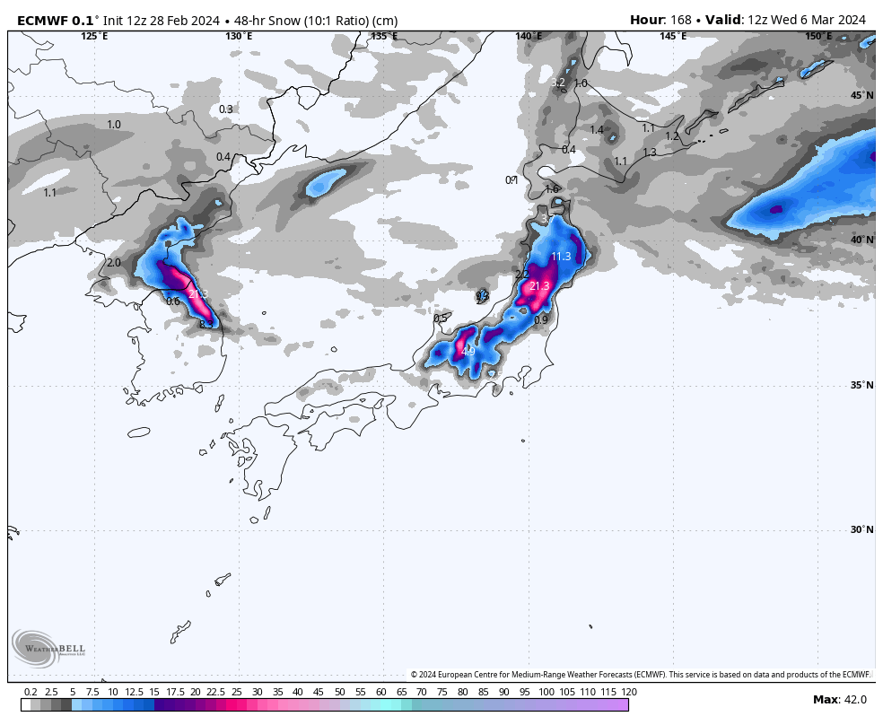
Up to 40-70cm has reported at the bases of various resorts on Honshu the last few days after a powerful snowstorm got underway during Sunday. The pattern will remain active over Japan for at least the next 7-10 days, bringing consistent snowfall to Honshu with even bigger numbers stacking up, giving resorts there a much-needed late season perk-up.
However, all this snowfall will be triggered by two lows from the west, which, as you savvy apprentices may have guessed, will also bring an initial period of about 24hrs of mild southerly winds and elevated snow levels. The first low arrives later today, the second arrives Tuesday.
Snow levels will also lift a little on Honshu Sunday and Monday as a few wobbles in the isobars bring fresh waves of westerly winds, as well as peaks and troughs in snowfall intensities.
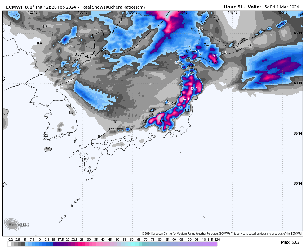
Thursday 29th Feb & Friday 1st March
Today, a ridge of high pressure drifts up the country, allowing some sunshine to sneak a look in. Any flurries over Northern Honshu and western Hokkaido will gradually clear up as chilly NW winds ease. However, it’ll be a balmy afternoon for Central Honshu as a light southerly breeze kicks in while high cloud increases – a couple of good tell-tail signs that something else is on the way.
That something else is a Pacific Coast low from the west. This low will spread snow northwards over Honshu from late this afternoon through tonight, with a period of heavy falls, before eventually spreading over Hokkaido Friday afternoon.
Temperatures will be marginal at base levels, so some rain and sleet are expected there, especially on Honshu. But as the low pulls away later on Friday, W-NW winds will strengthen over the country and snow levels will plummet, reaching rock-bottom at night.
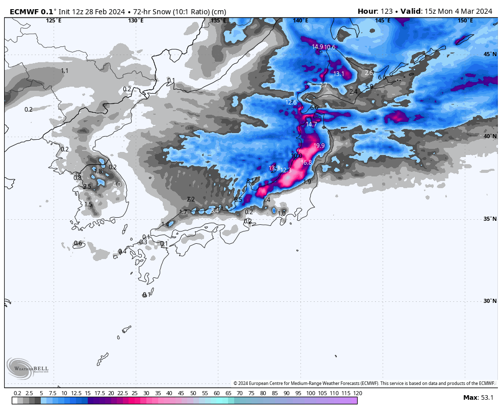
Saturday March 2nd to Monday March 4th
A whole heap of snow will fall during this period, with a few peaks and troughs in snowfall intensities as fresh waves of strong westerly winds sweep over the country.
The heaviest falls will come during the early hours of Saturday, before tapering off throughout the day and even clearing with blue skies for a time over Honshu during Sunday.
The next wave hits Northern Honshu from late Sunday morning, then Central Honshu and Hokkaido later in the afternoon with another peak in snowfall intensity, although temperatures will again become marginal at base levels on Honshu.
The third and final westerly wave and snowfall peak will come early Monday, before a ridge of high pressure dries things up later in the day.
Tuesday March 5th & WednesdayMarch 6th
Tuesday will likely see another low shooting out of the west spreading heavy rain and snow up Honshu, along with strong, mild winds from the south. As the low pulls away during Wednesday, winds will swing around to the NW and snow levels will eventually lower to base levels, leaving nothing but high quality Japow falling from the skies.
Hokkaido, meanwhile, will stay clear of all the kerfuffle down south, with just partially cloudy skies and a possible flurry or two.
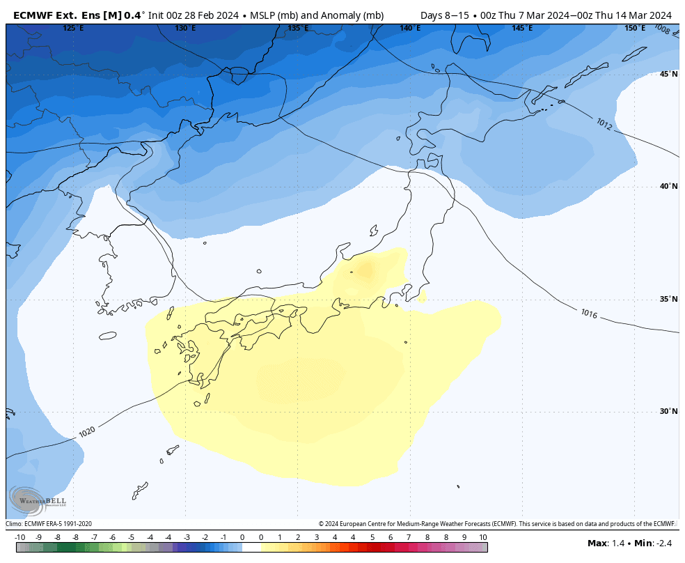
Extended Outlook
A chilly westerly flow is likely to persist over Japan next Thursday through into the following weekend (9th-10th March), which should provid good consistent snowfall and deep totals.
Early-mid the following week, models hint at another low from the west, which will likely see snow levels lift then fall yet again, but hopefully leave us another decent load of powder.
That’s all from me today. Have a great week, see you next Thursday.
Grasshopper


