Weekly North America Forecast, December 26th – Zero to Hero for Sierras as Christmas Storm Continues, Moderate Totals Elsewhere

Mountainwatch | The Grasshopper
Written Thursday afternoon, 25th December (Pacific Standard Time)
So far, December has been a mixed bag in North America, with some big snowfalls north of the border, particularly in the Canadian Rockies and BC’s Coast Mountains, while in the US, many resorts have had their worst December snow totals in years.
A storm crossed out of the Pacific two days ago and it has been dumping in California’s Sierras with some huge 24-hour totals. It has also been a very white Christmas for resorts in British Columbia and it’s not over yet, with more action on the way this weekend.

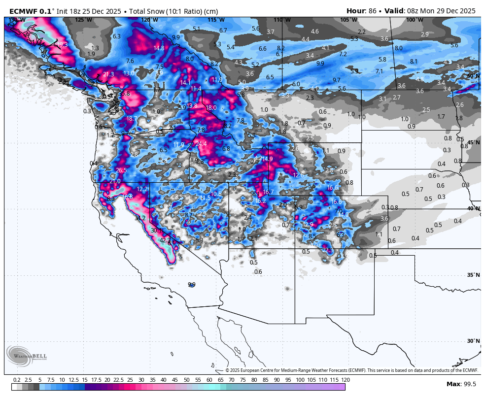
Thursday 25th to Sunday 28th December
A storm kicked off in the Sierra Nevada Range on Christmas eve (yesterday) with off-the-charts snowfall rates. Mammoth reported a storm tally of 130 cm by Christmas morning and similar totals can be found at the Tahoe resorts, which also picked up more snow in the days preceding. The storm will start to turn cold on Friday as snowfall rates ease, eventually clearing completely overnight Friday, leaving another 40-75+ cm for most resorts.
The storm will also bring moderate snow totals to most other areas of Western North America as it expands north and tracks eastwards. The last of the snowfall will eventually dry up in Colorado and northern New Mexico as cold, dry air and high pressure fill the void left by the storm’s exit to the east.
The next storm will come rolling down northern BC/Alberta during the weekend, bringing milder southwesterlies and lifting snow levels.
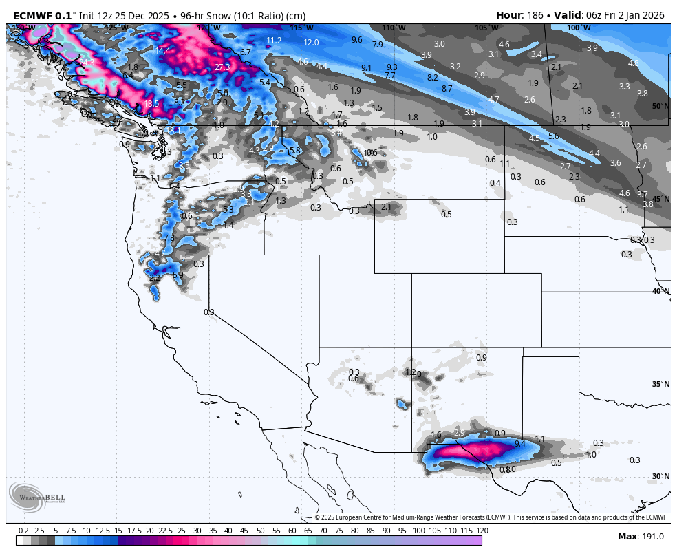
Monday 29th December to Thursday 1st January
Monday through Wednesday, the lead up to the New Year, storm activity will be restricted to the north, where the bulk of precipitation will fall along the Alaskan Coastline and northern BC. Here, mild, moisture-laden south-to-southwest winds will bring moderate falls and elevated snow levels, with lighter falls reaching further south into the northern Cascades, Idaho and Montana from late Tuesday as the storm starts to turn colder and expand southwards. The cold air pushes further south in the west, where it should reach the Tahoe resorts by late New Year’s Day.
A weak storm is also picked to brush the far south on New Year’s Day, giving resorts in Arizona and New Mexico a much-needed dusting.
That’s all from me today, folks. Have a great week, and I’ll see you back here next Thursday for another weekly rundown of North America’s highlights and snowlights.
Grasshopper


