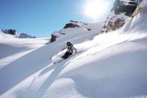
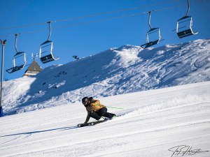
New Zealand Forecast – Fresh Snow & Cold Temps Next Few Days, Will It Be Enough?
Published early Monday, 15th June 2026
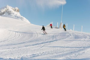
Kiwi ski fields endured some more rain and warm temperatures over the last few days as they remain in a holding pattern, waiting for conditions to improve. Coronet Peak kept its learner slopes running, while The Remarkables, Cardrona and Mt Hutt are hoping to open this Saturday, the 20th of June.
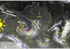
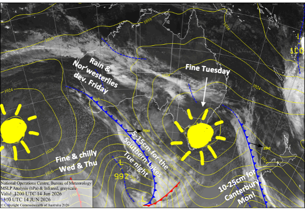
Fortunately, a couple of cold fronts will cross the South Island this week and deliver snow and cold temps, bringing those hopes closer to reality. Canterbury ski fields should score about 10-25cm on Monday, and then the Southern Lakes 5-15cm Tuesday night, with the snow guns also running for long periods.
However, warmer northwest winds and rain developing on Friday will hit this improved snowpack, making it touch-and-go for Opening Day. So keep your boots and poles crossed that there’ll be enough to get us over the line.
Monday 15th June
A cold front that passed over the Southern Lakes overnight will continue northwards over Canterbury during the morning. Rain will quickly turn to snow as cold air from the south floods in. Snow will fall throughout the latter half of the day as snow levels continue to drop, eventually reaching as low as 800-900m before clearing overnight. Totals of around 10-25cm are expected for this event, which will go a fair way toward getting things rolling.
The Southern Lakes largely miss out on the snowfall event, apart from a dusting up high before the cold front clears during the wee hours before dawn. However, cold southerly breezes trailing the front will have the snow guns cranking and may bring a few light flurries.
Tuesday 16th June
On the heels of the cold front, it’ll be a chilly start with some morning cloud, but mild west-to-northwest winds will quickly clear the skies and warm things up.
The next cold front crosses the South Island overnight, giving the Southern Lakes a nice shot of around 5-15cm of snow. The situation is more uncertain for Canterbury, but ski fields there are most likely to miss out, apart from a possible dusting up high for the Craigieburn Range.
Wednesday 17th June
Cold southerly breezes should have the snow guns firing again throughout the day. Cloud will eventually clear the Southern Lakes, but it’ll remain in Canterbury with a few light flurries possible.
Thursday 18th June
A nice, fine day with just a little cloud about the Southern Lakes. Light breezes from the west to northwest, and chilly temperatures early morning and at night should have the snow guns running.
Friday 19th June
Strong northwesterlies develop, and then rain will spill over the Main Divide as then next front moves onto the lower South Island and stalls. The Southern Lakes will cop most of the rain, while winds will blow a gale in Canterbury. Temperatures will likely be too warm for snow and any snowmaking, so the snowpack will take a bit of a hit.
Extended Forecast
This weekend, Saturday the 20th and Sunday the 21st, the stalled front will be shoved northward by a cold, dry airmass from the southwest. Rescheduled Opening Day on Saturday could be a little rough, but conditions should improve throughout the day. It’s unlikely we’ll score any snow from this system, but temperatures should dip on Sunday, allowing the snow guns to fire back up.
Temperatures may remain cold for several more days, possibly till Friday the 26th, as a cold southwest flow gradually eases and high pressure builds across the country. We could see more unsettled weather at the end of next week, with the potential for snow, but we’ll have to wait until closer to the time before getting into the weeds.
That’s all from me today, folks. I’m sending out NZ forecasts every Monday, Wednesday and Friday throughout the season. Have a great couple of days, and I’ll see you back here on Wednesday.
Grasshopper