West-Pacific Storm Bears Down on Whistler, Up to 200cm Expected – Snow Alert
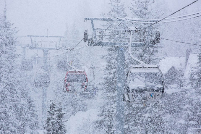
A view of what’s to come. Image:: Mitch Winton/Coast Mountain Photography
Mountainwatch | Snow Alert
There’s a series of wild winter storms are currently spinning their way up toward the Pacific Northwest and making a beeline for Whistler Blackcomb.
There’s likely to be some variation in the freezing level as the event nears closer, but at this stage it appears to be hovering just above 1000m, which means the snow line could well be at the Village’s altitude of ~700m.
There are a whole stack of powder days on their way.
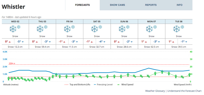
So far, Ullr has been kind to Whistler, enabling them to open almost a week early. The resort is currently sporting an 86cm base with 176cm of cumulative snowfall. In today’s snow forecast, local forecasters said, “A series of pacific frontal systems is expected to push across the region between now and Sunday. The first system will start snow overnight and continue throughout tomorrow with somewhat mild conditions. A break in the snowfall is expected then on Friday with gusty alpine winds. It is followed by a significant frontal system that will prevail with continuous snow for most of the weekend.”
Stay tuned next week for updates as the storm progresses.
The forecast table as at 10:30am December 3rd.
Whistler forecasts,
snow reports and
live snow cams.


