World Snow Wrap – Austria Leads the European Charge
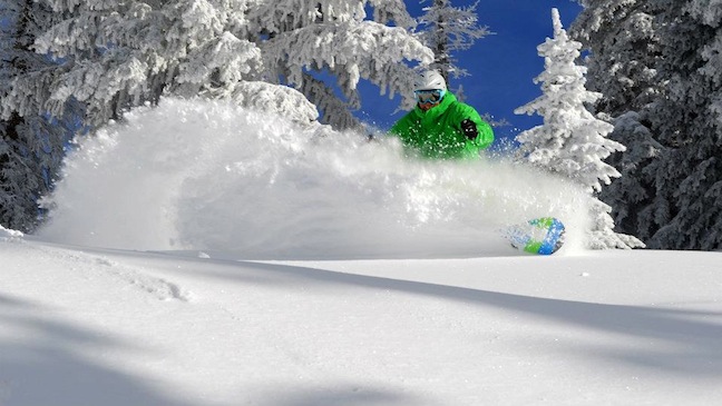
A little bit of fun in Steamboat 12 February. Image:: Steamboat
Weekly Snow Wrap
Europe’s really showing itself to be the come-from-behind success story of the season. From green hills in early December to almost daily snow top ups every region is revelling in the huge turnaround.
Meanwhile, despite the strength of conviction in the US that things would have to change the season there really didn’t get started – except in the Pacific North West where it’s been epic. Still, some nice snowfalls have made for some fun days on the slopes.
Top 5 Snowfalls last 7 days: 1. Arabba Marmolada, Italy – 96cm A, 2. Monte Amiata, Italy – 85cm 3. Artesina, Italy, 65cm 4. Petzen, Austria – 55cm and 5.Entracque, Italy – 50cm
Top 5 forecast this week: 1. Lech Zurs, Austria – 107cm 2. Damuls, Austria – 104cm 3. St Anton, Austria – 102cm 4. Gran, Austria – 98cm 5. Alpenarena, Austria – 97cm
If we could pick anywhere this week, we’d be:
Austria… birthplace of modern skiing, apres ski and Jagermeister, also, going to be the most snowed upon place in the world this week.
North America
British Columbia
Status: Open 100% pretty much everywhere
Recent snow: It’s been relatively clear in BC this past week, the interior – Revelstoke, Whitewater, Red Mountain, received 15cm or so over the weekend and there was some light snowfall last week.
Coming snow: It’ll snow all week, abet lightly. Thursday will be the heaviest day, with about 16cm expected at Whistler.
Conditions generally: It’s still good and staying good. Revelstoke, Whistler, Whitewater – most resorts have bases well over the 2m mark.
Whistler on the weekend. Image:: Whistler
Alberta
Status: Open 100% pretty much everywhere
Recent snow: No snow this week in the Banff area.
Coming snow: Small flurries all through the week, tops of around 2cm per day.
Conditions generally: Still one of the best seasons in the past 13 years or so!
California
Status: More trails opening all the time.
Recent snow: Not a huge week snow wise, spatterings of snow here and there but nothing significant anywhere.
Coming snow: This week is looking more promising, with 12cm or so expected on Monday and a storm gathering itself for some serious snowfall on the weekend.
Conditions generally: January snowfall totalled about 1.5m which, off the back of an almost completely dry December isn’t enough to totally turn the season around, but it is enough for some fun turns.
Colorado
Status: 100% pretty much all round.
Recent snow: 15cm at Crested Butte, 33cm at Winter Park, 25cm at Steaboat… It’s been a good week for the Colorado resorts.
Coming snow: The storm will die out slowly over the next few days, there’s maybe 10cm or so left in it, then it will be sunshine to finish the week.
Conditions generally: This last storm has laid out some actual powder days, and contributed to the cover, which is still sitting down around the 1m or less mark.
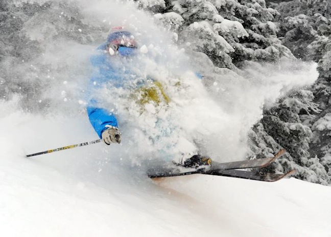
Eating pow in Steamboat 10 February. Image:: Steamboat
Utah
Status: 100% or near enough.
Recent snow: It’s been a good weekend for Utah. 23cm at Alta and Snowbird, 12cm at Brighton and 3cm or so at the Park City resorts over the weekend.
Coming snow: There’s about 8cm left in the storm before the sun arrives on Thursday. Then next weekend it’s return to snowfalls with about 9cm on Saturday.
Conditions generally: It’s stayed cold and the cover is good. these nice little snowfalls have been providing some fun freshies through the week.
North West – Wyoming, Idaho, Montana, Washington, Oregon
Status: Pretty much all open at nearly 100%
Recent snow: As much as 25cm (Red Lodge Mountain) in Montana, 22cm in Wyoming and 15cm in Oregon over the weekend, less in Washington and Montana.
Coming snow: By the standards of the North West it’s not going to be a big snow week, looking at maybe 10cm – 15cm all up.
Conditions generally: A few sunny days won’t hurt the amazing cover and it’ll be a welcome change from constant storm conditions!
Stormy Aspen 10 February. Image:: Aspen
Europe
France
Status: Open, open, open!
Recent snow: There was some snow for the Southern French resorts in the middle of the week but the best news was some slightly warmer temperatures, still well into the freezing zone but up from the bitter cold of recent days,
Coming snow: Tuesday and Wednesday should be big days with about 30cm each day expected in the Pyrenees, about 40cm in the Vosges region and a little less in the Southern Alps.
Conditions generally: Super, super cold weather has preserved the cover amazingly and the constant snowfalls have been incredible.
Austria
Status: Yep, open.
Recent snow: Some light snow in the middle of the week – about 10cm or so. It was cloudy at the end of the week but not much snow materialised.
Coming snow: BIG snowfalls all this week – kicking off with around 10cm or so on Tuesday, then 30cm – 35cm on both Wednesday and Thursday. Down to 15cm on Friday and 10on Saturday.
Conditions generally: It’s already incredible, thanks to the combination of super cold weather and frequent snowfalls, but with this coming snow it will be all-time.
Switzerland
Status: Open, open and open right across the alps.
Recent snow: More clear skies than snowfall this past week, the weekend was slightly snowy, but nothing exciting.
Coming snow: The same storm will hit Switzerland on Tuesday but without the strength it will exhibit in Austria – looking at about 40cm by the end of the week, the eastern regions will be the better off.
Conditions generally: Outstanding.
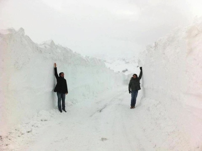
Abruzzo last week. Image:: Abruzzo
Italy
Status: Same story – open, open, open!
Recent snow: Various resorts received snow mid last week – in the vicinity of 20cm – 40cm and the weekend saw as much as 70cm in the Dolomites area.
Coming snow: Wednesday and Thursday are looking promising again, about 25cm in store for Livingo and surrounds, but the big snowfalls were last week.
Conditions generally: Great, amazing, epic… choose your adjective.


