World Snow Wrap, December 6 – Huge Snow Totals Again in California, More Snow in Europe and Japan, Still Slow in Canada
Mountainwatch | Reggae Elliss
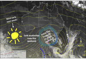
While summer snowfalls in Australian generated a bit of novelty value early this week, the real action is in the Northern Hemisphere, as it should be at this time of year with significant snowfalls in the US, Europe and Japan. The totals coming out of California are huge with seven-day totals of 2.4 metres and there is more on the way with another three-day storm set to drop 70-80cms by early next week. If you’re on the fence about escaping the heat, smoke, bushfires and blue bottles of an Australian summer read on, you may just be convinced to book that airfare for somewhere cold and snowy.
USA
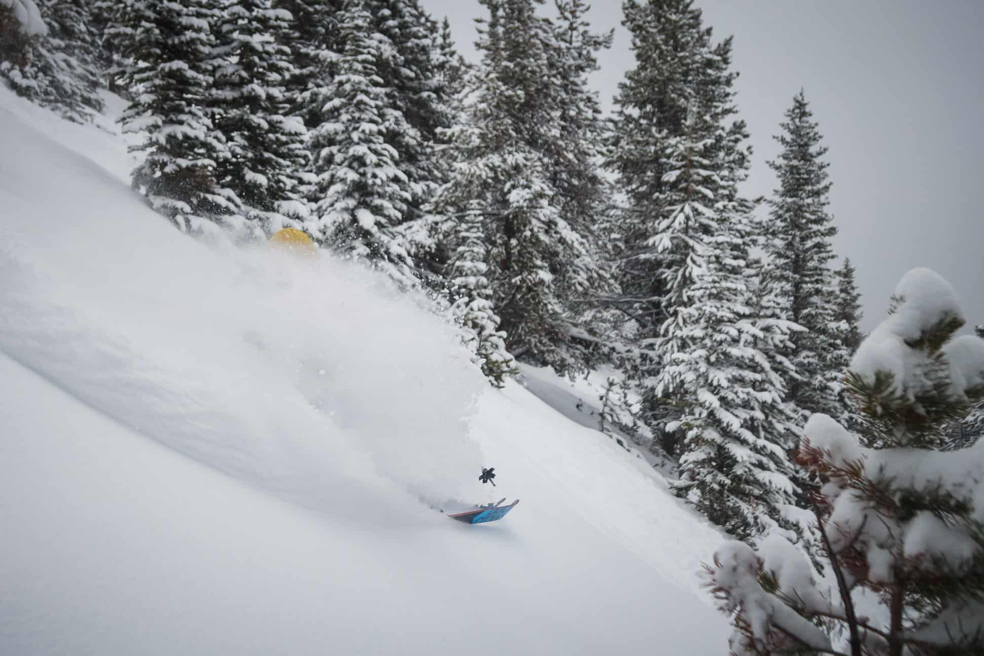
The Sierras are renowned for big storm totals and the past week is a very good example, from zero snow a week ago to seven-day totals of one to 2.4metres on the upper mountains, Kirkwood in California with the top reading. Not surprisingly, avalanche danger is high and mountain ops teams have been working hard to manage the snow and get more lifts and terrain open at all the Tahoe resorts for the weekend. There is a break in the storm action now, but not for long with another strong storm set to deliver 30-95cms for California from Friday night through to Sunday. Mammoth is looking good for 45cms at the base and double that up high, which will lead to more terrain opening over the next week.
Further inland, the Rockies have received 10-20cms this week, and the good early season conditions continue in Colorado with another 25cms expected late on the weekend. It will be a similar story for Utah, the forecast calling 25-30cms across most resorts and the Tetons also won’t miss out and Jackson Hole should see 30cms overnight Sunday through to Monday.
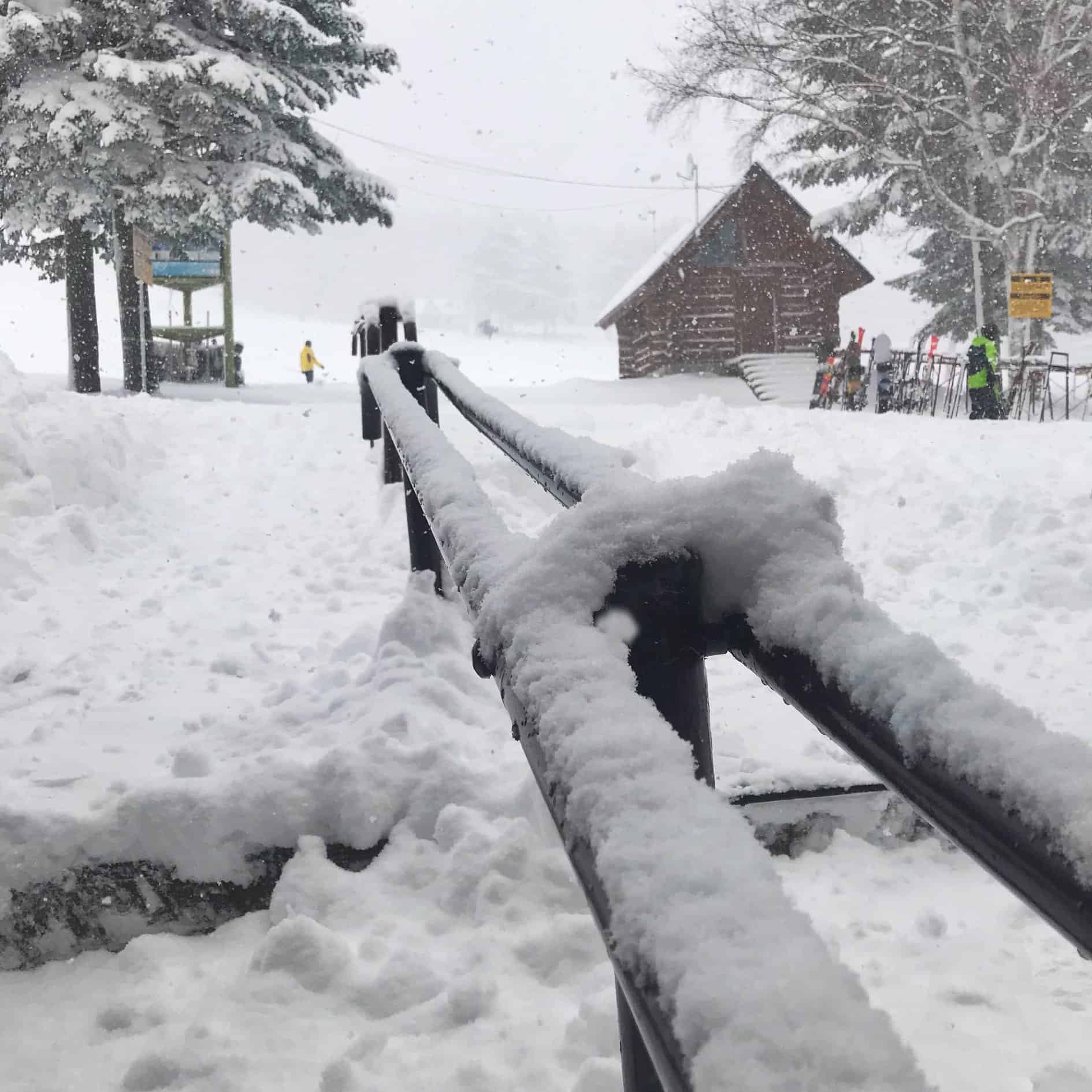
JAPAN
Still only limited terrain open in Japan, but there have been some good snowfalls this week in Hokkaido and Honshu with Niseko receiving 76cms in the past week including another another 25cms last night. There are now nine lifts open in Niseko with more expected over the next few days and there is another 20-25cms forecast over the weekend. Rusutsu is faring pretty well and has a good amount of terrain open with lifts operating on all three “mountains” which are now inter-connected and there have been some excellent powder turns available this week. Furano received similar amounts this week, including a big 40cms overnight on Dec 3-4. Lifts opened there on November 23 and Lucy Morrell has started her Furano snow reports, so check them out for daily updates.
Snow also fell across the Honshu resorts with 10-20cm at base level in Hakuba and 50-70cms on the upper mountain. Today was the first day of lifts operating with Hakuba 47, Goyru and Happo One having a couple of mid-mountain intermediate runs open. The forecast is for clearing weather, but cold temps will continue, which will help the snowmakers build a base on the lower mountain.
CANADA
It has been cold with light to moderate snowfalls in Canada over the past week, resorts in British Columbia receiving 5-20cms of snow, but there were good falls of 20-30cms in Alberta. Whistler Backcomb opened last weekend and has had 14cms over the past seven days, but they’re still waiting for the big season-starter storm to get more terrain open. Big White and Silverstar also opened last weekend and Sun Peaks opens tomorrow, albeit on limited terrain. Snowfalls are expected for the Coast Mountains over the next week and Whistler Blackcomb could receive 25cms at mid-mountain and above over the next three day and there is another storm due mid-week.
In Alberta, the Banff resorts received 30cms over the past week and Lake Louise now has all lifts open with a good cover on piste, but needs more snow for more advanced off-piste areas to open. However, there is not much in the forecast with a few light falls over the next week but it will be very cold with a max temp next Tuesday of -16 degrees.
EUROPE
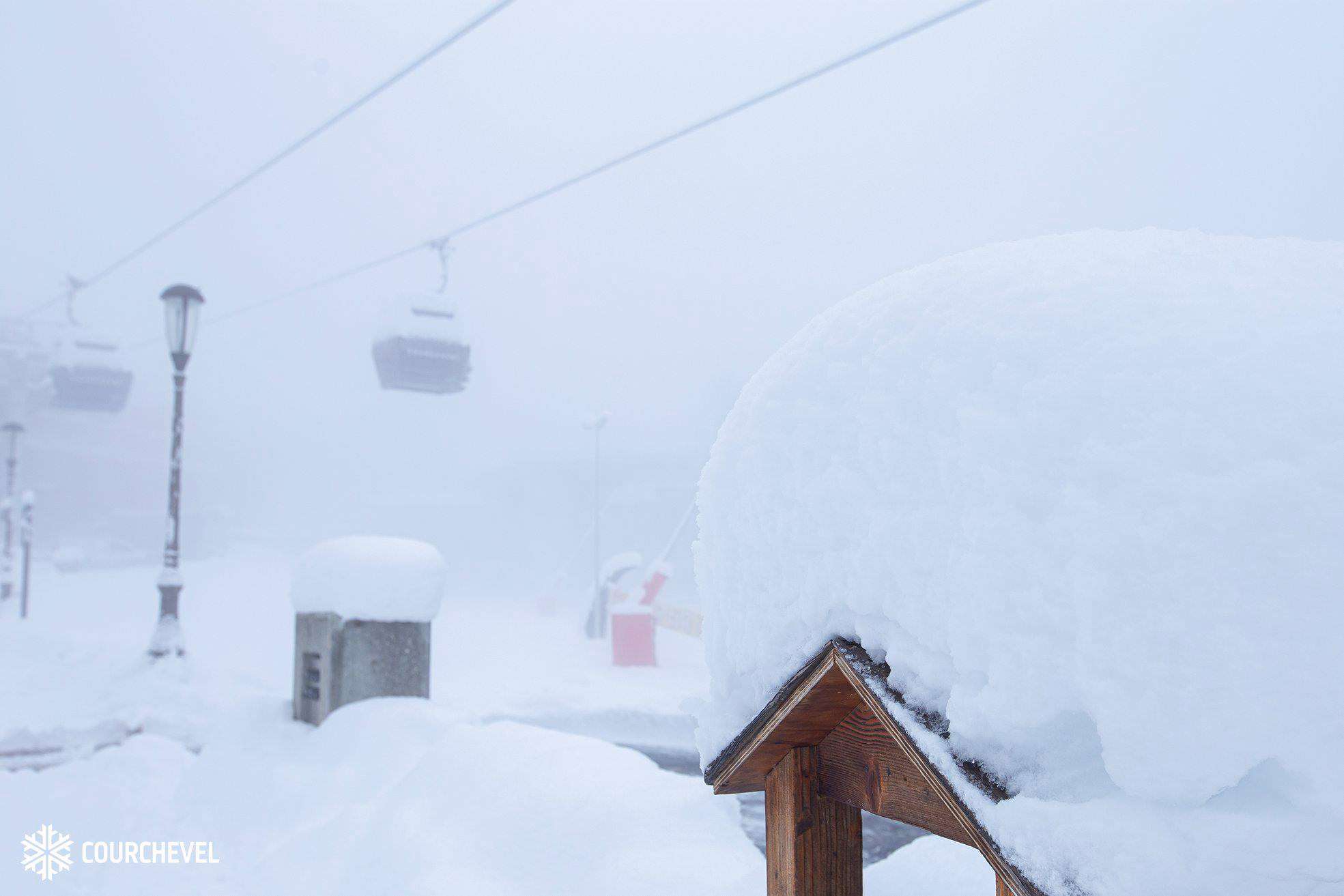
After a very snowy November for much of the European Alps, December has continued the trend with some areas of the western and southern Alps experiencing moderate to heavy snowfalls over the past week. Courchevel in France reported a healthy seven-day total of 104cms, perfect timing as the resort’s opening day is tomorrow.
In Austria and Switzerland, the totals were lower, in the 15 to 30cms range but there were some good falls in Italy, with up to 50cms reported in the Dolomites. There is currently a break in the snowfalls and the fine weather will continue for the next 24 hours ahead of the next storm which is expected late Sunday with 20-50cms likely for both the eastern and Western Alps by mid-week.
WHERE WE WOULD LIKE TO BE THIS WEEK
Rusutsu – after 70-90cms of fresh powder this week and minimal early season crowds, it is the place to be for some untracked turns. Plus, there’s another 25cms in the forecast over the next 48 hours! This clip was shot in Rusutsu this week:
https://www.instagram.com/p/B5r0dxOB4gE/