Australian Forecast – A Little More Snow Up Top Sunday, More Snow Next Week
Published early Friday, 4th July 2025
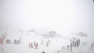
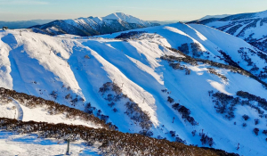
The East Coast Low wasn’t what we ordered, but it did give us some snow up high, with some resorts with terrain above 1800m receiving up to 10cm. It turned a little colder on Thursday, with a couple of centimetres accumulating down to around 1600m.
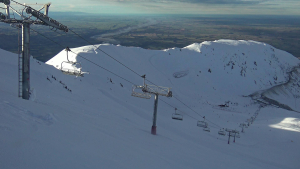
A ridge of high pressure will give us a couple of nice days, Friday and Saturday. Then on Sunday, a weak low-pressure system passes to the north, dragging in a few showers, which should fall as snow about the tops again with up to 5-10cm possible. Another ridge will give us another nice day on Monday.
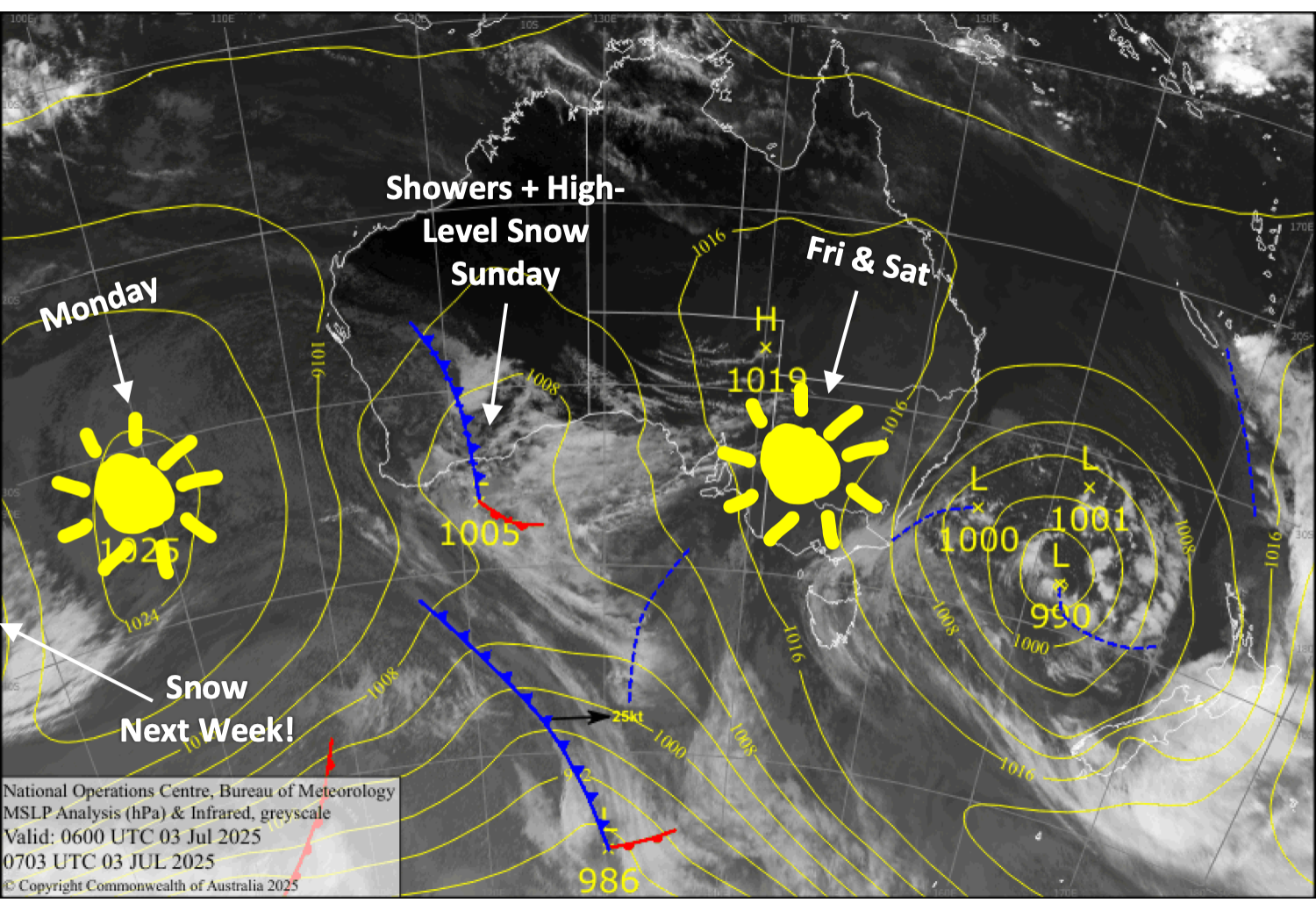
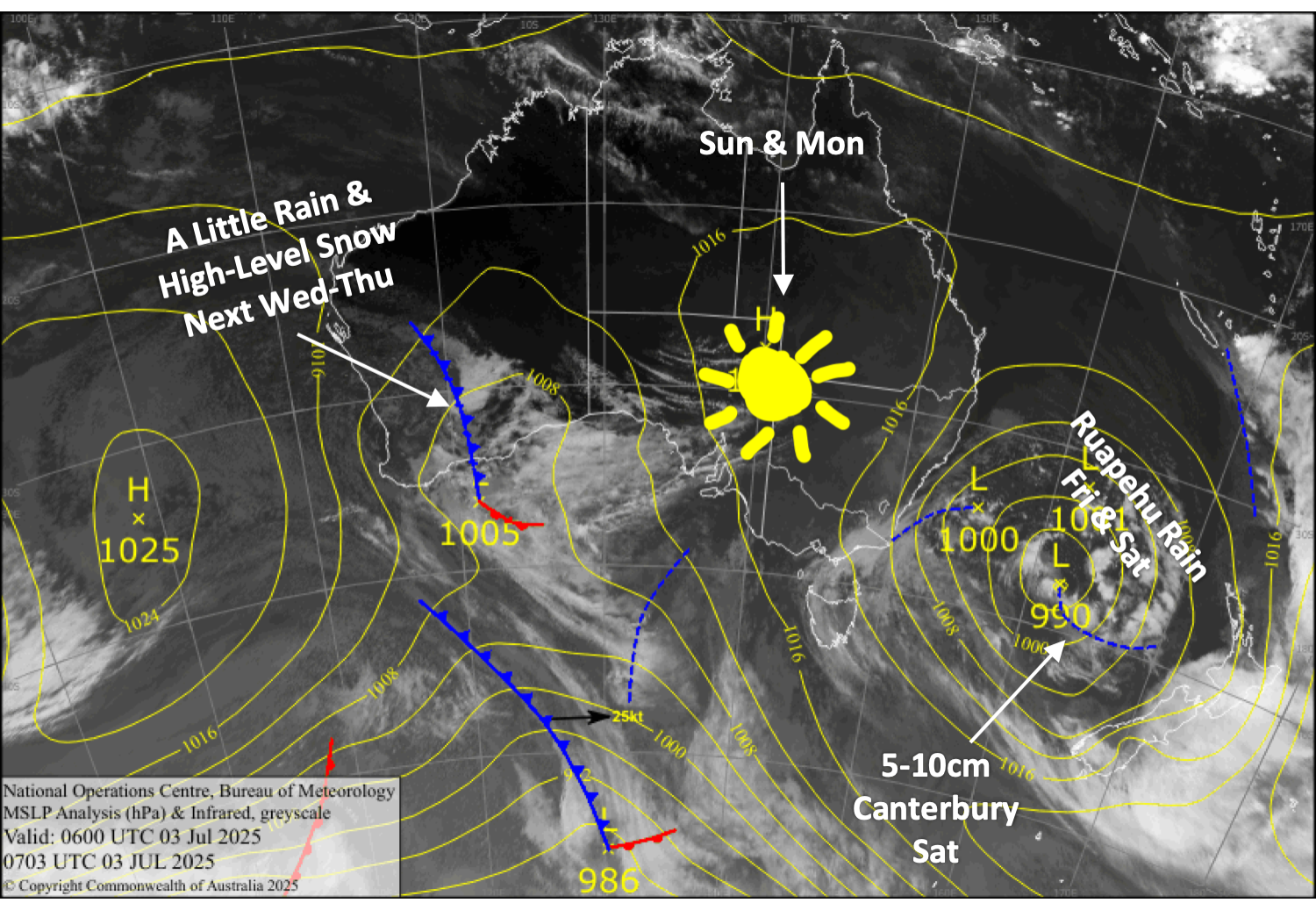
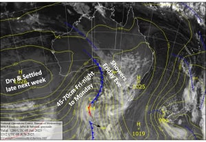
Latest pressure analysis and satellite image. Source: The BOM (vandalised by the Grasshopper)
Friday 4th July
Any remaining cloud cover will clear early for a fine, sunny day. Northwest breezes develop.
Saturday 5th July
Mainly fine again with strengthening northwest winds, although high cloud will gradually build over New South Wales.
Sunday 6th July
Showers spread across the Aussie Alps during the morning, then clear Victoria in the afternoon and New South Wales overnight. Snow will fall above about 1800m during the second half of the day, accumulating up to 5-10cm in New South Wales. Northerly winds gradually die away during the day.
Monday 7th July
A partly sunny, partly cloudy day, while southerly breezes turn northwest.
Extended Forecast
We are still on track for a couple of storm systems to bring snow to the Aussie Alps from Tuesday, the 8th, to Friday, the 11th, but model forecasts have backed off a touch on totals, which I reckon are now in the ballpark of 20 to 40cm. Still, it’ll be greatly appreciated after the recent rain event.
That’s all from me today, folks. I’m sending out these forecasts every Monday, Wednesday and Friday throughout the season. Have a great weekend, and I’ll see you back here on Monday.
Grasshopper