SNOW ALERT – The Last Powder Day
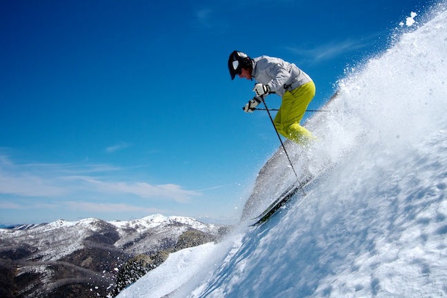
Steve Lee skiing Mt McKay at Falls Creek on 1 October 2010. Image:: Chris Hocking
SNOW ALERT
Snow likelihood rating: Well it’s snowing now…
The images coming in from the resorts this morning are pretty exciting, the snow is just piling up all over the place…
Here’s what the Grasshopper had to say Friday 30 September:
We have a delicate situation on our hands after the deliciousness of yesterday. A low pressure cell in the Bight just south of Adelaide is going to move north-east across western Victoria today, with a moderate north-westerly feeding snow showers onto the Alps.
The low will move up into NSW on Saturday, largely skirting north of the Aussie Alps, and as does so it will suck a south-easterly over the Alps, and it’s on this south-easterly that we’re seeing the signal for another 15 to 25cm of snow. I hate to be the pessimist but I’m finding it hard to trust that forecast completely. Then again, we do still have some fairly moist cold air around. These south-easterlies can be fickle beasts, so I’m going to sit on the fence on this one.
The snow showers should largely clear on Sunday, apart from the east of the Snowy Mountains district, but I still expect some cloud on a moderate southerly. By Monday things should be looking absolutely lovely as up to half a metre of fresh powder goes completely to waste.
Perisher forecasts,
snow reports and
live snow cams.
Falls Creek forecasts,
snow reports and
live snow cams.
Mount Buller forecasts,
snow reports and
live snow cams.
Hotham forecasts,
snow reports and
live snow cams.
Thredbo forecasts,
snow reports and
live snow cams.


