Australian Forecast – A Warm, Sunny End to the Week After a Wet & Soggy Start
Published early Wednesday, 15th July 2026
It’s been a wild and woolly few days. We were looking good after the storm first rolled in and dumped 10-20cm overnight Saturday, followed by another 10cm or so on Sunday. However, snow levels crept up Sunday night, and it’s been wet and soggy on the lower slopes since, with snow levels mostly sitting above 1700m. Still, high altitudes had 5-10cm of new, dense snow by Tuesday morning, and Perisher’s Snow Stake has had another 5cm on it since then.
The storm has now cleared, and temperatures are well and truly freezing at the time of writing in these early hours of Wednesday. Snowcams show the snow guns are firing, repairing the damage of the last couple of days.
High pressure now moves in to settle things down for a nice, sunny end to the week. Temperatures will be positively balmy from Thursday onwards, with daytime highs getting into double digits, but it should still get cold enough for some snowmaking overnight Wednesday and Thursday, particularly in New South Wales.
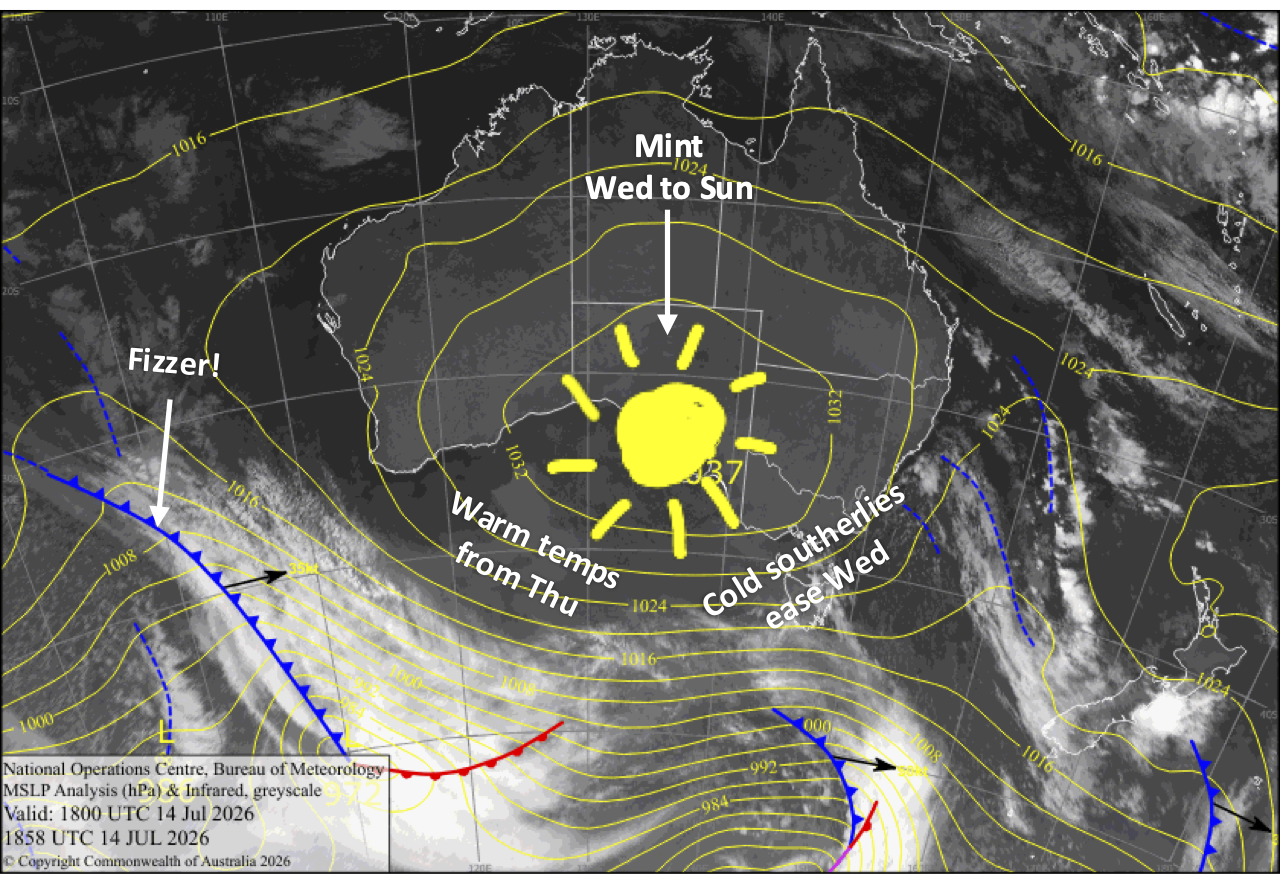
Wednesday 15th July
A mostly sunny day as strong south-to-southwest winds ease, although Mt Baw Baw will be stuck in the clouds. Chilly snowmaking temps in New South Wales morning and night.
Thursday 16th July
A mint, sunny day, and a surprisingly warm one with light southerly breezes. Mt Baw Baw will be cloudy again. Chilly snowmaking temps again in New South Wales morning and night.
Friday 17th July
Another warm, sunny day with a light southerly breeze.
Saturday 18th July
Clear, calm and warm. An absolute stunner!
Sunday 19th July
Sunny and warm again, with a northwest breeze developing.
Extended Forecast
The back half of next week, from Wednesday the 22nd of July onwards, a couple of weak storm systems are likely to brush past us, with only light upper-level snow on the cards at this stage. It’s not the forecast we’re after right now, so hopefully it doesn’t hold.
That’s all from me today, folks. I’m firing out these forecasts every Monday, Wednesday and Friday throughout the season, and an extra update on Sundays during peak season. Have a great couple of days, and I’ll see you back here on Friday.
Grasshopper