New Zealand Forecast, Monday August 5th – A Nice Start to the Week, Then a Top-Up late Thursday into Friday

Mountainwatch | The Grasshopper
It was a cracker of a weekend, with sunshine and deep powder creating incredible conditions. Not surprisingly, every person and their dog was keen to get amongst it, so lift queues were out the gate.
Today and tomorrow will be just as incredible, thanks to a building ridge of high pressure. Lift queues should also be quieter, being work days and all.
On Wednesday, a front passing over the South Island from the west will bring strong NW winds. Most resorts will pick up about 5-15cm of snowfall as it spills over the Main Divide during the latter half of the day and through the night, although some of that will fall as rain on the lower slopes of Canterbury. A possible southerly change Thursday afternoon will bring some more snow showers to lower levels.
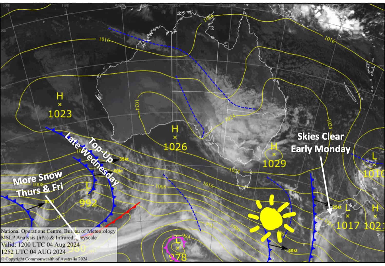
Monday August 5th
Any morning cloud will clear for a fine day. Westerly winds, easing early in Canterbury.
Tuesday August 6th
Another mint day, apart from a little morning cloud for the Southern Lakes where NW winds will be brisk up high. Winds will be light in Canterbury.
Wednesday August 7th
Clouds build over the South Island as NW winds strengthen, reaching gale force in exposed areas. Then, snow showers will start to spill over the Main Divide in the afternoon, with a period of heavier snowfall after dark. However, Mt Hutt and Porter’s Pass will only see light showers of rain and snow from evening.
Thursday August 8th
For the Southern Lakes, it’ll be a fine morning with a westerly breeze, but a brisk southerly change in the afternoon will bring clouds and a couple of light snow flurries.
In Canterbury, showers of rain and high-level snow will clear in the morning as strong NW winds ease. But a cold southerly change in the afternoon will see snow showers return.
Extended Forecast
On Friday, a low may develop over the North Island. This will keep the snow falling lightly over the middle parts of Canterbury, but heavier falls in the north could see little Mt Lyford receive another deep load of powder. Mt Ruapehu should also pick up a much-needed load of snow.
That should all clear up on Saturday. Then, W-NW winds pick up on Sunday ahead of a quick-moving cold change next Monday, bringing a light shot of powder to most NZ resorts.
That’s all from me today, folks. The next forecast is Wednesday. See you then, and have a great couple of days.
Grasshopper


