New Zealand Forecast, September 18th – A Front a Day Brings More Light Shots of Powder
Mountainwatch | The Grasshopper
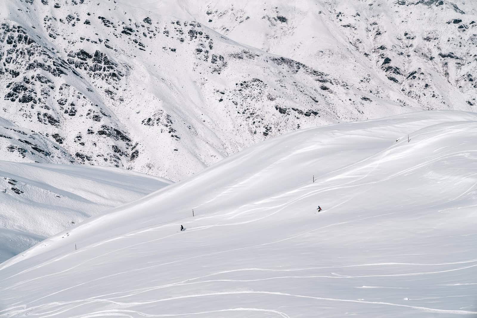
The Southern Lakes scored another 5-15cm dump of powder Monday night after a short, sharp polar blast stormed up the country. Is it the third or fourth round of snowfall they’ve had within a week? I’ve lost count! Weekly snowfall accumulations are now around three quarters of a metre and conditions are excellent, perhaps the best it’s been in years.
The same polar blast also dropped 15cm on Mt Hutt, while Mt Ruapehu received up to 40cm; it’s the first big dump there in a very long time and may allow more terrain to open up.
The next several days will see a constant procession of fronts passing over the country as the strong, unsettled spring westerly pattern continues. It’s four-seasons-in-one-day kind of weather and we’ll almost see one front per day, bringing fresh shots of powder ranging up to several centimetres. However, temperatures will be marginal at times, especially in Canterbury and on Mt Ruapehu where the snow will fall as rain at mid and lower elevations.
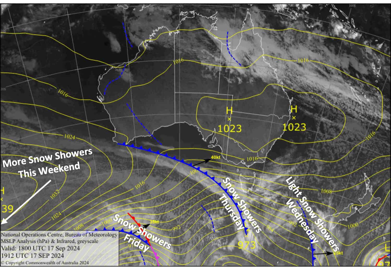
Wednesday September 18th
A partially sunny/cloudy day for the Southern Lakes with light snow showers kicking in during the afternoon, although they may be a bit wet and sleety at base levels. Northwesterly winds.
A cold, clear start for Canterbury, but clouds build this afternoon as northwesterlies strengthen.
Also a cold, clear start for Mt Ruapehu, but cloud and light snow showers arrive from late morning as brisk southwesterlies turn westwards.
Thursday September 19th
A front passing over the Southern Lakes will bring a period of snowfall during the morning to early afternoon, although it may be wet and sleety about the lower slopes. Skies start clearing up later in the afternoon. Gusty northwest winds turn westerly.
In Canterbury, strong northwest winds will be blowing a gale in exposed areas, bringing showers of rain and mid- to high-level snow to resorts in the MacKenzie Basin and Craigieburn Range. Mt Hutt will only briefly see a little rain early afternoon before skies clear later in the afternoon.
Snow showers on Mt Ruapehu will turn wet at mid and low elevations in the morning as temps warm, and there’ll be heavier, more persistent falls in the afternoon. Westerly winds strengthen, reaching gale in exposed areas.
Friday September 29th
A fine start for South Island resorts, but another front will bring snow showers from around midday to early evening. However, the snow will fall as rain on mid- to lower slopes in Canterbury, and Mt Hutt will just see a few rain showers. Gusty northwest winds, rising to gale in exposed areas of Canterbury.
Showers of rain and mid- to high-level snow on Mt Ruapehu become heavier and more persistent again in the afternoon as northwesterly winds strengthen.
Saturday September 21st
Another fine morning for the South Island, but yet another front will spread snow showers over the Southern Lakes in the afternoon and Canterbury in the evening while northwest winds strengthen again. The snow will eventually turn wet on mid- to lower slopes at night as temperatures warm a little.
A partially cloudy day for Mt Ruapehu with a few light snow showers. Strong southwesterlies ease and turn west.
Extended Forecast
Another front from the west passes over the country on Sunday, likely bringing more showers of rain and snow to the country along with northwest winds.
Next week, a low may pass over the North Island on Tuesday, drawing cold air up over the South Island, with light snow likely falling on resorts there through into Wednesday.
That’s all from me today, folks. The next forecast is Friday. See you then, and have a great couple of days.
Grasshopper


