Grasshopper’s North American 2024-2025 Snow Season Outlook Update, December 31st – Climate Drivers Continue to Favour Snow for British Columbia and Pacific Northwest
Mountainwatch | The Grasshopper
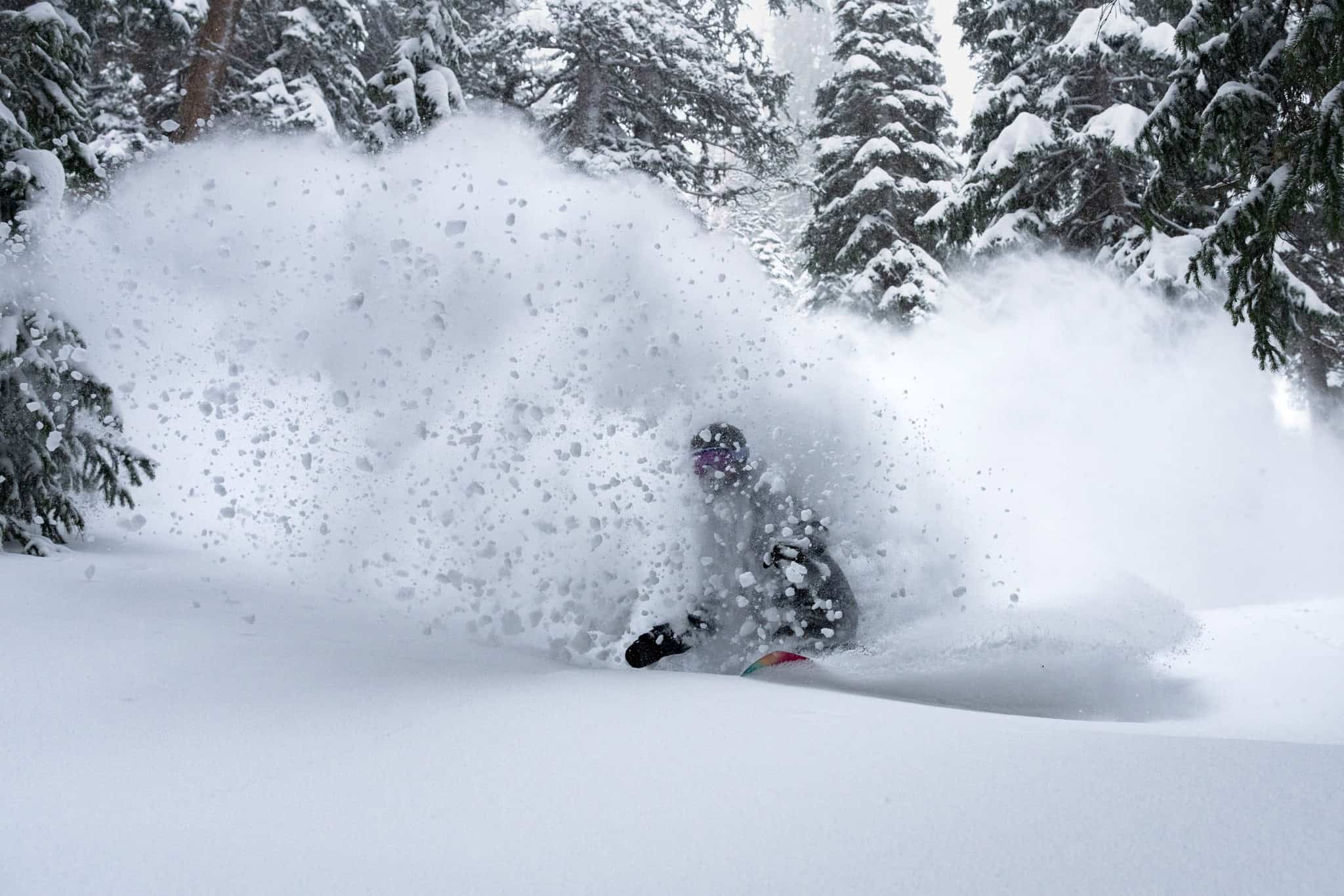
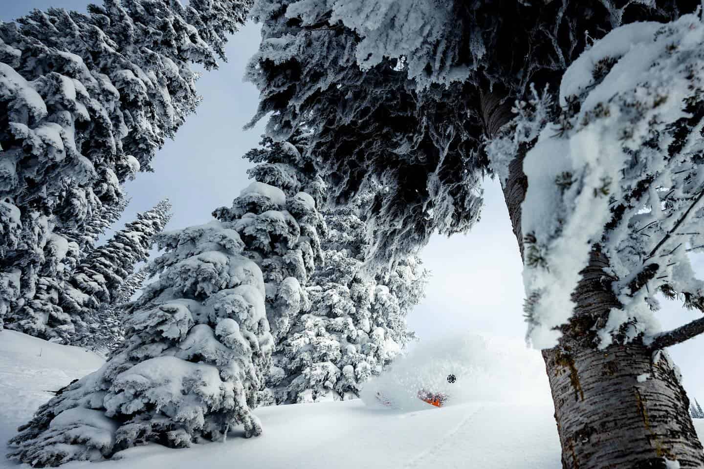
With 2025 on the doorstep, the winter season is well underway throughout North America, with some solid December snow totals so far with a current storm dropping widespread snowfalls and powder over the past few day. The upcoming week is looking like another active one for British Columbia and the Pacific Northwest among other areas around the northwestern United States.
The story of our last outlooks was that a potential La Nina event would see areas of Northwestern United States and Southwestern Canada be best placed to benefit from increased precipitation and lower than average temperatures so let us revisit what to expect as we continue through winter, and if this has changed.
For a quick snapshot of snow conditions so far this season the image below shows snow water equivalent values for areas of the western United States. Yellows and reds represent a lower than the median value and greens and blues represent higher. We see conditions throughout areas further northwest faring better than those further south in places like New Mexico. If you cast your mind back to previous outlooks this is similar to what was expected with a negative neutral to weak La Nina ENSO phase.
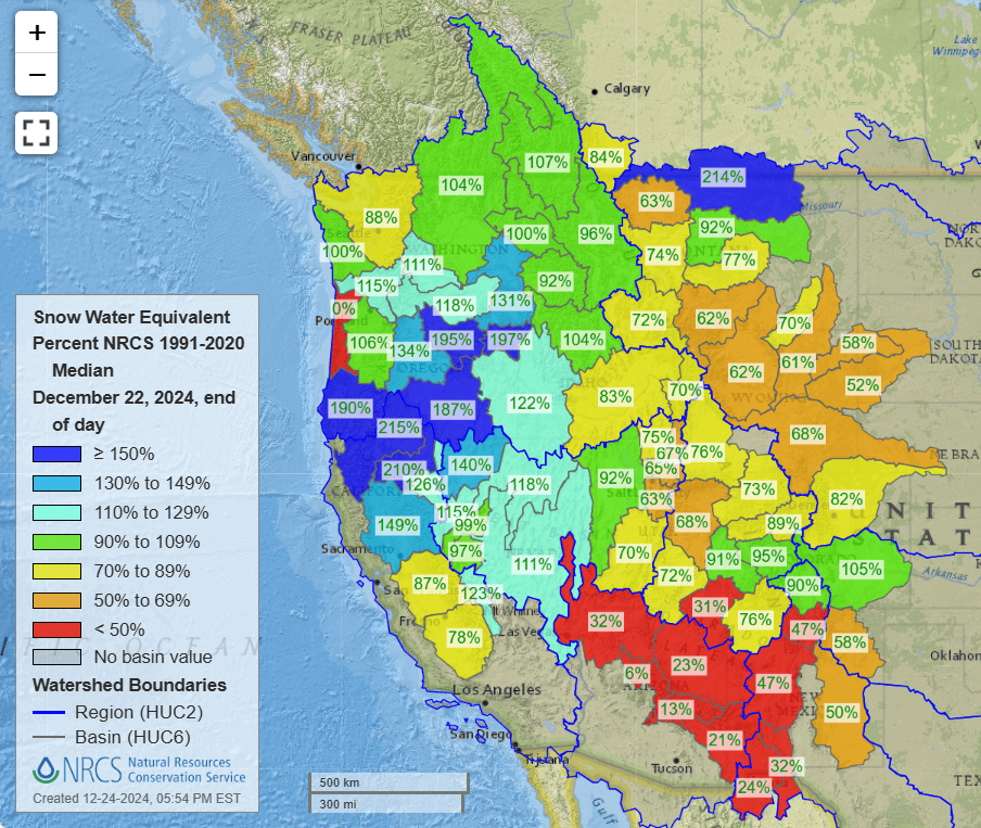
SNOTEL Snow water equivalent percentage of median value for basins across the western United States. 100% represents the conditions for that area being exactly on the median value for that area for that date based off data collected from 1991-2020.
ENSO Update
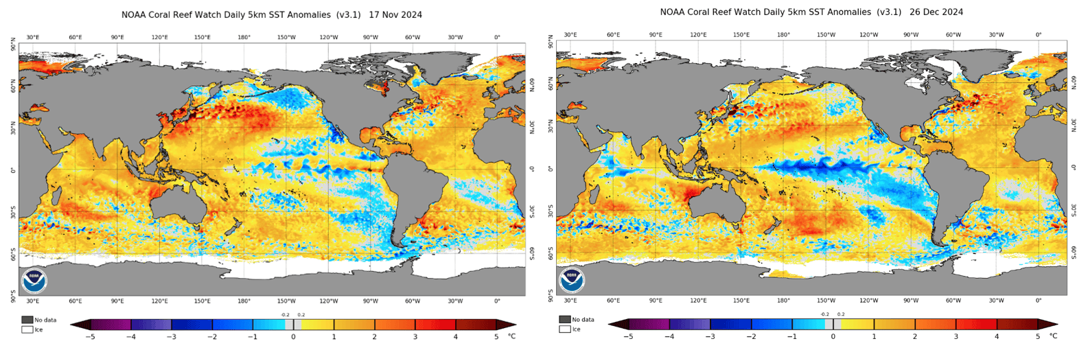
Comparing conditions in the Pacific to last month we see further development of cooler than average waters in the central-eastern Pacific as was forecasted. Right now, the SST conditions are sitting within the La Nina range and other La Nina metrics like stronger trade winds and typically pressure differences hinting at a La Nina event. We will have to wait and see if these conditions can persist long enough for an event to be declared.
The official probability of a La Nina event developing before the end of January is 59% according to NOAA which is right around the 57% number reported last update. So, we will watch whether an event is officially reached through January, with signs pointing to a weak La Nina being the most likely scenario.
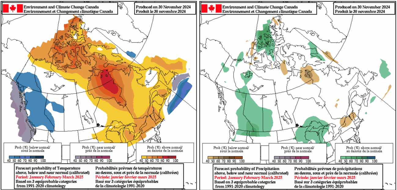
Official Seasonal Forecasts
Looking now at the official outlooks from NOAA and Environment Canada we see a consensus that supports our thinking so far. These products span January to March. Last update we further explored the pattern of colder and wetter conditions in the northwestern USA/southwestern Canada related to the La Nina influence on “normal” jet stream and storm track position and we see this is still present.
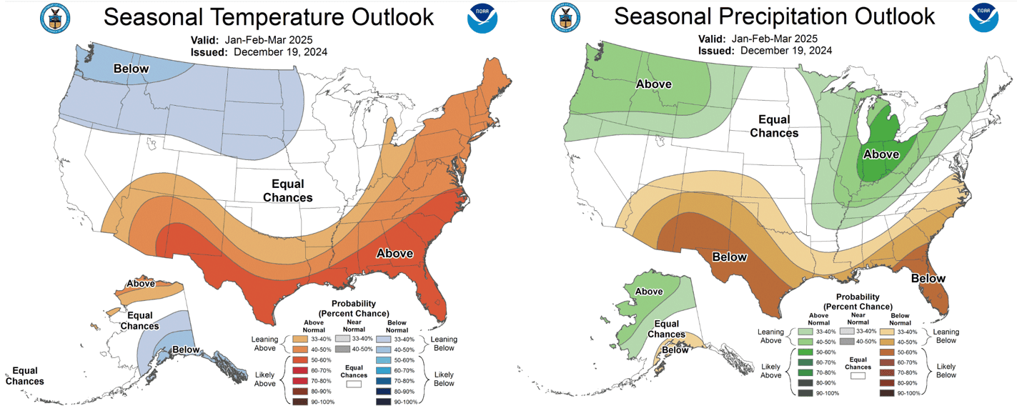
North of the border in Canada we can see the Environment Canada products better agreeing with their NOAA counterparts than in previous updates with confidence increasing as we head further into winter.
Through the first month of winter, we have had some solid storms roll through North America and things are shaping up to be much of the same for the rest of the season. Expect the best totals to again be in areas around the northwestern USA/southwestern Canada with places like the Pacific Northwest and the Canadian Rockies and Coast Mountains typically performing well under these kinds of conditions. I’ll keep an eye on how things develop throughout the rest of the season. In the meantime, check my weekly North American forecasts to see how things pan out, have fun and stay safe out there.


