Australian Forecast , Monday June 2nd– Cold Change Tuesday to Get the Snow Guns Firing Ahead of Opening Weekend Storm
Mountainwatch | The Grasshopper
Published early Monday, 2nd June 2025
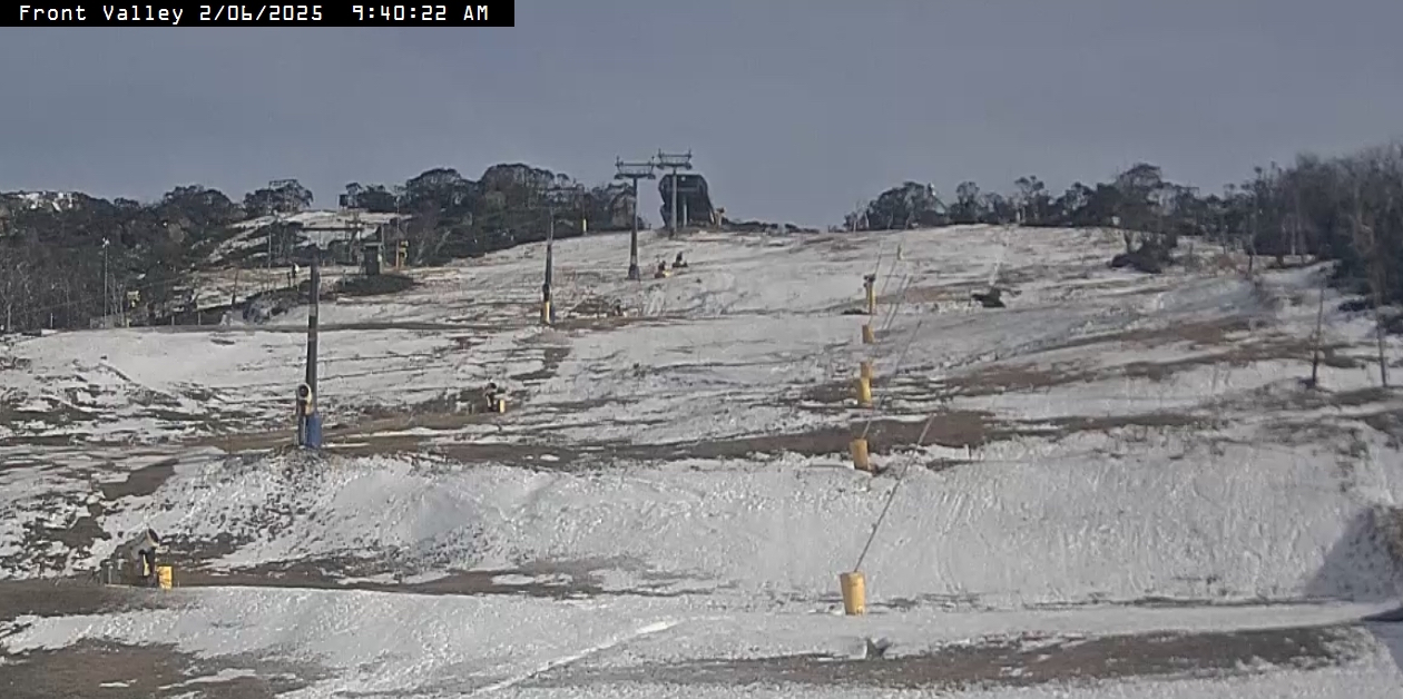
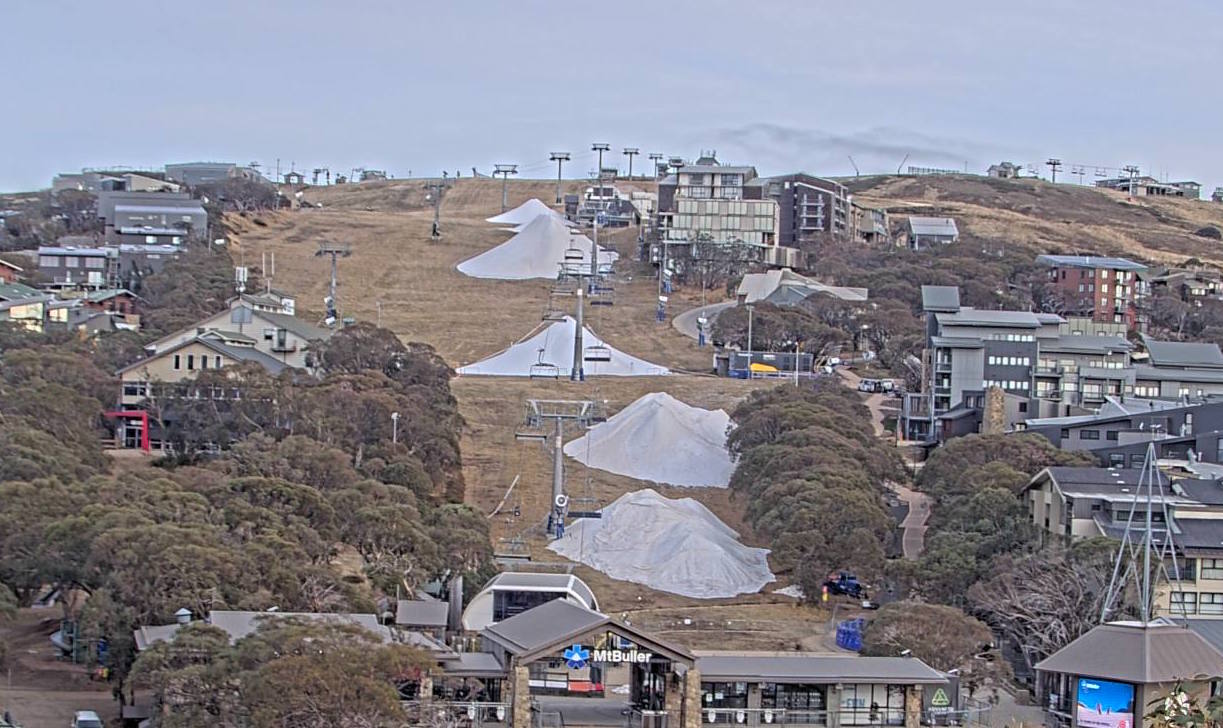
In six days, the Aussie ski season will kick off for its 2025 season. The lead-up to this point has left little in the way of natural snow, so we’re all glued to the weather charts. Thankfully, Mother Nature will cut us some slack and this week. Cold temperatures from Tuesday onwards should allow the snowguns to start laying a base followed by an additional light dusting of snow.
Then, from Opening Weekend through to around the middle of next week, a storm is expected to bring in enough snow to get the season started. Conditions will be a bit rough for Opening Weekend, and it may be a bit damp on the lower slopes, but if it means snow, I don’t think anyone will be complaining.
Monday June 2nd to Friday June 6th
It’ll be warm in the Aussie Alps on Monday, but it should get cold enough for the snow guns to fire up at some point overnight in the NSW resorts at least.
A cold southerly wind change will bring some light snow showers on Tuesday. Only a skiff or dusting of snow is expected, although Mt Baw Baw might receive a few centimetres down to as low as 1000m. There is a chance of some leftover snow flurries on Wednesday as the southerly winds take their sweet time to back off. During this time, temperatures will be nice and cold, especially Tuesday and Wednesday nights, so the snow guns will get a good run in.
A ridge of high pressure will bring dry settled conditions on Thursday, with cold overnight temperatures again.
On Friday, northwesterly winds will pick up as a storm system approaches from the southwest. The winds won’t be the hairdryer type, mind you. In fact, it should be cold enough for any light showers that may turn up to fall as snow flurries about the upper slopes at least.
Extended Forecast
The storm system approaching from the southwest will likely arrive in the Aussie Alps on Saturday and may linger until around Wednesday next week, June 11th.
Snow levels are looking marginal for the lower slopes for Opening Weekend, but mid and upper levels at least should receive decent snowfall from strong, chilly winds from the northwest, which will blow in some extras from the windward side.
The storm looks to be a touch colder from Monday through into Wednesday, so at this stage, we can expect decent snowfall down to resort base levels.
Although conditions aren’t looking particularly pleasant for Opening Weekend, this storm should bring in enough snow to get the season started. As we get closer to the time, I’ll start putting numbers to it.
That’s all from me today, folks. The next forecast is Wednesday. Have a great couple of days and see you back here then.
Grasshopper


