Grasshopper’s Australian 2026 Snow Season Outlook — Mid-Season Update
August 8th, 2026
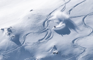
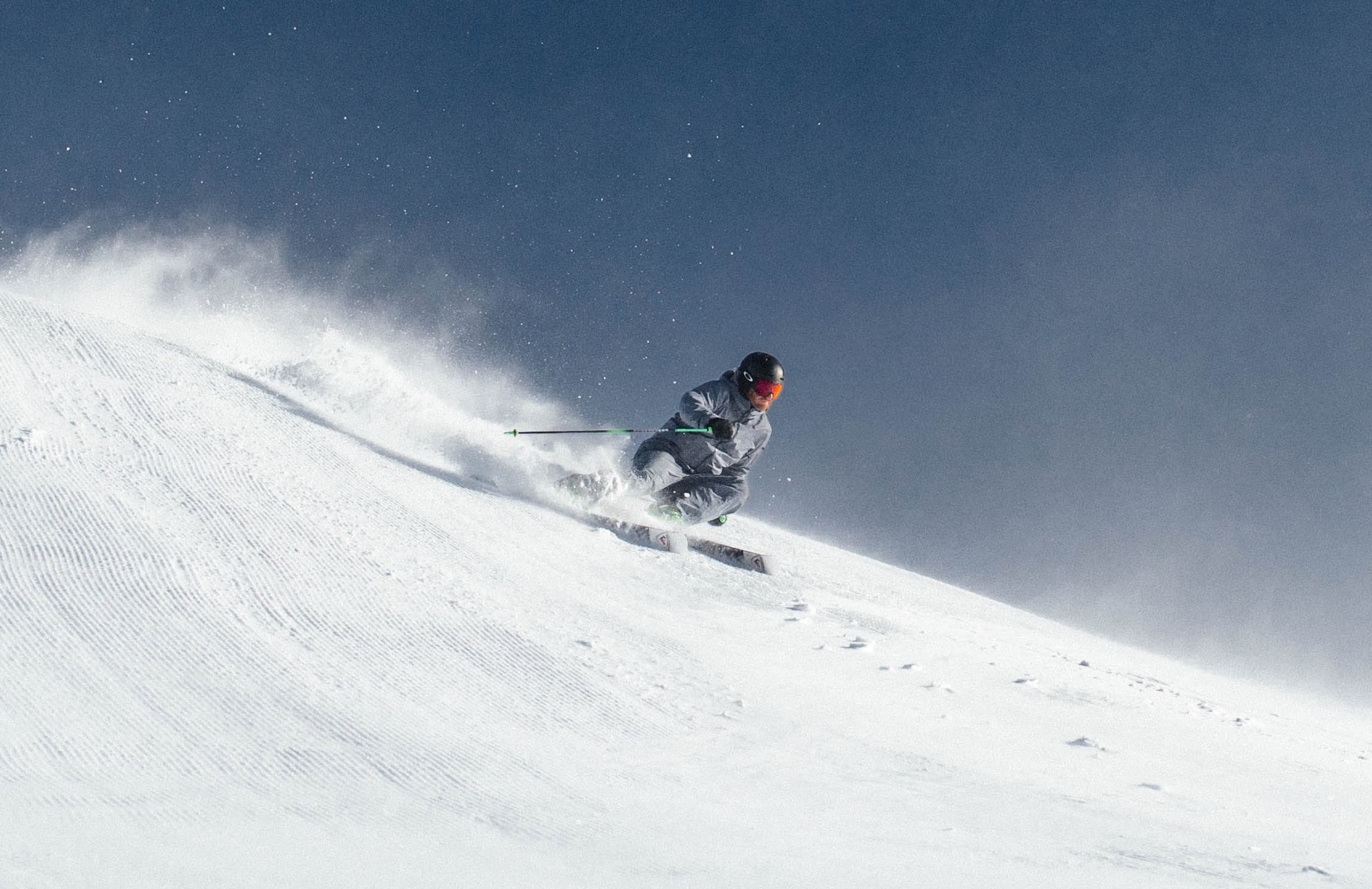
Conditions have been good over the past few days after consistent snow showers earlier this week added 10-20cms across the resorts. The snowfall coincided with the Southern Annular Mode (SAM) ,diving into negative territory, allowing the storm track tis weak to move further north. Scott Kneller reaping the rewards in Thredbo, Thursday August 6th. Photo” Thredbo
Mountainwatch | The Grasshopper
Another month into the season and we’re holding out hope for a renaissance in the remainder of the season. The good news is that one of the best storms so far this season is on the way; the bad news is that so is a record-breaking El Niño. Let’s unpack both below.
Resort depths are currently sitting around 60–100cm at major resorts, while Snowy Hydro’s current snow depth reading at Spencer’s Creek (altitude 1830m) is 87.1cm. Fair to say, we need another real top-up to open more terrain and really kick the season into gear.
This weekend, a front will move across the southeast, gradually catching up to a weaker system ahead of it. As I wrote in my forecast yesterday, things kick off on Sunday, with precipitation starting from Saturday night and temperatures initially making heavy rain the most likely scenario, with some snow above 1900 metres. Temperatures will drop later Sunday, with the snow piling up on Monday and Tuesday. Another system is also expected to arrive later in the week, so a much-needed boost to the snowpack looks to be on the cards.
For a more in-depth short-term look, check out my detailed forecast tomorrow morning. As for the numbers, the upper range for Monday and Tuesday looks to be around the 70–80cm mark, with higher accumulations possible over the course of the whole week.
ENSO RECAP
Back to the less exciting longer-term investigations, it’s time to check how our old friend ENSO is doing. It should come as no surprise that the El Niño declared in our last update is still present and on track to become the strongest ever in terms of sea-surface temperature anomaly.
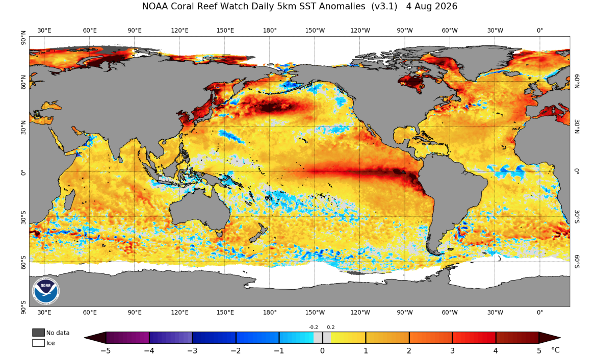
For context, the next strongest was the 2015–16 “Super” El Niño, which peaked at around 3.0°C (the exact number depends slightly on who you ask). This year’s event is forecast to potentially reach 3.5–4.0°C — a noticeable difference that shows just how unusually strong this year’s event is. We can see the current event in the daily SST anomaly below, with a very obvious pattern.
Daily global SST anomaly from August 4th showing the clear El Niño event in the Pacific, with anomalies getting towards the pointy end of the scale. Source: NOAA.
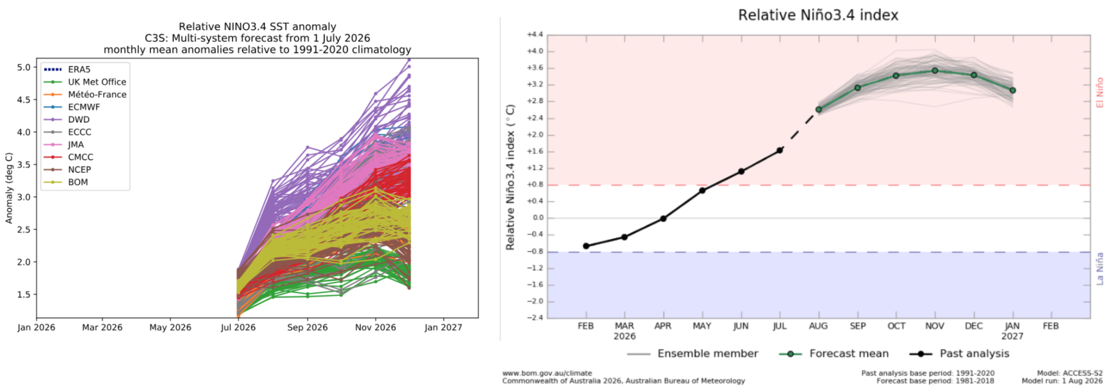
Below are two plots illustrating this, which we have featured in past updates. The right shows the forecast from the BOM, illustrating the evolution so far this year, while the left shows forecasts from a number of other major agencies. As seen in previous updates, we’re currently on the way up, and there is no sign of turning back any time soon.
A combined look at the forecast for the Nino3.4 index over the coming months. The left shows the forecast from a bunch of different agencies while the right shows the BOM forecast specifically, which also includes the previous evolution over the beginning of this year.
A high pressure environment
From our previous discussions, we know that El Niños are typically bad news because of the traditional high-pressure pattern they promote. This has been the story so far this season, with the pattern dominated by blocking highs over the Australian continent, promoting those clear skies, warm days and cool nights.
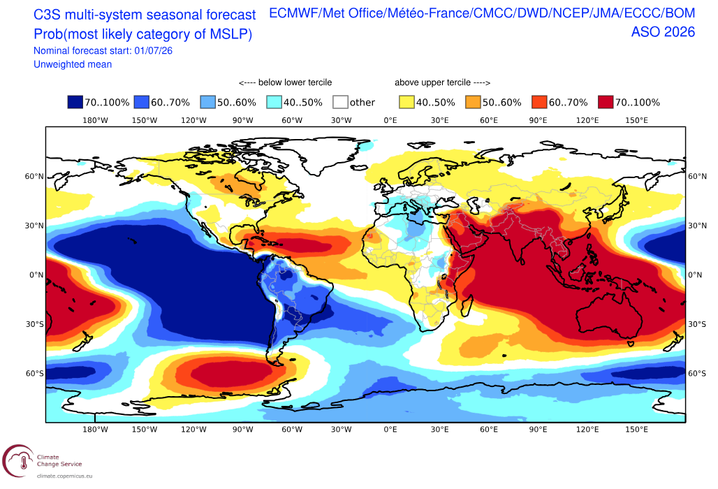
Below is the three-month forecast for mean sea-level pressure (MSLP), showing broadly much higher-than-normal pressures around much of Asia, including Australia. So, although we have some good short-term news with decent storms on the way over the next week, it looks like the longer-term pattern will most likely continue similarly to what we have seen so far.
This keeps with our original seasonal idea that this season will be dominated by getting lucky with a few powerful storms rather than a consistent supply of storm cycles.
Most likely category of three month MSLP for the August-October period from the C3S model, which incorporated many of the major met agencies. Much higher than average pressures encompassing most of Australia are shown. Source: Copernicus Climate Change Service.
Connected to the impact of the strong El Niño event and high pressures over Australia is the Southern Annular Mode (SAM), which has been strongly positive over the start of the season. A positive phase keeps the storm track and stronger westerly winds in the Southern Ocean further south, which isn’t ideal for allowing storms to reach far enough north to impact the Australian Alps.
One interesting note is that SAM has recently returned to neutral and dipped negative, coinciding with some of the more recent storm activity reaching areas of southeast Australia.
Seasonal Products
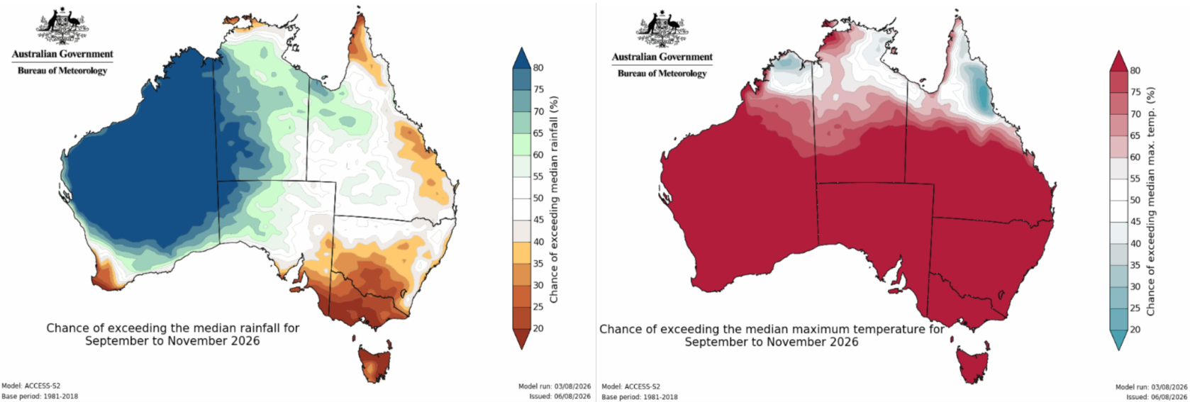
Looking into the crystal ball for spring, below are the September–November forecasts for precipitation and temperature. Zoning in on the southeast, a familiar warmer and drier signal comes as no real surprise.
Three monthly precipitation (left) and temperature (right) forecasts from the Bureau of Meteorology showing an all too familiar drier and warmer signal for the southeast of the country. Source: Bureau of Meteorology.
Wrap Up
Going into this season, the long-term picture was relatively clear-cut, with a record-breaking El Niño bearing down on us. However, we knew it could be made or broken by a few large storms. Warm temperatures have been a thorn in the side of many resorts, but with some decent days in the outlook over the next week, resorts will receive a much-needed top-up to the base.
As discussed earlier in the season, the best conditions will cling closely to storm cycles, but there are still some great days to be had — particularly in the near future.