2019-2020 North American Snow Season Outlook – The Grasshopper
Good Chance Of Above Average Snowfalls in Canada, But Below Average In The Sierras
Mountainwatch | The Grasshopper
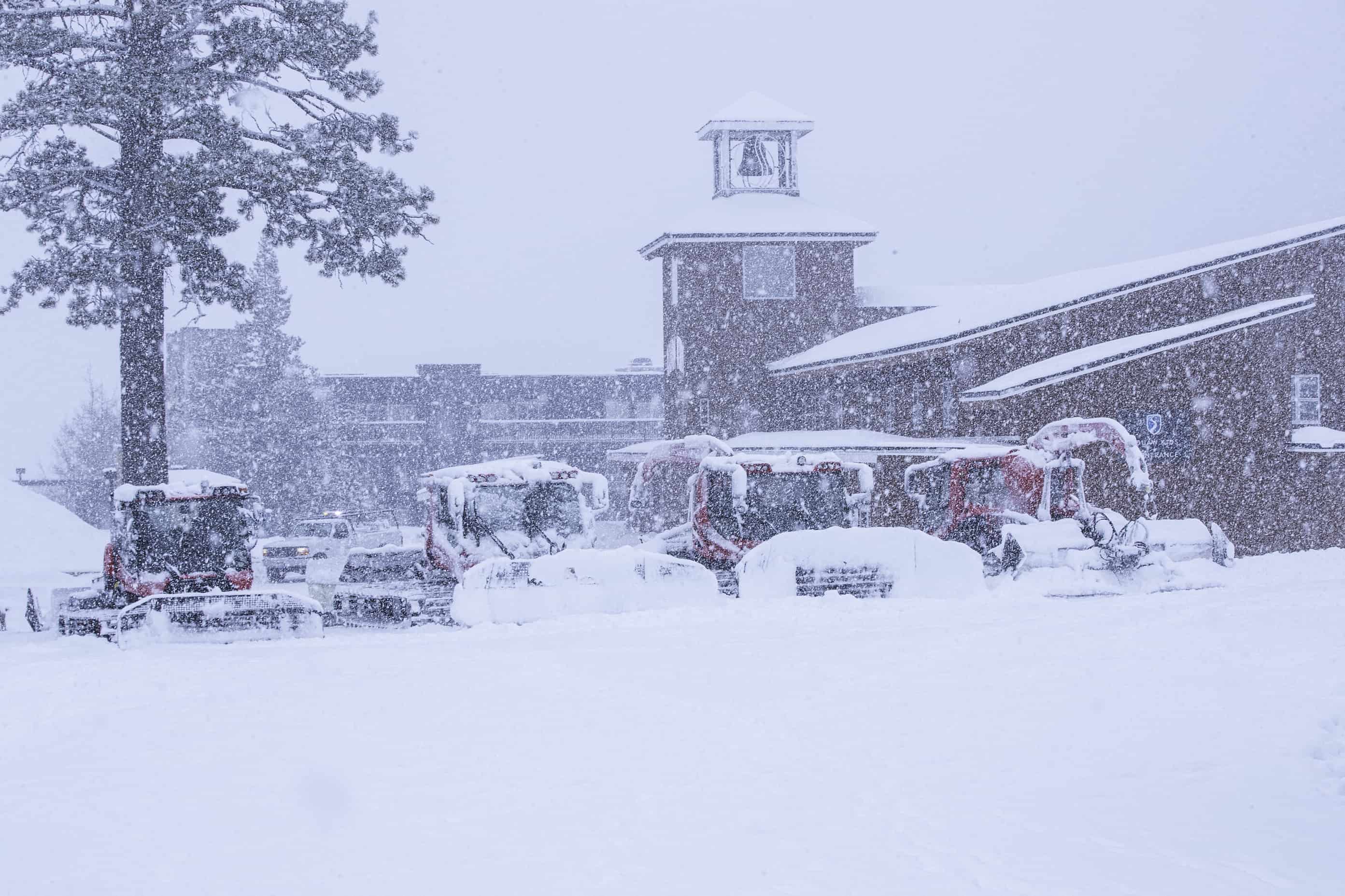
It’s after dark on the eve of Thanks Giving, and I am staring into a blackened screen speckled with illuminated white streaks. It’s snowing!
A few days ago, these webcams in Mammoth were showing barely a trace of white. Now, halfway through the first big snowstorm of the season, about one to two-thirds of a metre of high quality powder blankets American resorts. The second half of the storm will drop a similar amount over the next couple of days, mostly over the southern half of the Rockies.
The Sierra Nevada will then cop another mega load from Saturday night into Monday as a low loiters off the west coast. By channeling in an atmospheric river of warm, moist air from the tropics, up to a metre or more should fall at high elevations. Lower down, snow levels can be an issue with such systems. Fortunately, snow levels shouldn’t rise too much above 2000m, the height at which most resorts sit above.
Canadian resorts will mostly miss out on all this action, but my prospects for the season as a whole look promising for the hearty northerners. And while the southern tier of the States are exploding onto the scene, over the long run we’re not likely to see a repeat of last years bonanza and we’ll be happy to see an average amount fall.
Pacific influences
A neutral phase of the El Nino Southern Oscillation (ENSO) is likely to persist throughout the season, leaving North American snowfall mostly to the whim of harder-to-forecast, short-term atmospheric fluctuations. However, waters over the tropical Pacific are on the warm side of neutral, especially through central parts, which paints a picture not unlike an El Nino Modoki, albeit, a weak one.
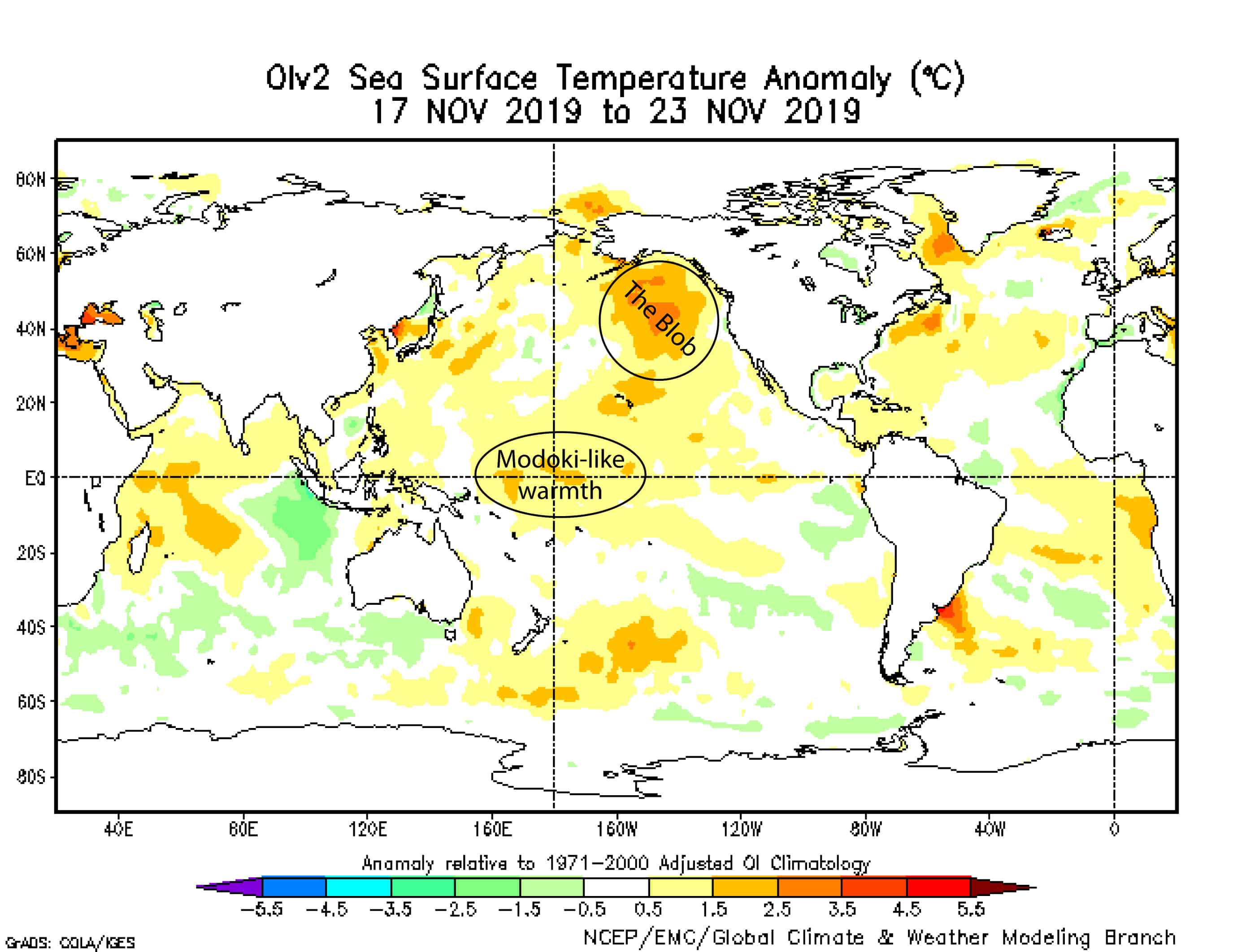
Sea surface temperatures are Modoki-like warm in the central tropical Pacific, while a blob of warm water covers the northeast Pacific. Source: NOAA
Although less well known than its siblings El Nino and La Nina, Modoki’s are becoming more common as the planet heats up and can have different but equally far-reaching influences on atmospheric circulations. Climate models have picked up on this Modoki idea and show some classic signs and symptoms, including increased precipitation and lower pressures over the central tropical Pacific during the winter months.
All this action over the central tropical Pacific may strengthen the Hadley Cellin this region, resulting in higher pressure to the adjacent north, followed by lower pressures farther downstream east of the Rockies. Linking all these together is a big call, but overall this looks similar to a negative phase of the Pacific-North American pattern.
In such a scenario, more cold outbreaks from the Arctic will dump more of that high quality blower powder over the Rockies, especially the northern half. The Coastal Ranges of Canada will also benefit from a more northerly storm route with at least average snowfalls there. However as we head farther south, the Sierras appear to be left a little high and dry.
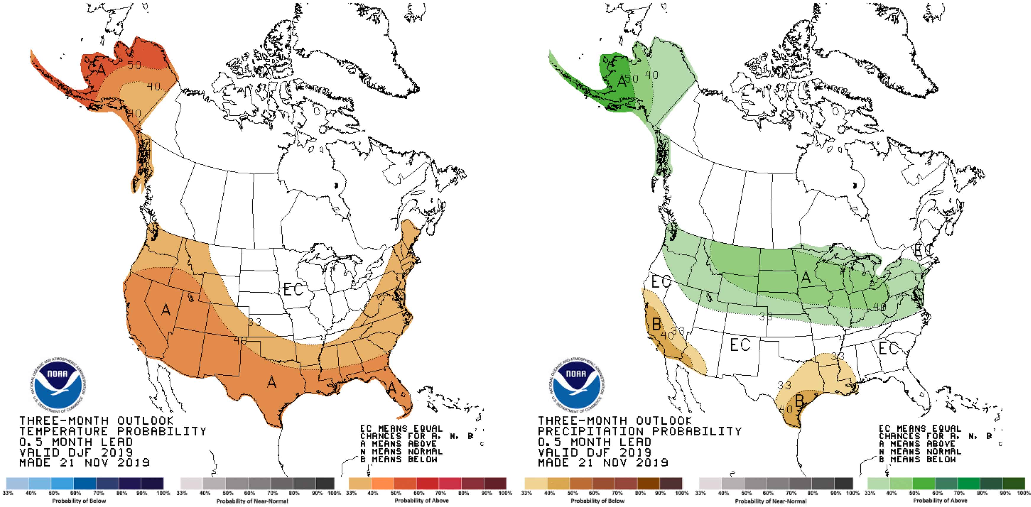
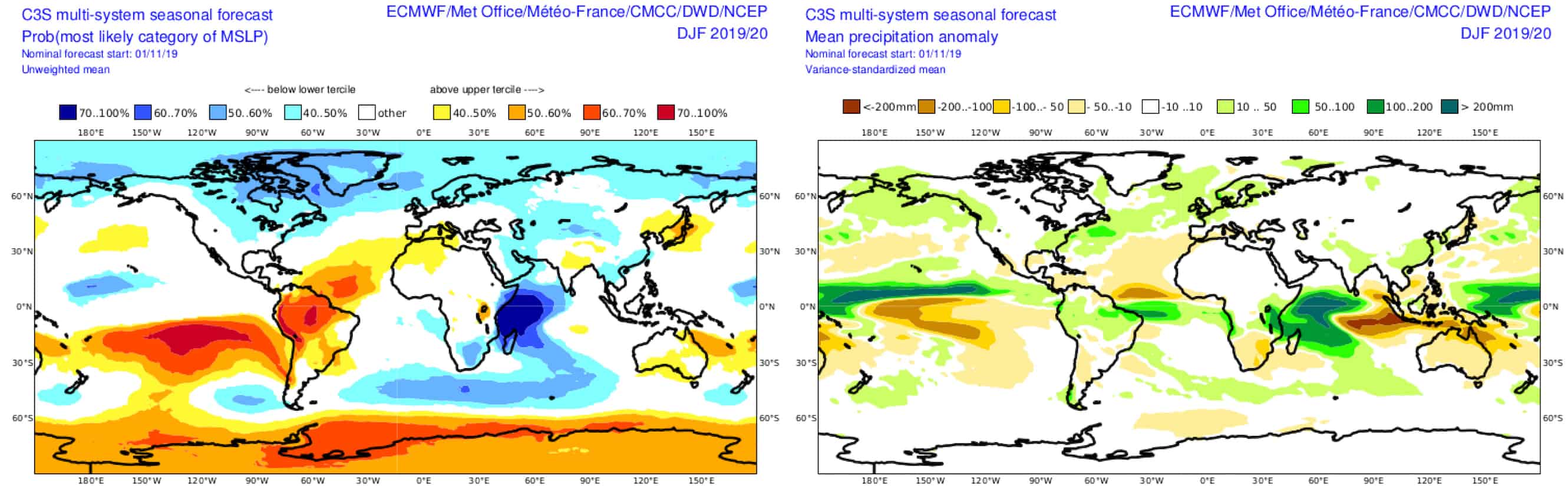
This scenario is fairly well depicted by temperature and precipitation forecasts by climate models as well as NOAA’s winter outlook. In the case of temperature forecasts, things get a little messy not only due global warming, but also because of a massive blob of warm water stewing over the eastern half of the North Pacific.
Suitably, this has been named “The Blob” and is reminiscent of that which formed during the autumn of 2014 and had devastating impacts on marine life. This is expected to raise temperatures and possibly increase precipitation along the Pacific Crest for at least the start of the season, until winter storms churn up colder water from deeper below the surface.
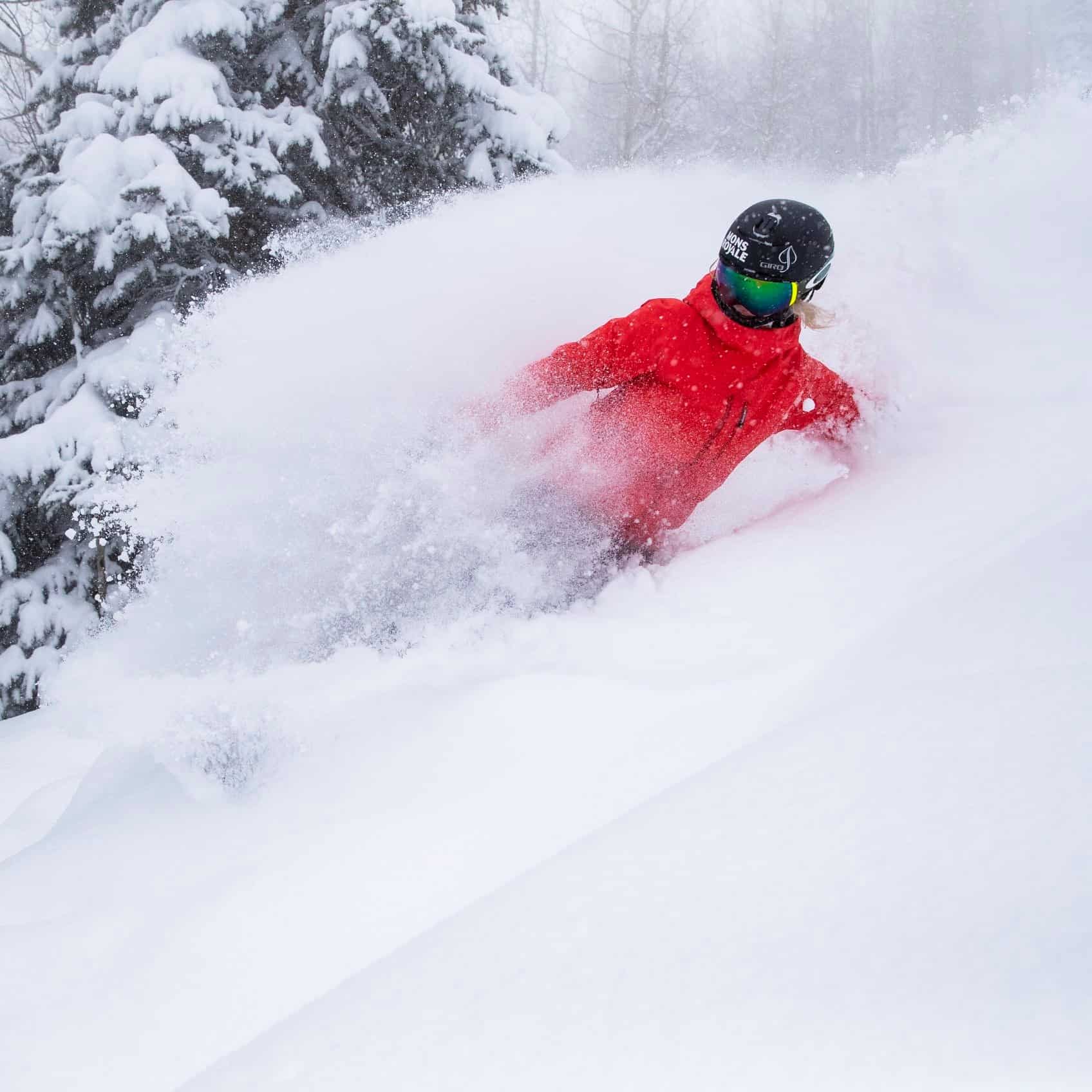
Another offshoot of a warm central tropical Pacific is the extra fuel it may add to the Pineapple Express. Incase you haven’t heard of this phenomena, it’s an atmospheric river that forms from time to time, sending warm, moisture-laden air from the tropics to the Pacific Crest – the likes of which we’ll see when the Sierras cop the next mega load from Saturday night. Like I mentioned, snow levels can be an issue for lower elevations, but higher up, accumulations can be up and over the metre mark. A couple of these whoppers could be the saving grace for the Sierras.
Summary
With climate influences on the weak side, I’ve scraped the bottom of the barrel to glean any trends in North American snowfall this season. Not that they are unfounded, as climate models backing these trends are in remarkably good agreement.
These trends favour the north and not the south. So we can expect average or above snowfalls over Canada and perhaps the northern tier of the American Rockies. The Sierras are likely to receive average or below amounts, while the Cascades and remainder of the Rockies sit in the average range where they could easily swing either way. The heavy use of “average” is due to the weak nature of climate influences.
That’s all from me folks. I’ll update this outlook in another month or so when we’re in full swing. I’ll be issuing weekly forecasts for both Japan and North America this season starting in December, so make sure you tune in.
That’s all from the Grasshopper. Wanna keep your finger on the pulse of all things snow? Join my weekly email list by filling in the box on my forecast page. If you have a question or feedback for me, hit me up on facebook.


