2021 Season Wrap – The Covid Roller Coaster and a Not Quite Average Winter For Snow
Mountainwatch | Reggae Elliss
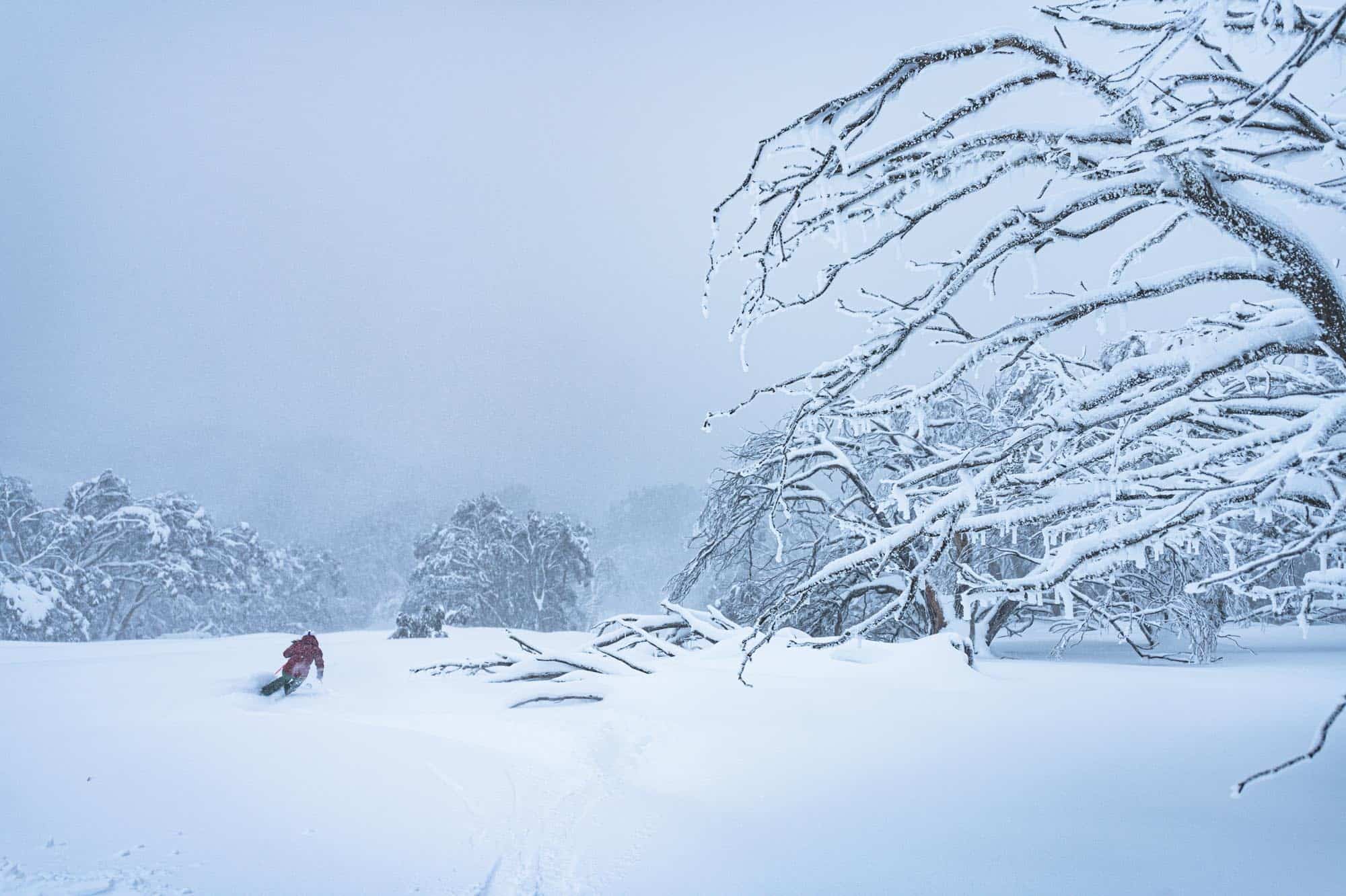
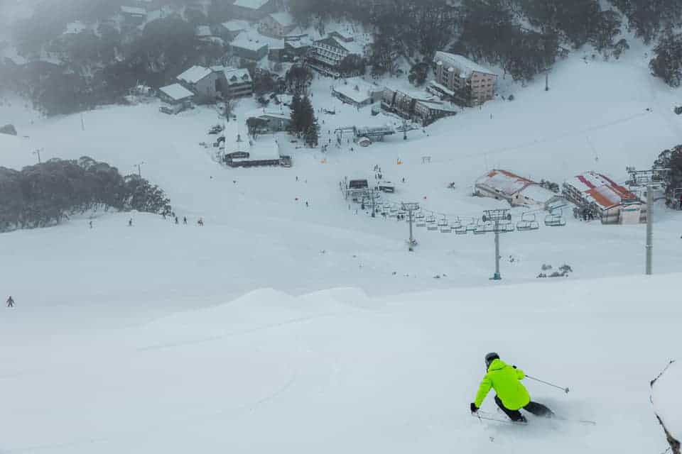
It’s now three days after the closing weekend, sunny but windy here in Thredbo, the upper mountain looking good after a spring storm on Monday/Tuesday dropped 10cms of snow across the Australian resorts. The lifts may be closed but the backcountry is worth a spring tour if you are keen and you live in an area not in lockdown.
It is not unusual to see snowfalls after the season ends, but it was unusual for only Falls, Hotham and Buller to have lifts spinning on closing weekend, the NSW resorts having already closed due to the latest Covid lockdown.
What a roller coaster season, both in terms of Covid lockdowns and snowfalls. As far as snowfalls go, you could say this winter was a one-month wonder with two big storms in July saving 2021 from being a very below average season. Using the Snowy Hydro’s snow depth reading at Spencers Creek as a guide, the snow depth for 2021 peaked on July 29 at 183.6cms, and by the end of August was down to 157.3cms. In most winters the peak snow depth is reached in August or September and it is the first time since 2014 that it was reached during July.
As far as lockdowns go, the Victorian resorts went through three lockdowns of varying length, but were open for 75days this season – a lot better than 2020. However, for most of that time only regional Victorians were allowed to visit the resorts as the in and out lockdowns meant Melbournians only had access to the mountains for a month at the start the season when minimal terrain was open and then for 10 days from July 27-August 5 and the city has been in lockdown since.
Sydney has been in lockdown since June 26, leading to a 70% decline in visitation to the Snowy Mountains and when the ACT and other regional areas also went lockdown, that decline increases. The Sydney and Melbourne lockdowns have a had a big impact on the businesses and alpine communities that rely on winter tourism while the Australian snow industry has suffered two poor years in a row.
The first lockdown here in the Snowy Mountains ran from August 15 through to September 20, after the NSW government locked down the entire state, with just 90 mins official notice on Saturday August 14.
The latest lockdown in the Snowy Mountains region started last Thursday, just two weeks after the previous lockdown ended, when cases we’re recorded in Cooma, Jindabyne and Thredbo, after being Covid-free the entire pandemic.
Anyway, enough of Covid and lockdowns, let’s talk about the weather and have a look back at this season’s snow conditions which was once again a winter of highs and lows. Pre-season, we had a couple of light snowfalls and good snowmaking temps in late May which saw Perisher achieve another early opening, with lifts open on Front Valley a week early on June 4. The other resorts had been busy building a base in snowmaking areas and it was looking good for a typical opening weekend with a few lifts open on minimal terrain and the usual fireworks, music and social celebrations.
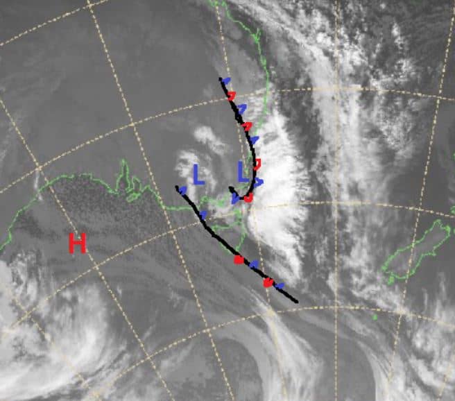
However, the weather was looking very interesting as an East Coast low developed of the NSW south Coast in the week leading into the opening weekend. The first snow was on Tuesday June 8 when 5-10cms fell, before heavy snow unloaded across the Alps over the next two days. In his first forecast for the season on Wednesday June 9, the Grasshopper had written that, “The question is just how much will fall and remain as a base, but maximum totals look to be over half a metre.”
He was right with the resorts reporting 30-60cms of snow over a two-day period and in the Snowy Mountains heavy snow fell down to Jindabyne which created havoc on the roads.
The storm dropped a good base of heavy snow which saw all resorts open lifts on the June long weekend. However, the rest of June was pretty uneventful with the snowmakers taking advantage of the cold temps when they could with more lifts and terrain opening over the next weeks. However, we didn’t see much in the way of natural snowfalls during June with just a small 8cms top-up on June 24-25, but that came after 50mm of rain.
At the start of July, the Snowy Hydro’s snow depth reading at Spencers Creek was 54.8cms and the open terrain in the resorts was still limited to snowmaking areas. However, climate drivers which had been neutral were starting to change with the IOD (Indian Ocean Diapol) looking like it would move into a negative phase and in the July update if his season outlook, the Grasshopper reckoned we had cause to “dare to dream”.
July started off well with 15cms on July 3-4 and in my notes, I described Sunday July 4 as the first good day of the season thanks to temps at -4, 11cms of fresh snow and the opening of some off piste terrain. The next couple of weeks stayed cold with quality dry packed snow and moderate WNW winds also blowing in a lot of snow, with fun mornings on the corduroy and dry, chalky snow off piste.
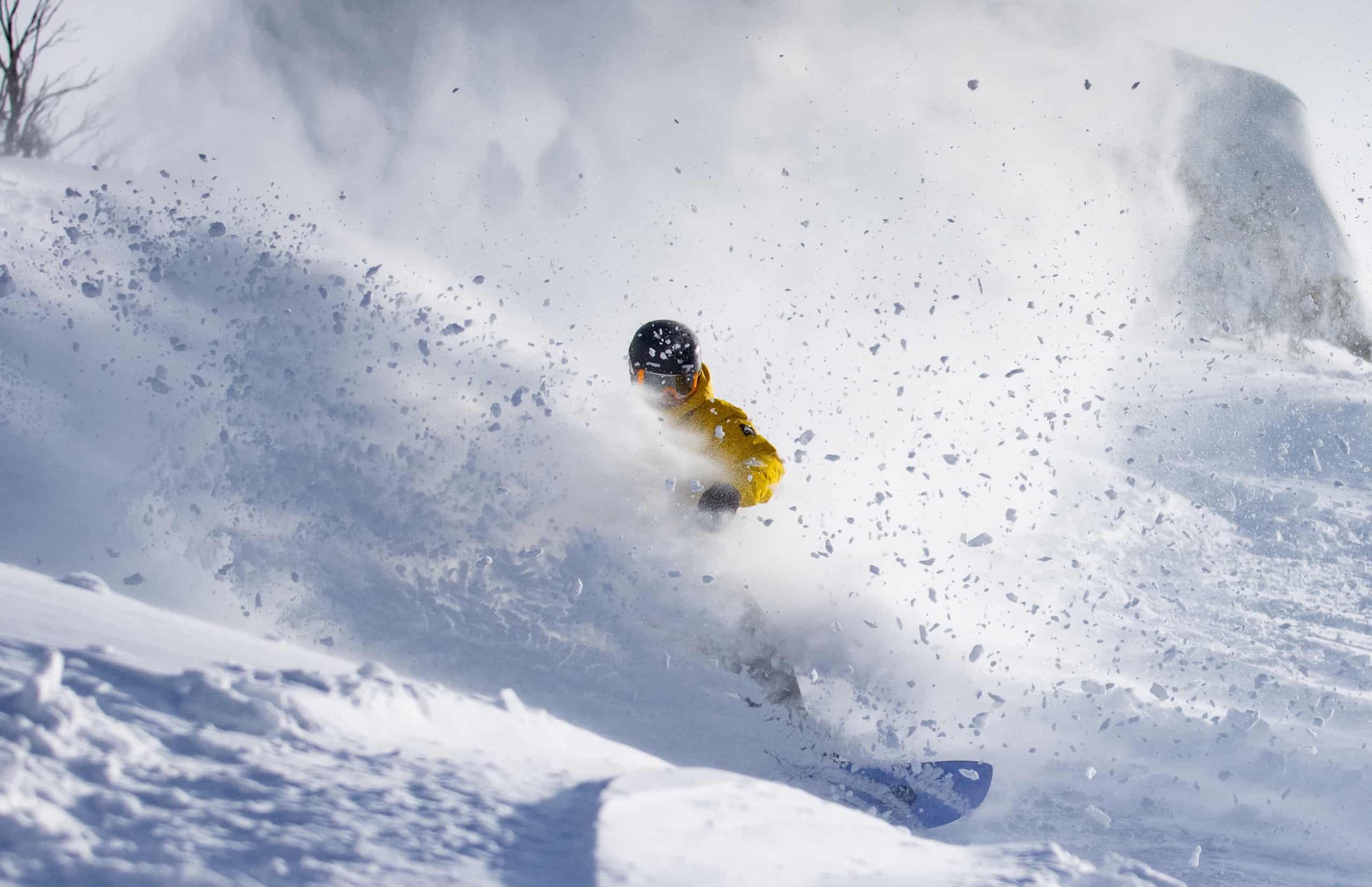
However, a change was in the works, and on July 9 the Grasshopper mentioned that we were looking good for significant snow the following week and the following Thursday morning he was forecasting 30-65cms by the end of the week. The storm kicked into gear that afternoon, with increasing snowfalls and dropping temps and Saturday July 17 was one of those “best in years” kind of day with 30cms of fresh snow and temps down at -4.5.
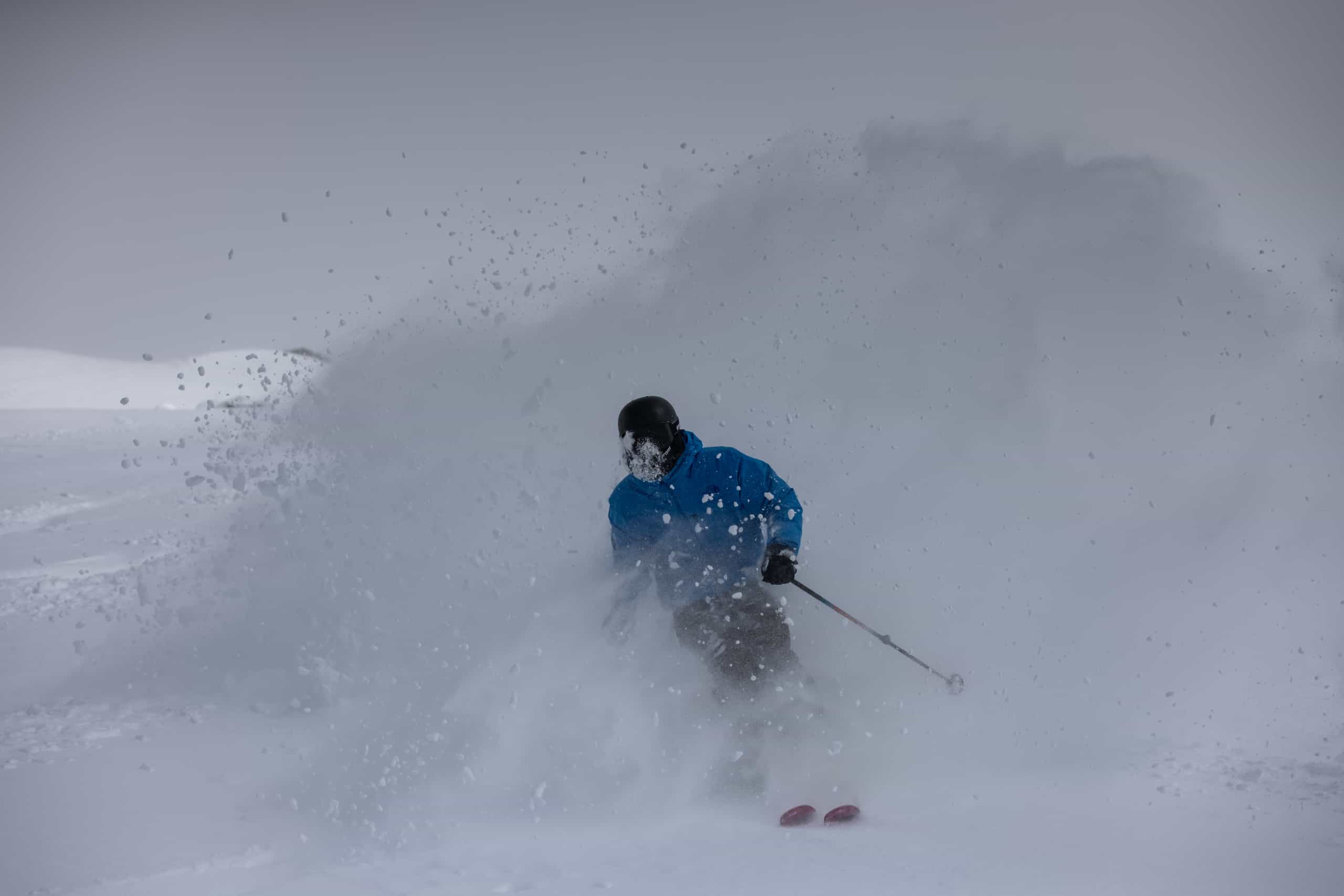
Snow showers continued over the next couple of days with another 15cms in 24 hours on July 20-21 and yet another solid storm was on the way, with snowfalls starting on Friday 23rd. In his forecast that day the Grasshopper was again calling for totals of 30-70cms over a three-day period, but strong winds made it hard going with wind-hold at times. The snow hit hardest on Saturday July 24 with 40-50cms by Sunday morning followed by another 10cms on Sunday night. If you like storm skiing it was an awesome couple of days and the following week saw another 10cms top up on the 28thwith consistent snowmaking and wind-blown snow adding to an already excellent cover.
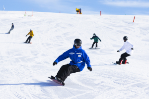
The Victorian resorts were in lockdown in the back half of July, the on-mountain local crew making the most of their backcountry gear for some great in-resort touring before the resorts reopens ion July 27. In NSW the Sydney lockdown meant there were minimal crowds on the hill and the consistent storms and wind made for one of the best month’s skiing I can remember. It may have been cold and blowy, but the rewards were definitely there and the lack of crowds made for a mellow vibe with no agitated “first chair” hustlers, even on a powder days.
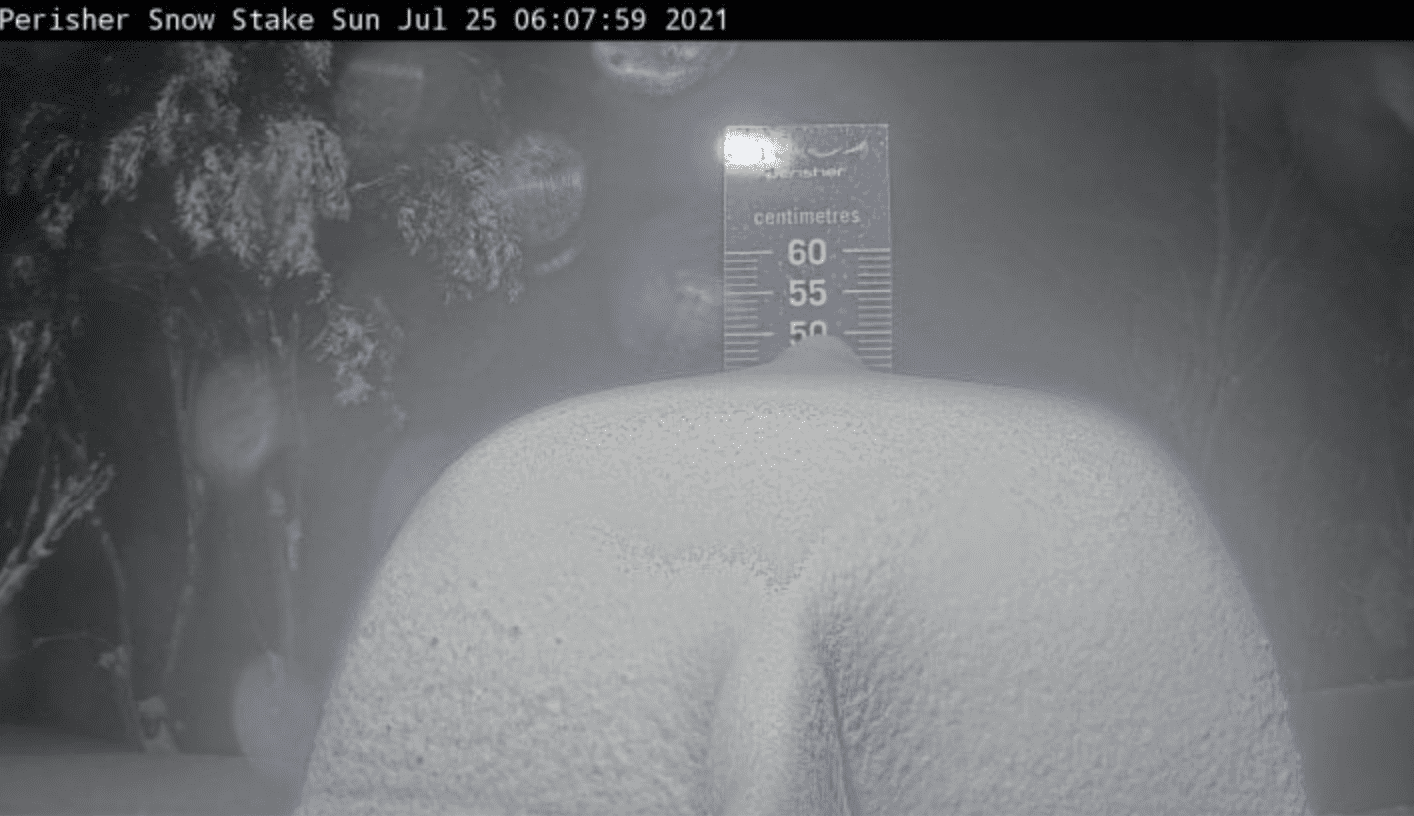
The two July storms turned out to be the biggest storms of the year, the snow depth at Spencers Creek jumping from 63.7cm on July 14 to 183.6cm on July 29 and heading into August hopes were high the winter storms would keep on coming. In his August season update the Grasshopper pointed out that the July storms were due to a neutral SAM which “ saw the return of those more traditional fronts from the southwest which are usually responsible for the dumps we receive in the Aussie Alps.”
August started off OK, with a nice 15cms snow fall over the 3rdand 4thand then it remained dry and mainly fine for the next two weeks. The next storm didn’t roll in until August 24 and it wasn’t that big, with 15-20cms dropping across the Aussie Alps. The final week of August saw light falls on the 28th/29thand the month closed with a 10cm top-up on August 30, but the cumulative snowfall for the month was only 55cm and the snow depth at Spencers Creek was 157cm, a 30cm drop since the start of the month.
The snow melt continued in September, a warm air mass and hairdryer northwest winds during the first week of the month keeping overnight temps above zero degrees and temps at dawn as warm as +8. That trend changed with cooler temps returning mid-September and there was a dusting of 5cms on the 13thfollowed by a few days of very cold temps which slowed the snow melt and maintained the snow pack at higher elevations.
After entering another lockdown at 1.30pm on August 21, the Victorian resorts reopened on September 10, in time for some fun spring skiing and they stayed open until the end of the season. In NSW the resorts finally emerged from lockdown on September 16, Perisher opening Front Valley as soon as the restrictions lifted at 1.30pm while Thredbo reopened on Saturday September 18. With only two weeks left in the season most of NSW and the ACT remaining in lockdown, Charlotte Pass decided not to reopen.
The “reopening” weekend in NSW coincided with a big rain event that dropped 50m of rain in the early hours on Saturday followed by gale force pre-frontal north-westerly winds and wind-hold on the Sunday. However, another good storm was on the way which delivered good snowfalls on Monday turning on an excellent late season powder afternoon with no people and fresh turns every run, and up there with one of the best sessions of the year.
The snow cleared the following morning which, after 40cms in 24 hours, and with temps at -6.2 was like a classic mid-winter powder day. People came out of the woodwork and here in Thredbo it was one of the busiest mornings of the year, tracked out in a couple of hours and while it wasn’t the day of the season, it was pretty good, especially for September 21.
The rest of September saw some good spring skiing thanks to a melt/freeze cycle mixed in with a couple of rainy days last week leading into the closing weekend. There was also an earthquake on September 22, centred near Mansfield, that rocked the ski resorts, especially Mt Buller, the tremor captured live on the Little Buller Spur snow cam.
As you’d expect, with visitation limited to regional areas not in lockdown, the last two weeks of the season have been very quiet in all resorts and you had the feeling the season was limping to the finish line on October 3. Thredbo pulled the pin a week early on September 26 and Perisher had the pin pulled for it a few days later when the region went back into lockdown, but Falls Hotham and Buller made it through to closing day.
What a year, two tough winters in a row and all the resorts did an incredible job, maintaining the snow and handling reopening operations so those who were able to visit the resorts enjoyed the best conditions possible. Congratulations.
I’ll leave the closing paragraph to Bill Barker who summed things up nicely in his final Hotham report of the year: “It has been a wild ride, but we have made it to the official closing day of 2021. The season has certainly had its ups and downs, but I hope you were able to score at least some great turns at some point along the way. Hopefully next year will be a much more predictable affair and that everyone will have the opportunity to make the most of it from the opening weekend until the snow melts in October.”
Let’s hope so.
Check out the resorts 2021 season recaps and see you in 2020:
https://www.youtube.com/watch?v=mbn33jLXxNs
https://www.youtube.com/watch?v=oId3H4XUW_Q