Australian Forecast, July 17th – A Magical Sunny Sandwich, With A 2-4cm Filling
Mountainwatch | The Grasshopper
Written early Monday 17thJuly, valid Wednesday 19thJuly
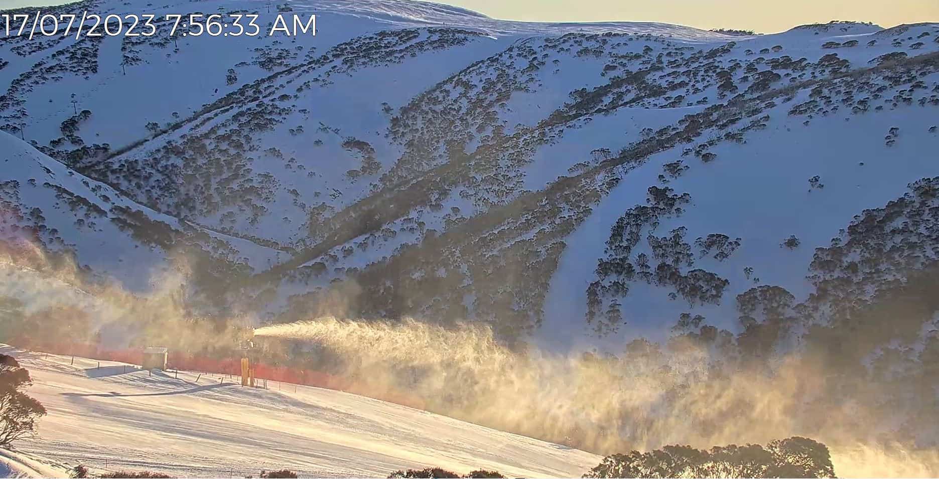
Well, that front that passed through late Saturday dropped little in the way of snow, only Mt Baw Baw reporting a measly 1cm, but it had the snow guns firing before a sunny, calm Sunday session. Just magic!
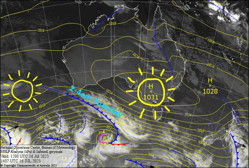
Monday and Wednesday will be another couple of magic days thanks to a pair of high pressure centres that lazily drift overhead. Sandwiched between the two highs, a cold front will bring strong winds and about 2-4cm of snow during Tuesday, along with nice n’ cold temps that should get the snow guns sparked up again.
Monday 17th
A crystal clear, sunny day with a NW breeze.
Tuesday 18th
A mostly cloudy day, with light snowfall during the afternoon and evening as strong-gale NW winds turn SW.
Wednesday 19th
Another clear, sunny day. Southerly winds dying away before a light NW breeze develops later in the afternoon.
Extended Forecast
The outlook features a couple more of these rapid-fire fronts that somehow manage to squeak through a whole bunch of high-pressure lurking within a stone’s throw of the Aussie Alps. The first will hit late Thursday and the second late Saturday, both dropping around 5cms each, and both topped off with cold, clear skies the following day… mmm, magic sandwiches!
After that, high pressure should see us through early-mid next week.
That’s all from me today, folks. See you again Wednesday.


