Australian Forecast, June 7th – Soupy Southeasterlies clear for Opening Day Saturday, Light Flurries on Sunday, Next Week’s Storm Weakens

Mountainwatch | The Grasshopper
Published early Friday 7th June 2024
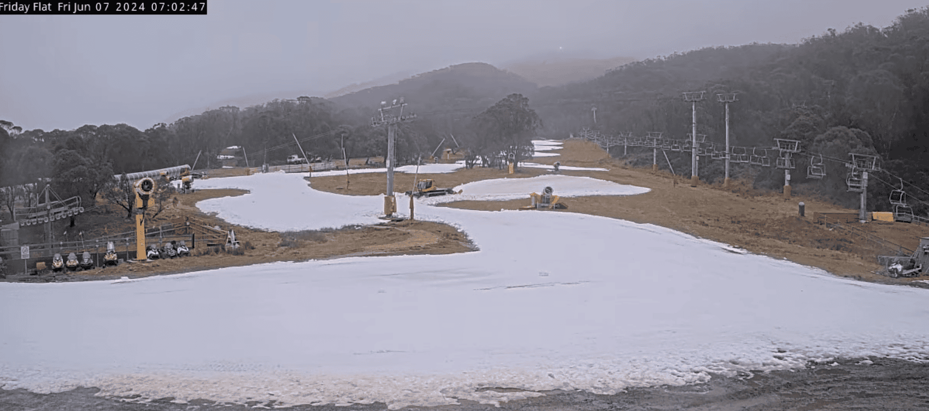
Wet, soupy conditions continue today as a low sitting off the east coast pushes humid southeasterlies into the Aussie Alps. The natural snow cover up high has all but disappeared, and the man-made snowpack at Thredbo and Perisher has taken a hammering after 20-30mm of rain. The stockpiles of man-made snow at other Buller and Baw Baw has fared better, especially at Mt Buller which has been sheltered from the worst of conditions.
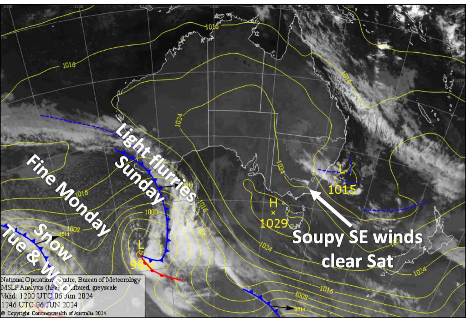
Skies will mostly clear up Saturday for Opening Day at Mt Baw Baw, Mt Buller, Thredbo and Perisher, who will all have limited terrain open for first turns of the season, suitable for first-timers and the super keen. A weak cold front brings light snowfall to mid-to-upper slopes later on Sunday, before a ridge of high pressure arrives Monday.

Friday June 7th
Soupy conditions continue today as a stiff southeaster drives in cloud, drizzle and rain. The precip should let-up on the NSW side sometime during the second half of the day.
Saturday June 8th
A mostly fine day for Victorian resorts, although a bit of cloud will stick around Baw Baw. A light SW breeze develops.
Drizzle on the NSW side clears early, then the cloud cover will break up for a mostly fine afternoon, although there’s a slight chance of a light shower. SE winds ease and turn SW.
Sunday June 9th
Any morning cloud affecting the resorts will clear early. Then cloud and a few light showers spread eastwards during the second half of the day, falling as snow up high initially before gradually lowering to mid-slopes as colder air arrives. Only 1-3cm or less is expected. W-SW winds.
Monday June 10th
A partially cloudy day with a chilly start should have snow guns working before the day warms. W-SW winds ease before a NW breeze develops over Victoria.
Extended Forecast
The Potential Season Starter Storm we’ve been keeping an eye on for a while now has shrunk considerably with each successive forecast. A front will bring heavy dense snow to upper slopes and strong NW winds on Tuesday 11th June, easing to snow showers down to base levels on Wednesday 12th June as winds turn to a colder southwesterly.
Despite lower snowfall than we were hoping, temps should stay cold through Thursday 13th and Friday 14th June so resorts will be able to make a tonne of snow and hopefully get more terrain open.
That’s all from me today folks. I’m sending out these forecasts every Monday, Wednesday and Friday, so I’ll see you again soon.
Grasshopper


