Australian Forecast, Thursday May 30th – Rain Tonight, Light Snow Showers up High Next Several Days, But Potential For More In Lead Up To Opening Day

Mountainwatch | The Grasshopper
Written Thursday, May 30th 2024
Here we go guys, just over a week to go before Australian snow resorts plan to open their gates. It’s crunch time, so I thought I’d jump in now and get the ball rolling to give everyone a heads up on what to expect in the lead up to the big day – will we have something to slide on or not?
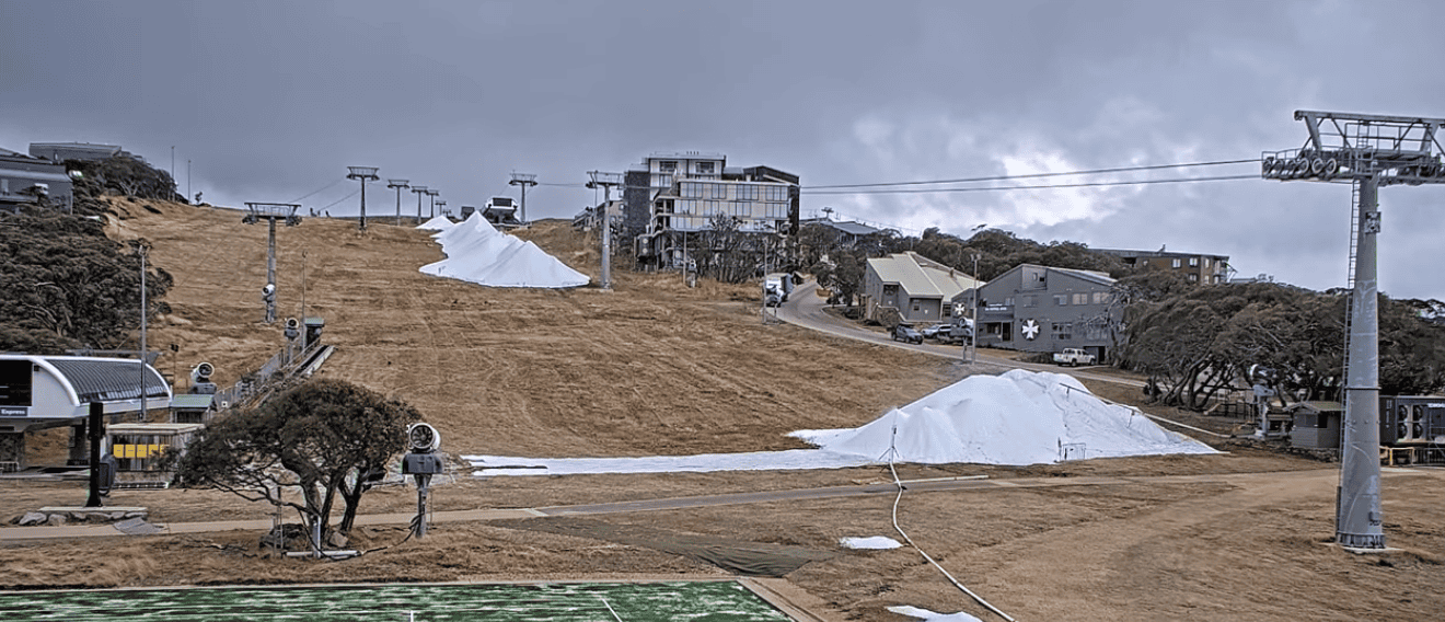
At present, there is no natural snow in the Aussie Alps, but resorts have been doing their best to make as much as they can with big piles of it showing in the webcams of Mt Buller and Baw Baw. Friday Flat at Thredbo and Front Valley at Perisher both have a coating of man-made snow.
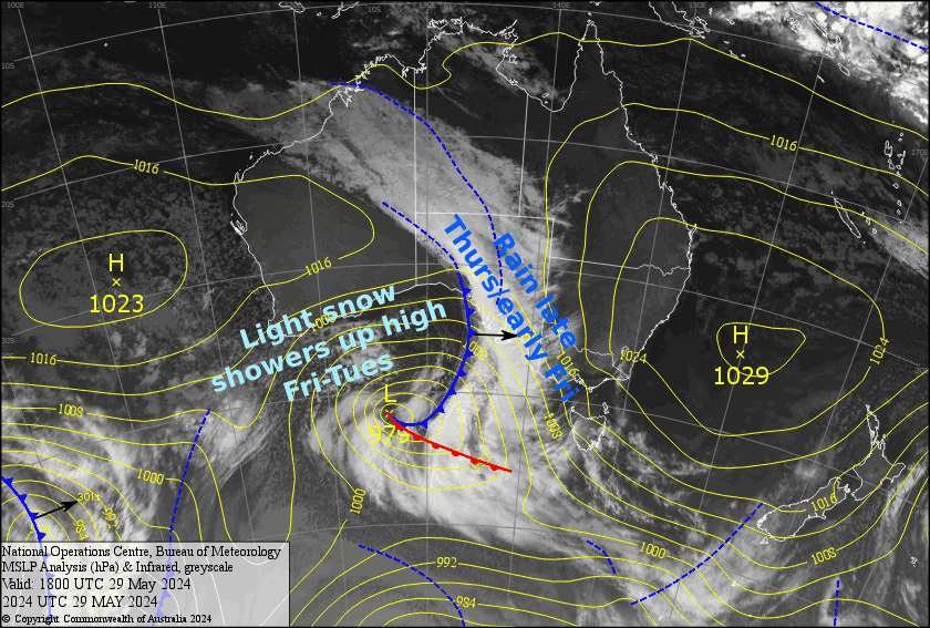
After a deluge of rain tonight into early Friday, it’s likely we’ll see light snow showers up high during Friday and through the weekend into early next week. At this stage I’m only expecting a couple-few centimetres all up for that period, with the potential for some more snowmaking as overnight temps dip into the negatives.
However, models are having a hard time dealing with an east coast low, which could bring a more decent load during Sunday & Monday if we’re lucky. I’m pinning more hope on a potential snowfall on Wednesday, June 5th, not a massive one, but a wee kick-starter in the 5-10cm range.

Thursday May 30th & Friday May 31st & Saturday June 1st
Strong and warm northwest winds are blowing across the Aussie Alps today (Thursday), ahead of a front which will bring heavy rain to Vic resorts this evening/tonight and NSW resorts early Friday. Both the wind and rain will cause some damage to any exposed man-made snow that resorts can’t protect (someone throw a tarp over those piles of snow please!).
Following the front, Friday and Saturday will be colder with light showers falling as snow on upper slopes, and maybe down to mid slopes at times if we’re lucky. Snow accumulations are likely to only be a couple of centimetres at best.
Sunday June 2nd, Monday June 3rd & Tuesday June 4th
From here the situation gets a bit trickier as a low develops off the coast of NSW during Sunday, then drifts southwards towards Tasmania Monday and Tuesday. Most likely we’ll just see more light snow showers up high during this time, with the potential for overnight snow making as temps dip into the negatives.
However, some models including the BOM’s ACCESS model and the GFS (Global Forecast System), which our forecast charts use, suggest the low will tuck a little closer to home, with the potential for a more decent load of snow during Sunday and Monday. If this was to happen, then it’s likely to be the wet, dense variety of snow, perfect for building the base.
Extended Forecast
Wednesday June 5th holds plenty of potential for snowfall as the east coast low near Tassie backtracks out into the Tasman Sea, sending a southerly front over the Aussie Alps. It’s early days, but something around 5-10cm looks about right.
Things should then calm down pretty quickly Thursday June 6th June before a ridge of high pressure drifts overhead, keeping a lid on things Friday June 7th and Opening Day Saturday June 8th.
That’s all from me today folks. I’ll be sending out forecasts every Monday, Wednesday and Friday from hereon in. See you again on Monday!
Grasshopper


