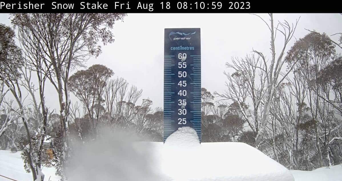
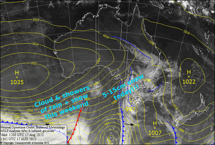
Australian Weekend Forecast, August 18th – 5-15cm Today, Then The Odd Shower Of Rain + Snow This Weekend.
Mountainwatch | The Grasshopper
Written early Friday 18th August, valid to Sunday 20th August
As I put pen to paper we have a cold front knocking on the door. This front will bring glorious snow today, with snow levels eventually hitting rock bottom as cold air floods over the Aussie Alps from the southwest. By the end of the day we should take home somewhere between 5-15cm, which isn’t massive, but combined with snow making it’ll go a long way to improve things. Plus, it’s the most decent snowfall we’ve seen in about a month and a half.
We’ll remain mostly cloudy this weekend, with light showers of rain/snow from time to time, as high pressure moves in to the north of us. Although, it won’t be blue bird, conditions underfoot will be better than we’ve seen for a while, so make the most of it.
Friday 18th
Today we have snow, glorious snow! There’ll be decent falls first thing this morning as brisk NW winds turn to the W-SW, then again this afternoon as even colder SW winds arrive, with generally lighter falls in between. Snow levels will sit between 1200-1400m throughout the day, then lower to around 900m during the evening while snowfalls ease.
Saturday 19th
Mostly cloudy with a cold start. However temps will warm during the afternoon with light showers of rain/snow developing in Victoria, and one or two showing up in NSW. W-SW winds will be quite strong in exposed areas.
Sunday 20th
A mostly cloudy day with the odd shower, becoming a little more frequent during the afternoon and falling as snow on mid-upper slopes. Brisk SW winds ease while clocking NW.
Extended Forecast
Showers will continue during Monday, with snow falling about mid-upper slopes, before a not-quite-cold-enough front hits Tuesday. This front will bring a decent top-up to mid-upper slopes, but will strike another blow to the lower mountain.
Wednesday should start out mainly fine, but a weak front may bring a few more showers of that same snow + rain mix late in the day.
That’s all from me today, folks. See you again Monday.


