Australian Weekend Forecast, Friday July 23rd – Winter is Back with More Snow on the Way

Mountainwatch | The Grasshopper
Published early Friday, 24th July 2026
Winter made a welcome return on Thursday, with cold westerlies whipping up a 1-2cm dusting before breaky, followed by a couple more centimetres throughout the day.
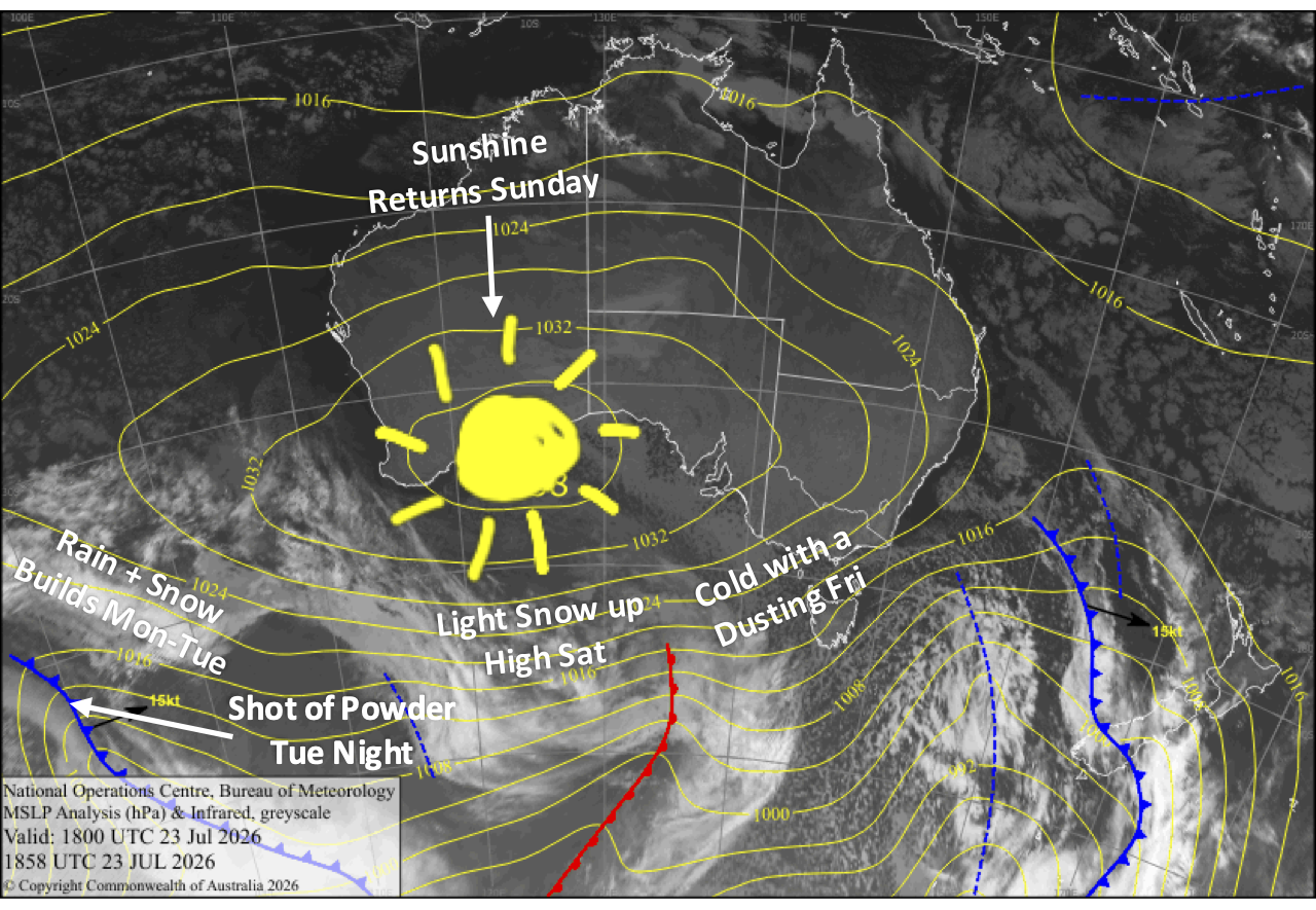
West-to-southwest winds persist Friday into Sunday as storm systems sliding underneath us continue to bring light snow showers, which turn wet about lower altitudes on Saturday as warmer air sneaks in.
Northwest winds and showers of rain and snow build during Monday and Tuesday, before a cold change comes through Tuesday night, giving us a shot of around 5-15cm of powder. It’ll be a timely top-up, and the snow guns will fire up on all cylinders as cold temperatures are expected to persist for a few more days afterwards.
Friday 24th July
A mostly cloudy day, especially in Victoria, where snow flurries continue with another 1-2cm accumulating, although Mt Baw Baw could receive 4-5cm. New South Wales may also see a few snow flurries if we’re lucky. Strong west-to-southwest winds will be icy cold, which should keep the snow guns blazing.
Saturday 25th July
Another grey, cloudy day with brisk west-to-southwest winds. Showers in western Victoria spread east through the day, reaching New South Wales in the evening, where they’ll be brief and light. The showers will fall as snow above about 1800m, but lower to mid slopes in the evening, and they’ll be most persistent about Mt Baw Baw and Buller as they’ll be in the firing line with a damp day lined up.
Sunday 26th July
Clouds gradually break up and clear New South Wales and eastern Victoria for a sunny afternoon as west-to-southwest winds die away. However, cloud will persist in western Victoria for a grey, clagged-in day at Mt Baw Baw and Buller.
Monday 27th July
Cloud and light showers gradually spread east as northwest winds pick up, with snow likely falling to mid slopes.
Tuesday 28th July
Showers build into rain as northwest strengthen, with snow falling to mid slopes. A colder southwest change whips through after dark, bringing a 5-15cm shot of powder.
Extended Forecast
We’ll likely have some lingering light snow showers on Wednesday, the 29th, before high pressure moves in for a fine settled end to the week. Temperatures will remain cold, so the snow guns will get a good run in. After that, models diverge wildly and uncertainty balloons too far out to make any calls.
That’s all from me today, folks. I’m firing out these forecasts every Monday, Wednesday and Friday throughout the season, and an extra update on Sundays during peak season. Have a great couple of days, and I’ll see you back here on Sunday.
Grasshopper