COUNTDOWN TO WINTER – Early Snow, A Meteorologist’s Opinion
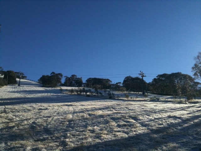
Snow in Thredbo, Tuesday morning. Image thanks to Will Clifford
Welcome to the Countdown to Winter 2011. Over the next five weeks we’ll keep you updated on the latest weather and snow information; the facts and the speculation, give you the rundown of what’s new in all the resorts for 2011 and help you prepare for opening day with gear guides, travel advice and everything else you need to know.
SNOW UPDATE: 11cm for Perisher, 20cm for Mount Baw Baw, 12cm for Hotham, 18cm for Selwyn… Wednesday is still promising the first significant snowfall. We had a chat to our meteorologist this morning, known only as The Grasshopper for reasons of national security, here’s what he had to say:
The weather models are now certain that we have a very cold mass of air moving over south-east Australia from Tuesday onwards, and it looks as though south-westerly winds will keep things chilly for the rest of the week. The big question is how much moisture will arrive with the cold front as it moves through the mountains on Tuesday evening. At this stage we’re looking good for between 8 and 15cm of snow, a nice little Autumn entree.
This snow is going to look gorgeous, and the cold weather for the rest of the week will help it to hang around for a while, but it’s still May, and probably still to warm for it to remain for long. For example the average daily max temperature for Thredbo at 1950 metres is 5 degrees. So we’re likely to get a few days above 4 degrees before the end of the month and that should encourage the thin snowbase to melt away. Any rocks that aren’t covered in snow add to this melt as well, because they absorb more of the sun’s energy and then radiate heat into the snow around them.
And what about the old snow myth?
My instinct as a meteorologist says that this is based more on psychology than fact. There’s no scientific reason that I know of, and I reckon its probably more a case of people getting their hopes up after May snowfalls in the past and then getting burned.
COUNTDOWN TO WINTER – Snow Update, early Snow?
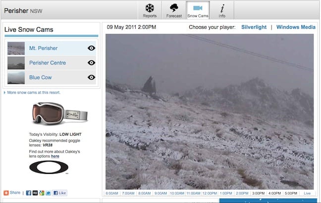
Snow cam vision of Mt Perisher Monday afternoon
Countdown to Winter 2011 | 9 May
NEW UPDATE – 5:30PM, MONDAY: Well we’ve already proven our own point. When the forecast data updated this afternoon, suddenly all the huge snowfalls predicted to Wednesday had dropped back considerably – 6cm or 7cm rather than 62cm… But such is the way of the early forecasts, all we can do is keep speculating, watching and hoping!
SNOW UPDATE: We awoke this morning to the promise of widespread snowfalls in Australia all this week. But we’ve heard that before right? So should we remain cynical or start dancing in the streets? A bit of both. Forecasting is a difficult business, the more you travel into the future, the less accurate your forecast becomes. Inside three days, we can call decently accurate. That this snow is expected in two days indicates a certain degree of accuracy, coupled with some fairly strong evidence on the weather maps, it looks like a safe bet that snow will fall this week. As of Monday afternoon the predicted totals were anywhere up to 62cm (at Selwyn), these numbers will most likely change as the weather front moves in.
The other good news, the ground will be frozen solid, ready to received and retain the coming snow thanks to snow flurries and rain on Monday which will freeze on the ground overnight.
Snow Myth? Snow in May means a bad season. This one is pulled out every year when the first snowfalls set in. Which in iteslf should speak to its invalidity – because it snows in May every year and the season goes on to become whatever it becomes. In 2000 there was so much early snow Thredbo opened, top to bottom, a week early and enjoyed a bumper season.
So keep checking the forecasts and watching the cams…
Perisher forecasts,
snow reports and
live snow cams.
Falls Creek forecasts,
snow reports and
live snow cams.
Mount Buller forecasts,
snow reports and
live snow cams.
Charlotte Pass forecasts,
snow reports and
live snow cams.
Hotham forecasts,
snow reports and
live snow cams.
Thredbo forecasts,
snow reports and
live snow cams.


