COUNTDOWN TO WINTER – Rain Signals Time to Panic? – No way
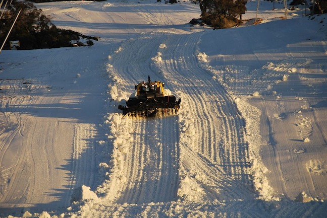
We have gone from this, to nothing… The rain has broken hearts across the country Image:: Perisher
Mountainwatch | The Grasshopper
Brought to you by ESS Boardstores
Over the last few seasons we’ve become accustomed to snow-making allowing us to have a few lifts turning on or before opening weekend. Unfortunately, more than 100mm of rain from Thursday to Sunday has wiped out this year’s early base and devastated those hopes, so now we face a shortened season.
The first thing that popped in to my little green head after I had moved through the denial, anger, bargaining and depression stages of grief to arrive at acceptance was to go and take a look at some previous winters with decent peak snow depths, and look at what base they had in the first week of June.
What I found will lift your spirits (I was about to say warm your heart, but warm is a four letter word right now).
Table of truth
Check out this table of peak snow depths for the whole season against snow depth on June 1 for years when had a peak base of more than two metres. What you can see is that of 16 years in the table, seven started out with no base at June 1, and a further six had 40cm or less. This data is telling us that the weekend’s rain does not rule out a solid recovery through July/August. In other words, there is no reason to sell your season pass yet.
| Year | Peak Depth (cm) (Spencers Creek) | June 1 Depth (~cm) |
|---|---|---|
| 1971 | 207 | 50 |
| 1972 | 227 | 31 |
| 1974 | 267 | 20 |
| 1977 | 227 | 79 |
| 1981 | 361 | 20 |
| 1984 | 234 | 0 |
| 1986 | 218 | 0 |
| 1990 | 293 | 0 |
| 1991 | 285 | 0 |
| 1992 | 316 | 20 |
| 1995 | 215 | 40 |
| 1996 | 254 | 0 |
| 2000 | 262 | 0 |
| 2003 | 201 | 75 |
| 2004 | 226 | 0 |
| 2012 | 210 | 34 |
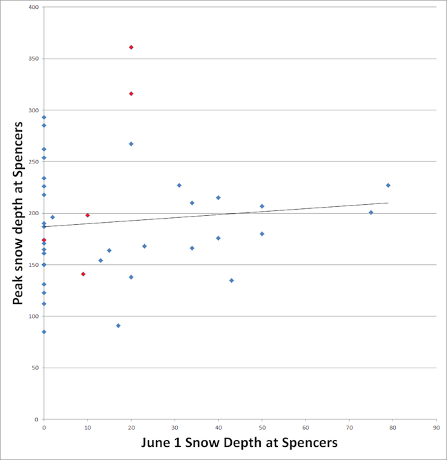
The Grasshopper’s not afraid to drop a complicated graph on his friends
In a similar fashion we can present the last 40 years in a scatter graph, as below. You can see the trend line is virtually flat. Good ole Microsoft Excel tells me there’s only a 1 per cent correlation between snow depth on June 1 and the eventual peak for the season, and that there’s a 50/50 chance that even this correlation is a statistical fluke.
The red dots on this graph are years that have a negative Indian Ocean Dipole event and neutral El Nino Southern Oscillation conditions, like we have been expecting in our last two seasonal outlooks. You can see that none of these years had more than 20cm at June 1, but two of them got past 3 metres later in the season, one got to 198cm, one reached 174cm and one reached 141cm. But here’s some even better news… all five of these years still had a base of 1 metre at the start of October.
To wrap up this impromptu piece of research, history tells us that the effect of the weekend’s rain is going to be most heavily felt during June. My thoughts go out to all businesses, big and small, and their employees who will be affected by this setback. If you see some mountain staff buy them a beer and give them a cuddle. But there’s a very good chance we’ll bounce back from this in July/August, with solid skiing conditions continuing right through till the end of the season.


